more stats
607 ft
Distance
-9 ft
Descent
00:01:39
Avg time
-10 ft
Altitude change
36 ft
Altitude min
46 ft
Altitude max
46 ft
Altitude start
36 ft
Altitude end
-1.6%
Grade
-3.9%
Grade max
246 ft
Distance down
256 ft
Distance flat
00:01:39
Avg time

Monstro Details

  • Activities
    • Mountain Bike
    • Winter Fat Bike
  • Riding Area
    Tudor Park
    Logan City
  • Difficulty Rating
  • Local Popularity
    100 in Mountain Biking
  • Global Ranking
    #129072 in Mountain Biking
  • Trail Type
    Singletrack
  • Bike Type
    AM, XC, DJ, Fat, CX
  • Direction
    One Direction
  • Climb Difficulty
    Green
  • Physical Rating
    Moderate
  • Trail Visibility
    Always easy to follow
  • eBike Allowed
  • TTFs on Trail
    Drop, Jump, Gap Jump, Other
  • Land Owner
    Logan City Council

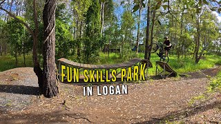
This trail is the most difficult trail in Tudor Park, starting from the mound/entry ramp behind KENG (northwest corner of park), and is strictly one direction only.
There is a return line to the start mound installed after the last jump, returning via rollers/pump line on Colony Trail.

Trail Supporters
Traditionally Indigenous Territory

Recent Activity on Trail

Past Week
  • 0 rides
  •  
6 Months
  • 0 rides
  •  
All
  • 5 rides
  • Last: Apr 13, 2026
c1c2c3c4
January
February
March
April
May
June
July
August
September
October
November
December
update trails status or condition

Monstro Trail Reports

statusdatedescription
Dec 13, 2024 @ 9:57am
Dec 13, 2024
Trails are open but may be wet or overgrown in areas
Dec 10, 2024 @ 1:08pm
Dec 10, 2024
Due to recent wet weather conditions, trails are temporarily closed for safety and to prevent trail damage. Please stay tuned for further updates....
Oct 23, 2024 @ 2:46pm
Oct 23, 2024
Oct 10, 2024 @ 8:09pm
Oct 10, 2024
Trails are open but please consider if trail conditions are suitable to ride
Oct 9, 2024 @ 2:29pm
Oct 9, 2024
Due to recent wet weather conditions, trails are temporarily closed for safety and to prevent damage. Please stay tuned for further updates. Thank...
more »
Status:
on Dec 13, 2024
Variable
no votes yet
Your vote: 0

view (203)
close
3D
Trail Conditions
  • Unknown
  • Snow Groomed
  • Snow Packed
  • Snow Covered
  • Snow Cover Partial
  • Freeze/thaw Cycle
  • Icy
  • Prevalent Mud
  • Wet
  • Variable
  • Ideal
  • Dry
  • Very Dry
Trail Flow (Ridden Direction)
Trailforks scans users ridelogs to determine the most popular direction each trail is ridden. A good flowing trail network will have most trails flowing in a single direction according to their intension.
The colour categories are based on what percentage of riders are riding a trail in its intended direction.
  • > 96%
  • > 90%
  • > 80%
  • > 70%
  • > 50%
  • < 50%
  • bi-directional trail
  • no data
Trail Last Ridden
Trailforks scans ridelogs to determine the last time a trail was ridden.
  • < 2 days
  • < 1 week
  • < 2 weeks
  • < 1 month
  • < 6 months
  • > 6 months
Trail Ridden Direction
The intended direction a trail should be ridden.
  • Downhill Only
  • Downhill Primary
  • Both Directions
  • Uphill Primary
  • Uphill Only
  • One Direction
Contribute Details
Colors indicate trail is missing specified detail.
  • Description
  • Photos
  • Description & Photos
  • Videos
Trail Popularity ?
Trailforks scans ridelogs to determine which trails are ridden the most in the last 9 months. Trails are compared with nearby trails in the same city region with a possible 25 colour shades. Think of this as a heatmap, more rides = more kinetic energy = warmer colors.
  • most popular
  • popular
  • less popular
  • not popular
ATV/ORV/OHV Filter
Max Vehicle Width
inches
US Cell Coverage
Legend
cell carrier legend

Radar Time
Activity Recordings
Trailforks uses anonymized public activity data. ?
Activity Recordings
Trailforks uses anonymized public activity data. ?
Personal Heatmap
Activity Types
all / none
Options
2
Date range month
Winter Trails
Warning A routing network for winter maps does not exist. Selecting trails using the winter trails layer has been disabled.
Missing Trails
Most Popular
Least Popular
Trails are colored based on popularity. The more popular a trail is, the more red. Less popular trails trend towards green.
Jump Magnitude Heatmap
Heatmap of where riders jump on trails. Zoom in to see individual jumps, click circles to view jump details.
BC Backroad Status

Service Road Atlas is a free to use, community-driven service for viewing and creating reports on the numerous back-country service roads around B.C. and Alberta.

map legend
Slope Aspect
Direction the slope faces
Flat N NE E SE S SW W NW
Trails Deemphasized
Trails are shown in grey.
disable
Only show trails with no bike usage.
Enable
Suggested Layers
Based on selected activity type

    Save the current map location and zoom level as your default home location whenever this page is loaded.

    Save
        Directions to monstro trailhead (-27.690090, 153.183920)

        Photos

        2 more »
        25 |
        Jan 23, 2026 @ 1:25pm
        Jan 23, 2026
        24 |
        Jan 23, 2026 @ 1:25pm
        Jan 23, 2026

        Videos

        1 more »
        youtuber This skills park is great for everyone!
        9:49 | 90 | Jul 9, 2025 , Logan City

        Reviews / Comments

        No reviews yet, be the first to write a review or ask a question.
        Use trail reports to comment on trail conditions.


        We hope you've been enjoying Trailforks!

        Create a FREE account to view trail comments and much more.

        • By Sneaky-PeteTF Pro NTCA NTCA & contributors
        • #534749 - 409 views

        Frequently Asked Questions About Monstro

        Where is Monstro located?
        Monstro is located in Tudor Park, Logan City, Australia. It is part of the Tudor Park trail network. The trailhead is located at coordinates -27.69009, 153.18392.
        How hard is Monstro?
        Monstro is rated as Black Diamond difficulty. The physical rating is Moderate. The average grade is 1.6%. The climb difficulty is rated Green.
        What is the elevation gain for Monstro?
        The trail has 9 ft of elevation descent. The elevation ranges from 36 ft to 46 ft.
        Is Monstro a point to point trail?
        Yes, Monstro is a point to point trail. The direction is One Direction. The trail type is singletrack.

        Hit the Trail

        Open in App

        Get this trail on your phone instantly.
        open trail in app

        Download Trail

        Save to wishlist, Garmin & download.
        save the trail

        Find Related Routes

        Find routes and users activities that include this trail.
        find routes for this trail

        You must enter a description before submitting.