Supporters, Builders, Maintainers & Land Managers of Monte Carlo Trail

BLMLand Manager
Monte Carlo Details
-
Activities
- Mountain Bike
- Hike
- Trail Running
-
Riding AreaPrince Creek & Crown Trail System
Colorado -
Difficulty Rating
-
Trail TypeSingletrack
-
DirectionBoth Directions
-
Climb DifficultyBlue
-
Physical RatingModerate
-
Dogs AllowedYes
-
Global Ranking
-
Local Popularity60 in Mountain Biking [+]
- 60 in Trail Running
- 60 in Hiking
Find the start of this trail at the top of Prince Creek Trail (climbing only for bikes) or the bottom of Father of Ginormous (downhill only trail) or bottom of Monte Carlo (which is a two-way trail).
This descent provides a fun way to finish your ride on the Crown BLM trails in the Prince Creek area. The trail is parallel to the Prince Creek Trail, but shares a couple short sections with that trail—beware of two-way traffic at the large bridges and the open meadow section.
Enjoy a few small optional jumps, wood bridge crossings, and a short bermed gully section as you drop elevation on your way back towards Carbondale. The trail finishes at the "Bull Pen" Trailhead Parking Area on Prince Creek Rd.
Local Trail Association
-

-
Please consider joining or donating to the local trail association to supportdonate to earn trail karma!
trail development & maintenance.
Traditionally Indigenous Territory
More Stats for Monte Carlo mountain bike trail trail
-
Altitude change-407 ft
-
Altitude min6,861 ft
-
Altitude max7,268 ft
-
Altitude start7,268 ft
-
Altitude end6,860 ft
-
Grade-4.3%
-
Grade max-17%
-
Grade min19.9%
-
Distance climb932 ft
-
Distance down1 mile
-
Distance flat1,263 ft
-
Avg time00:12:55
-
Avg reverse time00:18:50
- view trail stats
-
Layers w
- Map Content
- More Layers
- Pro
- Pro
- Pro
- Pro
- Pro
- Pro
- Pro
- Pro
-
Upgrade to

- Unknown
- Snow Groomed
- Snow Packed
- Snow Covered
- Snow Cover Partial
- Freeze/thaw Cycle
- Icy
- Prevalent Mud
- Wet
- Variable
- Ideal
- Dry
- Very Dry
The colour categories are based on what percentage of riders are riding a trail in its intended direction.
- > 96%
- > 90%
- > 80%
- > 70%
- > 50%
- < 50%
- bi-directional trail
- no data
- < 2 days
- < 1 week
- < 2 weeks
- < 1 month
- < 6 months
- > 6 months
- Downhill Only
- Downhill Primary
- Both Directions
- Uphill Primary
- Uphill Only
- One Direction
- Description
- Photos
- Description & Photos
- Videos
- most popular
- popular
- less popular
- not popular

- mountain biking recent
- mountain biking (>6 month)
- hiking (1 year)
- moto (1 year)
- Downhill Ski
- Backcountry Ski
- Nordic Ski
- Snowmobile
Save the current map location and zoom level as your default home location whenever this page is loaded.
SaveMonte Carlo Trail Reports
Recent Ridelog Activity on Trail
- 5 rides
- 28 miles avg distance
- 13 rides
- 25 miles avg distance
- 550 rides
- Last: May 12, 2024
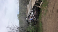
Photos
We hope you've been enjoying Trailforks!
Create a FREE account to view trail comments and much more.
Videos
Nearby Trails
- Skill Saw 3 ft
- The Crown (8320) 1,053 ft
- Highline 2,021 ft
- South Porcupine 4,026 ft
- Plunge 1 mile
Prince Creek & Crown Trail System
- By todd
 Trailforks & contributors
 - #14130 - 1,562 views
- follow/subscribe
- login to download gpx or kml files.
You must enter a description before submitting.