more stats
1,670 ft
Distance
20 ft
Climb
-230 ft
Descent
00:09:40
Avg time
-212 ft
Altitude change
899 ft
Altitude min
1,111 ft
Altitude max
1,111 ft
Altitude start
899 ft
Altitude end
-12.7%
Grade
-51.8%
Grade max
27.7%
Grade min
138 ft
Distance climb
1,496 ft
Distance down
33 ft
Distance flat
00:09:40
Avg time

Mr X Details

  • Activities
    • Mountain Bike
    • Hike
    • Trail Running
  • Riding Area
    Wrights Hill
    Wellington
  • Difficulty Rating
  • Voted Difficulty
    Secondary Access Road/Trail (3 votes)
  • Local Popularity
    45 in Mountain Biking [+]
    • 25 in Trail Running
    • 5 in Hiking
  • Global Ranking
    #89239 in Mountain Biking [+]
    • #126216 in Trail Running
    • #124179 in Hiking
  • Trail Type
    Singletrack
  • Bike Type
    DH, AM
  • Direction
    Downhill Only
    Popular Direction Shown
  • Physical Rating
    Moderate
  • Dogs Allowed
    Yes

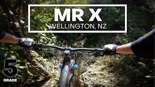
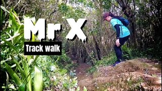
Alternative entry to Deliverance

Starts with a super tricky rocky chute into a sharp turn. Then something else equally fraught. Then traverses north with a few steep sections that are probably at their most technical when super dry as the loose rocks are like ball bearings.

Continue traversing/dropping downwards and you will meet Evil on your right. Some 100 metres further along Downpipe emerges from the bush only 30 metres before you join Deliverance.

source: tracks.org
Local Trail Association

Recent Activity on Trail

Past Week
  • 0 rides
  •  
6 Months
  • 2 rides
  • 20 miles avg distance
All
  • 70 rides
  • Last: May 28, 2026
c1c2c3c4
January
February
March
April
May
June
July
August
September
October
November
December
update trails status or condition

Mr X Trail Reports

statusdatedescription
Apr 6, 2025 @ 8:43am
Apr 6, 2025
Nov 29, 2024 @ 10:01pm
Nov 29, 2024
running good, ride it now! No rut's, visibility good, all rollable.
Mar 25, 2024 @ 10:48am
Mar 25, 2024
Apr 5, 2023 @ 7:05am
Apr 5, 2023
Lots of leaf litter on trail surface. Needs a rake or better still, more riding…
Jan 1, 2023 @ 10:35pm
Jan 1, 2023
A bit overgrown in places. Getting dry out in open but still damp in odd place under trees. The entry rut doesn’t seem to have gotten worse in...
more »
Status:
on Apr 6, 2025
Wet
Avg: 4.16 (6 votes)
Your vote: 0

view (749)
close
3D
Trail Conditions
  • Unknown
  • Snow Groomed
  • Snow Packed
  • Snow Covered
  • Snow Cover Partial
  • Freeze/thaw Cycle
  • Icy
  • Prevalent Mud
  • Wet
  • Variable
  • Ideal
  • Dry
  • Very Dry
Trail Flow (Ridden Direction)
Trailforks scans users ridelogs to determine the most popular direction each trail is ridden. A good flowing trail network will have most trails flowing in a single direction according to their intension.
The colour categories are based on what percentage of riders are riding a trail in its intended direction.
  • > 96%
  • > 90%
  • > 80%
  • > 70%
  • > 50%
  • < 50%
  • bi-directional trail
  • no data
Trail Last Ridden
Trailforks scans ridelogs to determine the last time a trail was ridden.
  • < 2 days
  • < 1 week
  • < 2 weeks
  • < 1 month
  • < 6 months
  • > 6 months
Trail Ridden Direction
The intended direction a trail should be ridden.
  • Downhill Only
  • Downhill Primary
  • Both Directions
  • Uphill Primary
  • Uphill Only
  • One Direction
Contribute Details
Colors indicate trail is missing specified detail.
  • Description
  • Photos
  • Description & Photos
  • Videos
Trail Popularity ?
Trailforks scans ridelogs to determine which trails are ridden the most in the last 9 months. Trails are compared with nearby trails in the same city region with a possible 25 colour shades. Think of this as a heatmap, more rides = more kinetic energy = warmer colors.
  • most popular
  • popular
  • less popular
  • not popular
ATV/ORV/OHV Filter
Max Vehicle Width
inches
US Cell Coverage
Legend
cell carrier legend

Radar Time
Activity Recordings
Trailforks uses anonymized public activity data. ?
Activity Recordings
Trailforks uses anonymized public activity data. ?
Personal Heatmap
Activity Types
all / none
Options
2
Date range month
Winter Trails
Warning A routing network for winter maps does not exist. Selecting trails using the winter trails layer has been disabled.
Missing Trails
Most Popular
Least Popular
Trails are colored based on popularity. The more popular a trail is, the more red. Less popular trails trend towards green.
Jump Magnitude Heatmap
Heatmap of where riders jump on trails. Zoom in to see individual jumps, click circles to view jump details.
BC Backroad Status

Service Road Atlas is a free to use, community-driven service for viewing and creating reports on the numerous back-country service roads around B.C. and Alberta.

map legend
Slope Aspect
Direction the slope faces
Flat N NE E SE S SW W NW
Trails Deemphasized
Trails are shown in grey.
disable
Only show trails with no bike usage.
Enable
Suggested Layers
Based on selected activity type

    Save the current map location and zoom level as your default home location whenever this page is loaded.

    Save
        Directions to mr-x trailhead (-41.297640, 174.736630)

        Photos

        No photos have been added for Mr X yet, add a photo.

        Videos

        5 more »
        youtuber AWKWARD & TIGHT - Mr X Mountain Bike Trail...
        2:16 | 1057 | Aug 14, 2020 , Wellington
        youtuber MR X @ Wrights Hill
        2:54 | 651 | Feb 20, 2019 , Wellington
        Track walk: Mr X at Wrights Hill
        7:26 | 262 | Oct 30, 2022 , Wellington
        Mr X Trail, Wrights Hill, Wellington, NZ
        2:34 | 470 | Jun 21, 2019 , Wellington

        2 Reviews & Comments


        We hope you've been enjoying Trailforks!

        Create a FREE account to view trail comments and much more.

        • By gristlybits BTB & contributors
        • #18314 - 5,084 views

        Frequently Asked Questions About Mr X

        Where is Mr X located?
        Mr X is located in Wrights Hill, Wellington, New Zealand. It is part of the Wrights Hill trail network. The trailhead is located at coordinates -41.29764, 174.73663.
        How hard is Mr X?
        Mr X is rated as Black Diamond difficulty. The physical rating is Moderate. The average grade is 12.7%.
        What is the elevation gain for Mr X?
        Mr X has 20 ft of elevation gain. The trail has 230 ft of elevation descent. The elevation ranges from 899 ft to 1,111 ft.
        Is Mr X a point to point trail?
        Yes, Mr X is a point to point trail. The direction is Downhill Only. The trail type is singletrack.

        Hit the Trail

        Open in App

        Get this trail on your phone instantly.
        open trail in app

        Download Trail

        Save to wishlist, Garmin & download.
        save the trail

        Find Related Routes

        Find routes and users activities that include this trail.
        find routes for this trail

        You must enter a description before submitting.