
more stats
1,184 ft
Distance
6 ft
Climb
-124 ft
Descent
00:01:33
Avg time
-120 ft
Altitude change
1,361 ft
Altitude min
1,488 ft
Altitude max
1,481 ft
Altitude start
1,362 ft
Altitude end
-10.1%
Grade
-21.5%
Grade max
11.2%
Grade min
115 ft
Distance climb
971 ft
Distance down
95 ft
Distance flat
00:01:33
Avg time

Nightshift Details

  • Activities
    • Mountain Bike
    • E-Bike
    • Hike
    • Trail Running
  • Riding Area
    Diamond Head
    Squamish, British Columbia
  • Difficulty Rating
  • Local Popularity
    100 in Mountain Biking [+]
    • 100 in E-Biking
    • 40 in Trail Running
    • 45 in Hiking
  • Global Ranking
    #32438 in Mountain Biking [+]
    • #5155 in E-Biking
    • #157146 in Trail Running
    • #153560 in Hiking
  • Provincial Ranking
    #1,604 in Mountain Biking · British Columbia [+]
    • #458 in E-Biking
    • #9,726 in Trail Running
    • #9,502 in Hiking
  • Trail Type
    Singletrack
  • Bike Type
    DH, AM, XC
  • Direction
    Downhill Only
    Popular Direction Shown
  • Physical Rating
    Moderate
  • Dogs Allowed
    Yes
  • eBike Allowed
    Yes up to Class 1
  • TTFs on Trail
    Berm, Jump
  • Ride in Rain
    Yes
  • Year Opened
    2007

Whole new trail realignment as of 2025 with some black options.

Tags
BermsJumps

Trail Supporters

  • past supporters

  • Dream Wizards
    Sponsor
  • Dream Wizards
    2007 - 2025
    Maintainer

  • Dream Wizards

    2007 - 2025
    Builder

Local Trail Association

Traditionally Indigenous Territory

Recent Activity on Trail

Past Week
  • 5 rides
  • 7 miles average
6 Months
  • 566 rides
  • 11 miles avg distance
All
  • 1,835 rides
  • Last: Oct 25, 2026
c1c2c3c4
January
February
March
April
May
June
July
August
September
October
November
December
update trails status or condition

Nightshift Trail Reports

statusdatedescription
Oct 26, 2026 @ 1:50pm (America/Vancouver)
10 hours
Trails reopened. Lots of fresh dirt. Be gentle on the corners! New roller/double after the hip step down.
Oct 24, 2026 @ 1:25pm (America/Vancouver)
2 days
Trail Closed for maintenance - will be open next week after the rain 🤘fully buffed the top section, thanks Squamish Enduro for the trail day
Oct 19, 2026 @ 3:32pm (America/Vancouver)
Oct 19, 2026
reporter
Sep 28, 2026 @ 10:49am (America/Vancouver)
Sep 28, 2026
reporter
Sep 23, 2026 @ 4:09pm (America/Vancouver)
Sep 23, 2026
reporter
more »
Status:
on Oct 26, 2026
Ideal
Avg: 4.3 (27 votes)
Your vote: 0

view (10,220)
close
      Directions to nightshift trailhead (49.745990, -123.077710)

      Photos

      25 more »
      mtb
      348 |
      Sep 2, 2016 @ 4:18pm
      Sep 2, 2016
      mtb
      1,217 |
      Jun 29, 2016 @ 12:15am
      Jun 29, 2016
      mtb
      69 |
      Apr 28, 2025 @ 6:41pm
      Apr 28, 2025
      mtb
      75 |
      Apr 28, 2025 @ 6:41pm
      Apr 28, 2025

      Videos

      3 more »
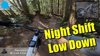
      youtuber Fast flow on Nightshift and Low Down | Squamish
      mtb
      2:34 | 29 | Oct 16, 2026 , Squamish
      youtuber Low Down | Fast Flowy Fun in Squamish
      mtb
      2:54 | 372 | Jan 5, 2024 , Squamish
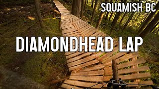
      Diamondhead Lap - Squamish Mountain Biking
      mtb
      7:46 | 487 | Apr 30, 2023 , Squamish

      Trail Lists

      Routes with this trail

      ★ 2.0 • 37 miles • 6,933 ft • 35 • Loop •
      There is a shuttle from Half Nelson lot to Garibaldi chain-up lot, courtesy of Shred Shuttle. As a result,...
      ★ 3.7 • 10 miles • 1,804 ft • 10 • Race •
      Loam Hustler Blue Course 2026
      7 miles • 1,949 ft • 7 •
      Legacy Climb > One Man's Garbage > Climb Trail > Lower One Man's Garbage > Garibaldi Park Road...
      4.4 ★★★★★
      27 Ratings
      5 ★ 52%
      4 ★ 37%
      3 ★ 7%
      2 ★ 4%
      1 ★

      4 Reviews & Comments

      Dyno2mono Dyno2mono
      Awesome new addition to our lower trail section. It would be nice to make one of the doubles a small table top for progression training. Thanks for the hard work !
      knollychill knollychill
      Unrecognizable from the days of Lowdown! Fun, flowy trail that links into Brodown and Lowdown. Great alternative to upper Pseudo-Tsuga.

      Everything is rollable making it a blue, hit the jumps to make this a black trail.
      maggiedurkin maggiedurkin
      Fun! Beware, for me it was easy to take a wrong split onto home brew.

      We hope you've been enjoying Trailforks!

      Create a FREE account to view all trail reviews and much more.

      • By frriv31TF Pro & contributors
      • #9962 - 7,787 views

      Frequently Asked Questions

      ▼ Where is Nightshift located?
      Nightshift is located in Diamond Head, Squamish, British Columbia, Canada. It is part of the Diamond Head trail network. The trailhead is located at coordinates 49.74599, -123.07771.
      ▼ How hard is Nightshift?
      Nightshift is rated as Blue difficulty. The physical rating is Moderate. The average grade is 10.1%.
      ▼ What is the elevation gain for Nightshift?
      Nightshift has 6 ft of elevation gain. The trail has 124 ft of elevation descent. The elevation ranges from 1,361 ft to 1,488 ft.
      ▼ Is Nightshift a point to point trail?
      Yes, Nightshift is a point to point trail. The direction is Downhill Only. The trail type is singletrack.
      ▼ How long is Nightshift?
      Nightshift is 1,184 ft long. The trail type is singletrack.
      ▼ Are dogs allowed on Nightshift?
      Yes, dogs are allowed on Nightshift. Please keep dogs on a leash where required and clean up after them.
      ▼ How do I access Nightshift? Where is the closest parking trailhead?
      The closest parking and trailhead locations to Nightshift are: View all parking locations in the area.
      ▼ How long does it take to ride Nightshift?
      Based on recorded activities, it takes an average of 2 minutes to ride Nightshift. The trail is 1,184 ft long. Actual times will vary based on fitness level, conditions, and pace. View recent activity logs for more details.
      ▼ How busy is Nightshift?
      Nightshift is a very popular trail. There have been 9,324 recorded activities on this trail. The trail has received 10,220 check-ins. View recent activity on this trail.

      Hit the Trail

      Open in App

      Get this trail on your phone instantly.

      open trail in app

      Download Trail

      Save to wishlist, Garmin & download.
      save the trail

      Find Related Routes

      Find routes and users activities that include this trail.
      find routes for this trail

      You must enter a description before submitting.