more stats
1.7 miles
Distance
11 ft
Climb
-238 ft
Descent
00:06:31
Avg time
-227 ft
Altitude change
2,608 ft
Altitude min
2,841 ft
Altitude max
2,835 ft
Altitude start
2,608 ft
Altitude end
-2.5%
Grade
-11.4%
Grade max
4%
Grade min
646 ft
Distance climb
1 mile
Distance down
896 ft
Distance flat
00:06:31
Avg time

Nitro Bench Details

  • Activities
    • Mountain Bike
    • Hike
    • Trail Running
  • Riding Area
    Sloan Canyon Trails
    Henderson, Nevada
  • Difficulty Rating
  • Local Popularity
    100 in Mountain Biking [+]
    • 40 in Trail Running
    • 85 in Hiking
  • Global Ranking
    #40961 in Mountain Biking [+]
    • #116426 in Trail Running
    • #51129 in Hiking
  • Trail Type
    Singletrack
  • Direction
    Both Directions
    Popular In Reverse
  • Climb Difficulty
    Green
  • Physical Rating
    Moderate
  • Dogs Allowed
    Yes
  • Land Owner
    BLM Sloan Canyon NCA and City of Henderson

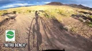
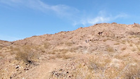
Flowy desert riding. Not steep or difficult. Heading north it flows really good if you keep on the gas. A few spots to air out and a couple little sandy washes with some river stone, but nothing too difficult.

Trail Supporters
  • BLM
    BLM
    Land Manager
Local Trail Association
Traditionally Indigenous Territory

Recent Activity on Trail

Past Week
  • 5 rides
  • 8 miles average
6 Months
  • 128 rides
  • 9 miles avg distance
All
  • 1,138 rides
  • Last: Jun 29, 2026
c1c2c3c4
January
February
March
April
May
June
July
August
September
October
November
December
Status:
on Mar 29, 2026
Dry
Avg: 4.24 (7 votes)
Your vote: 0

view (5,309)
close
3D
Trail Conditions
  • Unknown
  • Snow Groomed
  • Snow Packed
  • Snow Covered
  • Snow Cover Partial
  • Freeze/thaw Cycle
  • Icy
  • Prevalent Mud
  • Wet
  • Variable
  • Ideal
  • Dry
  • Very Dry
Trail Flow (Ridden Direction)
Trailforks scans users ridelogs to determine the most popular direction each trail is ridden. A good flowing trail network will have most trails flowing in a single direction according to their intension.
The colour categories are based on what percentage of riders are riding a trail in its intended direction.
  • > 96%
  • > 90%
  • > 80%
  • > 70%
  • > 50%
  • < 50%
  • bi-directional trail
  • no data
Trail Last Ridden
Trailforks scans ridelogs to determine the last time a trail was ridden.
  • < 2 days
  • < 1 week
  • < 2 weeks
  • < 1 month
  • < 6 months
  • > 6 months
Trail Ridden Direction
The intended direction a trail should be ridden.
  • Downhill Only
  • Downhill Primary
  • Both Directions
  • Uphill Primary
  • Uphill Only
  • One Direction
Contribute Details
Colors indicate trail is missing specified detail.
  • Description
  • Photos
  • Description & Photos
  • Videos
Trail Popularity ?
Trailforks scans ridelogs to determine which trails are ridden the most in the last 9 months. Trails are compared with nearby trails in the same city region with a possible 25 colour shades. Think of this as a heatmap, more rides = more kinetic energy = warmer colors.
  • most popular
  • popular
  • less popular
  • not popular
ATV/ORV/OHV Filter
Max Vehicle Width
inches
US Cell Coverage
Legend
cell carrier legend

Radar Time
Activity Recordings
Trailforks uses anonymized public activity data. ?
Activity Recordings
Trailforks uses anonymized public activity data. ?
Personal Heatmap
Activity Types
all / none
Options
2
Date range month
Winter Trails
Warning A routing network for winter maps does not exist. Selecting trails using the winter trails layer has been disabled.
Missing Trails
Most Popular
Least Popular
Trails are colored based on popularity. The more popular a trail is, the more red. Less popular trails trend towards green.
Jump Magnitude Heatmap
Heatmap of where riders jump on trails. Zoom in to see individual jumps, click circles to view jump details.
BC Backroad Status

Service Road Atlas is a free to use, community-driven service for viewing and creating reports on the numerous back-country service roads around B.C. and Alberta.

map legend
Slope Aspect
Direction the slope faces
Flat N NE E SE S SW W NW
Trails Deemphasized
Trails are shown in grey.
disable
Only show trails with no bike usage.
Enable
Suggested Layers
Based on selected activity type

    Save the current map location and zoom level as your default home location whenever this page is loaded.

    Save
        Directions to nitro-bench trailhead (35.971990, -115.009330)

        Photos

        6 more »
        112 |
        Aug 28, 2020 @ 4:08pm
        Aug 28, 2020
        134 |
        Aug 28, 2020 @ 4:08pm
        Aug 28, 2020
        258 |
        Feb 11, 2018 @ 9:50pm
        Feb 11, 2018
        241 |
        Feb 11, 2018 @ 9:48pm
        Feb 11, 2018

        Videos

        2 more »
        Las Vegas Trails - McCullough Hills
        6:01 | 606 | Mar 31, 2020 , Henderson
        OTB In Las Vegas
        0:17 | 315 | Mar 18, 2021 , Henderson

        Routes with this trail

        5.0 14 miles 1,431 ft 23 Loop
        Fun, flow, and a good workout. I ride this CCW. From the parking lot and the McCullough trail ... you're...

        1 Review & Comments


        We hope you've been enjoying Trailforks!

        Create a FREE account to view trail comments and much more.

        • By toddTF Pro Trailforks & contributors
        • #112548 - 2,316 views

        Frequently Asked Questions About Nitro Bench

        Where is Nitro Bench located?
        Nitro Bench is located in Sloan Canyon Trails, Henderson, Nevada, United States. It is part of the Sloan Canyon Trails trail network. The trailhead is located at coordinates 35.97199, -115.00933.
        How hard is Nitro Bench?
        Nitro Bench is rated as Green difficulty. The physical rating is Moderate. The average grade is 2.5%. The climb difficulty is rated Green.
        What is the elevation gain for Nitro Bench?
        Nitro Bench has 11 ft of elevation gain. The trail has 238 ft of elevation descent. The elevation ranges from 2,608 ft to 2,841 ft.
        Is Nitro Bench a point to point trail?
        Nitro Bench is not a point to point trail. The direction is Both Directions. The trail type is singletrack.

        Hit the Trail

        Open in App

        Get this trail on your phone instantly.
        open trail in app

        Download Trail

        Save to wishlist, Garmin & download.
        save the trail

        Find Related Routes

        Find routes and users activities that include this trail.
        find routes for this trail

        You must enter a description before submitting.