more stats
1.9 miles
Distance
364 ft
Climb
-943 ft
Descent
00:23:40
Avg time
-578 ft
Altitude change
542 ft
Altitude min
1,132 ft
Altitude max
1,132 ft
Altitude start
554 ft
Altitude end
-5.8%
Grade
-36.7%
Grade max
25.6%
Grade min
3,501 ft
Distance climb
1 mile
Distance down
354 ft
Distance flat
00:23:40
Avg time

Noodley Appendage Details

  • Activities
    • Mountain Bike
    • E-Bike
    • Gravel Bike
    • Winter Fat Bike
    • Hike
    • Trail Running
  • Riding Area
    Ledgeview
    Abbotsford, British Columbia
  • Difficulty Rating
  • Local Popularity
    95 in Mountain Biking heatmap [+]
    • 90 in E-Biking
    • 75 in Trail Running
    • 65 in Hiking
    • 5 in Winter Fat Biking
    • 80 in Gravel Biking
  • Global Ranking
    #32423 in Mountain Biking [+]
    • #19656 in E-Biking
    • #119216 in Trail Running
    • #130980 in Hiking
    • #5047 in Winter Fat Biking
    • #3073 in Gravel Biking
  • Provincial Ranking
    #1,601 in Mountain Biking · British Columbia [+]
    • #1,287 in E-Biking
    • #6,741 in Trail Running
    • #7,304 in Hiking
    • #347 in Winter Fat Biking
    • #216 in Gravel Biking
  • Trail Type
    Singletrack
  • Bike Type
    AM, XC, Fat, CX, Gravel
  • Direction
    Downhill Primary
    Popular Direction Shown
  • Physical Rating
    Moderate
  • Dogs Allowed
    Yes
  • eBike Allowed
    Yes up to Class 1
  • TTFs on Trail
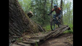
    Berm, Bridge, Drop, Jump, Gap Jump, Ladder Bridge

Trail crosses private property and use of the trail means you will be trespassing.

Two mostly cruiser downhill sections connected by a ~1km reasonably low grade mid trail climb to the adjacent peak. Downhills include optional gap jumps and mild steeps. A double blackish hit can be found on both descents for those who like some extra airtime.

Access Info

Direct connection to The Way of the Noodle, or access from around half way on Mixed Bag.

This trail is unsanctioned.

Tags
BermsBridgesDropsJumpsSkinnies

Trail Supporters

Traditionally Indigenous Territory

Recent Activity on Trail

Past Week
  • 9 rides
  • 7 miles average
6 Months
  • 125 rides
  • 8 miles avg distance
All
  • 1,029 rides
  • Last: Nov 20, 2026
c1c2c3c4
January
February
March
April
May
June
July
August
September
October
November
December
update trails status or condition

Noodley Appendage Trail Reports

Status:
on Nov 9, 2026
Avg: 4.4 (20 votes)
Your vote: 0

view (5,336)
close
      Directions to noodley-appendage trailhead (49.067280, -122.209650)

      Photos

      109 more »
      mtb
      101 |
      Oct 23, 2021 @ 5:40pm
      Oct 23, 2021
      mtb
      103 |
      Oct 23, 2021 @ 5:40pm
      Oct 23, 2021
      mtb
      100 |
      Oct 23, 2021 @ 5:40pm
      Oct 23, 2021
      mtb
      103 |
      Oct 23, 2021 @ 5:40pm
      Oct 23, 2021

      Videos

      6 more »
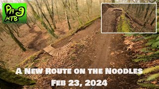
      A New Route on the Noodles Feb 23, 2024
      mtb
      10:20 | 361 | Mar 24, 2024 , Abbotsford
      youtuber Noodley Appendage - Ledgeview - Abbotsford...
      mtb
      6:48 | 259 | Oct 4, 2023 , Abbotsford
      Noodley Appendages
      mtb
      17:51 | 587 | Aug 11, 2020 , Abbotsford
      A day exploring Ledgeview trails
      mtb
      25:13 | 666 | May 1, 2020 , Abbotsford

      Routes with this trail

      more »
      ★ 2.0 • 9 miles • 2,596 ft • 19 •
      Fraser Valley Ledgeview Classic Fraser Valley Relive Your Ride For other ride suggestions for this and...
      37 miles • 5,538 ft • 37 • Loop •
      Valley (Merritt) Crown Tiara Route. Designed by Bobby Wallace, this route gives you some great miles with...
      30 miles • 6,217 ft • 48 •

      Trail Products

      4.6 ★★★★★
      19 Ratings
      5 ★ 58%
      4 ★ 37%
      3 ★ 5%
      2 ★
      1 ★

      5 Reviews & Comments

      jimbo77
      There's a big sign partway down announcing the sanctioning of the trail and how they are working with land managers, etc. Then there's another sign saying 'Private property. Absolutely no trespassing.' most of the way up the climb in the middle. Does anyone have info on this? Should we bypass the climb?
      JqdzD3oS
      I've ridden most of the major spots all over BC/WA/OR and this is probably my favorite "blue" singletrack. Such good, clean, fun! Bit of steep, bit of flow, some jumps. Depending on how wet it's been it ranges from the best tack ever to crazy scary grease to dust city but it's always good just slightly different. If I'm passing by I almost always make time for a lap!
      mulletator mulletator
      I rode the Noodley Appendage for the first time yesterday. Great trail and a great addition to Ledgeview. It's a fun, flowy trail.

      The middle part through the forest is really beautiful. Excellent flow and no wasted elevation. The features are big enough to keep you on your toes.

      Great job builders!

      We hope you've been enjoying Trailforks!

      Create a FREE account to view all trail reviews and much more.

      • #109392 - 5,825 views

      Frequently Asked Questions

      ▼ Where is Noodley Appendage located?
      Noodley Appendage is located in Ledgeview, Abbotsford, British Columbia, Canada. It is part of the Ledgeview trail network. The trailhead is located at coordinates 49.06728, -122.20965.
      ▼ How hard is Noodley Appendage?
      Noodley Appendage is rated as Blue difficulty. The physical rating is Moderate. The average grade is 5.8%.
      ▼ What is the elevation gain for Noodley Appendage?
      Noodley Appendage has 364 ft of elevation gain. The trail has 943 ft of elevation descent. The elevation ranges from 542 ft to 1,132 ft.
      ▼ Is Noodley Appendage a point to point trail?
      Noodley Appendage is not a point to point trail. The direction is Downhill Primary. The trail type is singletrack.
      ▼ How long is Noodley Appendage?
      Noodley Appendage is 1.9 miles long. The trail type is singletrack.
      ▼ Are dogs allowed on Noodley Appendage?
      Yes, dogs are allowed on Noodley Appendage. Please keep dogs on a leash where required and clean up after them.
      ▼ When is the best time of year to ride Noodley Appendage?
      Based on activity log data, the most popular months to ride Noodley Appendage are:
      • June (69 activities)
      • September (59 activities)
      • April (53 activities)
      Check the reports page for current trail conditions.
      ▼ How do I access Noodley Appendage? Where is the closest parking trailhead?
      The closest parking and trailhead locations to Noodley Appendage are: View all parking locations in the area.
      ▼ How long does it take to ride Noodley Appendage?
      Based on recorded activities, it takes an average of 24 minutes to ride Noodley Appendage. The trail is 1.9 miles long. Actual times will vary based on fitness level, conditions, and pace. View recent activity logs for more details.
      ▼ How busy is Noodley Appendage?
      Noodley Appendage is a very popular trail. There have been 5,380 recorded activities on this trail. The trail has received 5,336 check-ins. View recent activity on this trail.

      Hit the Trail

      Open in App

      Get this trail on your phone instantly.

      open trail in app

      Download Trail

      Save to wishlist, Garmin & download.
      save the trail

      Find Related Routes

      Find routes and users activities that include this trail.
      find routes for this trail

      You must enter a description before submitting.