
more stats
2,146 ft
Distance
-198 ft
Descent
00:03:07
Avg time
-198 ft
Altitude change
1,328 ft
Altitude min
1,526 ft
Altitude max
1,526 ft
Altitude start
1,329 ft
Altitude end
-9.2%
Grade
-26.2%
Grade max
-1.3%
Grade min
2,031 ft
Distance down
115 ft
Distance flat
00:03:07
Avg time

Oberegal Details

  • Activities
    • Mountain Bike
    • E-Bike
  • Riding Area
    Königstuhl
    Heidelberg
  • AKA
    Agal
  • Difficulty Rating
  • Local Popularity
    75 in Mountain Biking heatmap [+]
    • 70 in E-Biking
  • Global Ranking
    #5546 in Mountain Biking [+]
    • #39924 in E-Biking
  • National Ranking
    #223 in Mountain Biking · Germany [+]
    • #2,277 in E-Biking
  • Trail Type
    Singletrack
  • Bike Type
    AM, XC
  • Direction
    Downhill Only
    Popular Direction Shown
  • Trail Visibility
    Sometimes hard to follow
  • Dogs Allowed
    Yes
  • eBike Allowed
    Yes up to Class 1
  • TTFs on Trail
    Jump
  • Year Opened
    2025

Naturbelassender Trail, der abwechselnd durch Laubwald und Nadelwald führt und der ein paar kleinere optionale natürliche Kicker enthält. Anfangs relativ flach, im Verlauf wird er dann etwas steiler und damit auch schneller.
Im Anschluss geht es dann direkt weiter zum Egal.

This trail is unsanctioned.

Tags
Faint trailJumps

Recent Activity on Trail

Past Week
  • 0 rides
  •  
6 Months
  • 10 rides
  • 20 miles avg distance
All
  • 18 rides
  • Last: Oct 28, 2026
c1c2c3c4
January
February
March
April
May
June
July
August
September
October
November
December
update trails status or condition

Oberegal Trail Reports

statusdatedescription
Nov 10, 2026 @ 4:36pm (Europe/Berlin)
Nov 10, 2026
reporter Alles frei, ein paar kleinere Äste lagen auf dem Weg und stellenweise Laub
Aug 17, 2026 @ 4:24pm (Europe/Berlin)
Aug 17, 2026
Aug 2, 2026 @ 12:08am (Europe/Berlin)
Aug 1, 2026
reporter Baum weg, Weg frei! Auch etwas die Vegetation zurück gestutzt und Gerümpel entfernt
Jul 31, 2026 @ 12:58am (Europe/Berlin)
Jul 30, 2026
reporter Im oberen Bereich ist ein Baum auf die Linie gefallen, da muss man kurz durch den Wald.
Jul 18, 2026 @ 4:37pm (Europe/Berlin)
Jul 18, 2026
more »
Status:
on Nov 10, 2026
Variable
Avg: 4.39 (4 votes)
Your vote: 0

view (152)
close
      Directions to oberegal trailhead (49.398540, 8.762990)

      Photos

      3 more »
      report
      mtb
      31 |
      Aug 1, 2026 @ 3:09pm
      Aug 1, 2026
      report
      mtb
      43 |
      Jul 30, 2026 @ 3:58pm
      Jul 30, 2026
      report
      mtb
      47 |
      Aug 29, 2025 @ 5:48am
      Aug 29, 2025

      Videos

      2 more »
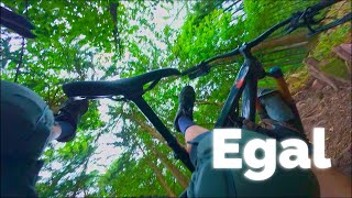
      youtuber Let's Ride MTB - Heidelberg // Königstuhl -...
      mtb
      7:07 | 135 | May 25, 2025 , Heidelberg
      Egal trails
      mtb
      8:16 | 204 | Aug 11, 2025 , Heidelberg
      5.0 ★★★★★
      4 Ratings
      5 ★ 100%
      4 ★
      3 ★
      2 ★
      1 ★

      1 Review & Comments

      hardtailssuck hardtailssuck
      Richtig starkes, grünes Segment. Mit Sinn und Verstand das Terrain genutzt. Sobald etwas Rollgeschwindigkeit vorhanden ist flowed es gut. Macht viel Freude.

      We hope you've been enjoying Trailforks!

      Create a FREE account to view all trail reviews and much more.

      • #680084 - 1,015 views

      Frequently Asked Questions

      ▼ Where is Oberegal located?
      Oberegal is located in Königstuhl, Heidelberg, Germany. It is part of the Königstuhl trail network. The trailhead is located at coordinates 49.39854, 8.76299.
      ▼ How hard is Oberegal?
      Oberegal is rated as Green difficulty. The average grade is 9.2%.
      ▼ What is the elevation gain for Oberegal?
      The trail has 198 ft of elevation descent. The elevation ranges from 1,328 ft to 1,526 ft.
      ▼ Is Oberegal a point to point trail?
      Yes, Oberegal is a point to point trail. The direction is Downhill Only. The trail type is singletrack.
      ▼ How long is Oberegal?
      Oberegal is 2,146 ft long. The trail type is singletrack.
      ▼ Are dogs allowed on Oberegal?
      Yes, dogs are allowed on Oberegal. Please keep dogs on a leash where required and clean up after them.
      ▼ How do I access Oberegal? Where is the closest parking trailhead?
      The closest parking and trailhead locations to Oberegal are: View all parking locations in the area.
      ▼ How long does it take to ride Oberegal?
      Based on recorded activities, it takes an average of 3 minutes to ride Oberegal. The trail is 2,146 ft long. Actual times will vary based on fitness level, conditions, and pace. View recent activity logs for more details.
      ▼ How busy is Oberegal?
      Oberegal is a very popular trail. There have been 132 recorded activities on this trail. The trail has received 152 check-ins. View recent activity on this trail.

      Hit the Trail

      Open in App

      Get this trail on your phone instantly.

      open trail in app

      Download Trail

      Save to wishlist, Garmin & download.
      save the trail

      Find Related Routes

      Find routes and users activities that include this trail.
      find routes for this trail

      You must enter a description before submitting.

