


more stats
2,575 ft
Distance
-172 ft
Descent
00:04:51
Avg time
-172 ft
Altitude change
1,011 ft
Altitude min
1,183 ft
Altitude max
1,183 ft
Altitude start
1,010 ft
Altitude end
-6.7%
Grade
-19.7%
Grade max
2,444 ft
Distance down
131 ft
Distance flat
00:04:51
Avg time

Ode to Joy Details

  • Activities
    • Mountain Bike
    • E-Bike
  • Riding Area
    Carpenter Bypass
    Eugene, Oregon
  • Difficulty Rating
  • Voted Difficulty
    Blue (4 votes)
  • Local Popularity
    85 in Mountain Biking heatmap [+]
    • 65 in E-Biking
  • Global Ranking
    #40830 in Mountain Biking [+]
    • #30643 in E-Biking
  • State Ranking
    #414 in Mountain Biking · Oregon [+]
    • #228 in E-Biking
  • Trail Type
    Singletrack
  • Bike Type
    DH, AM, DJ
  • Physical Rating
    Moderate
  • Dogs Allowed
    Yes
  • eBike Allowed
    Yes up to Class 1
  • TTFs on Trail
    Berm, Drop, Jump, Gap Jump, Rock Garden, Roller Coaster
  • Land Owner
    BLM

Downhill-only flow/freeride trail. Mandatory jumps, drops, and step-ups. Several gap jumps and step-downs with ridearounds. A couple of B-lines available with less challenging options. If you choose to roll many of the features you will find they are often packed with imported rocks.

Access Info

Access the top of this trail from a short gravel spur that heads west and uphill from the main paved Carpenter Bypass Rd. Shares an entrance with Mama Tried.

Tags
BermsDropsJumpsRock gardensRollers

Trail Supporters

  • BLM
    BLM
    Land Manager

Local Trail Association

Recent Activity on Trail

Past Week
  • 1 rides
  • 35.1 km average
6 Months
  • 53 rides
  • 17.8 km avg distance
All
  • 451 rides
  • Last: Nov 18, 2026
c1c2c3c4
January
February
March
April
May
June
July
August
September
October
November
December
update trails status or condition

Ode to Joy Trail Reports

statusdatedescription
Oct 18, 2026 @ 3:55pm (America/Boise)
Oct 18, 2026
Oct 4, 2026 @ 2:22pm (America/Boise)
Oct 4, 2026
Sep 20, 2026 @ 2:11pm (America/Boise)
Sep 20, 2026
Jun 19, 2026 @ 1:56pm (America/Los_Angeles)
Jun 19, 2026
Narrow but long tree blocking the trail. Cannot ride over it unless you can gap over it with significant speed. Hard to move — it is attached to...
Apr 18, 2026 @ 4:09pm (America/Boise)
Apr 18, 2026
couple slick wet spots
more »
Status:
on Oct 18, 2026
Ideal
Avg: 4.15 (13 votes)
Your vote: 0

view (2,035)
close
      Directions to ode-to-joy trailhead (43.806230, -123.270230)

      Photos

      9 more »
      mtb
      558 |
      Dec 29, 2018 @ 1:17pm
      Dec 29, 2018
      mtb
      750 |
      Dec 10, 2015 @ 6:41pm
      Dec 10, 2015
      mtb
      218 |
      Dec 6, 2022 @ 9:39pm
      Dec 6, 2022
      mtb
      457 |
      Apr 25, 2019 @ 4:57pm
      Apr 25, 2019

      Videos

      4 more »
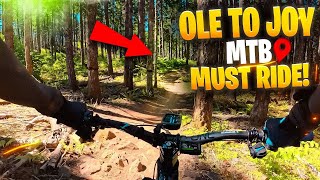
      Let's take a ride on Ode to Joy a full-pull...
      mtb
      4:04 | 142 | Oct 31, 2025 , Eugene
      Let's take an Ode to Joy sight lap at...
      mtb
      3:45 | 98 | Sep 12, 2025 , Eugene
      Carpenter Bypass (Whypass): Ode to Joy
      mtb
      2:47 | 434 | Jul 29, 2025 , Eugene
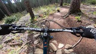
      Ode to Joy at Whypass (Carpenter Bypass) POV
      mtb
      2:56 | 598 | Sep 22, 2021 , Eugene

      Routes with this trail

      more »
      ★ 4.0 • 16 miles • 2,416 ft • 31 •
      Ben's suggested 3 hour Whypass ride.
      7 miles • 1,184 ft • 25 • Out & Back •
      This is a fun route. You can do laps at Hit Parade and The Gift area if you choose. I didn't include Y2K,...
      3 miles • 501 ft • 12 •
      Route to black d jump & tech lines
      4.3 ★★★★★
      13 Ratings
      5 ★ 62%
      4 ★ 23%
      3 ★
      2 ★ 8%
      1 ★ 8%

      6 Reviews & Comments

      Ebenbiker
      This trail was recently improved by DOD volunteers and now runs great! A couple of treacherous areas have been reworked. One was converted from a nasty rock lip to a nice drop of 3 ft or so. Trail starts off with some rock gardens and then berms, jumps and drops, all of which ate rollable except drop just mentioned.
      Benconomics Benconomics
      This is one of those trails that is fun the first time but keeps up the fun factor over time. Lately I've been trying to session some of the specific jumps to get them better dialed. Good for sessioning the whole trail or particular features to get skills dialed (a couple of drops, different types of jumps, etc.). Be sure you're tires are decently pumped to avoid pinch flats.
      RYANejHP6
      Fun trail, interesting jumps with rocks and obstacles that can be rough if you don’t clear it. The trail is clear and logging did NOT destroy this trail

      We hope you've been enjoying Trailforks!

      Create a FREE account to view all trail reviews and much more.

      Frequently Asked Questions

      ▼ Where is Ode to Joy located?
      Ode to Joy is located in Carpenter Bypass, Eugene, Oregon, United States. It is part of the Carpenter Bypass trail network. The trailhead is located at coordinates 43.80623, -123.27023.
      ▼ How hard is Ode to Joy?
      Ode to Joy is rated as Black Diamond difficulty. The physical rating is Moderate. The average grade is 6.7%.
      ▼ What is the elevation gain for Ode to Joy?
      The trail has 172 ft of elevation descent. The elevation ranges from 1,011 ft to 1,183 ft.
      ▼ How long is Ode to Joy?
      Ode to Joy is 2,575 ft long. The trail type is singletrack.
      ▼ Are dogs allowed on Ode to Joy?
      Yes, dogs are allowed on Ode to Joy. Please keep dogs on a leash where required and clean up after them.
      ▼ When is the best time of year to ride Ode to Joy?
      Based on activity log data, the most popular months to ride Ode to Joy are:
      • August (38 activities)
      • September (31 activities)
      • May (29 activities)
      Check the reports page for current trail conditions.
      ▼ How do I access Ode to Joy? Where is the closest parking trailhead?
      The closest parking and trailhead locations to Ode to Joy are: View all parking locations in the area.
      ▼ How long does it take to ride Ode to Joy?
      Based on recorded activities, it takes an average of 5 minutes to ride Ode to Joy. The trail is 2,575 ft long. Actual times will vary based on fitness level, conditions, and pace. View recent activity logs for more details.
      ▼ How busy is Ode to Joy?
      Ode to Joy is a very popular trail. There have been 1,361 recorded activities on this trail. The trail has received 2,035 check-ins. View recent activity on this trail.

      Hit the Trail

      Open in App

      Get this trail on your phone instantly.

      open trail in app

      Download Trail

      Save to wishlist, Garmin & download.
      save the trail

      Find Related Routes

      Find routes and users activities that include this trail.
      find routes for this trail

      You must enter a description before submitting.