more stats
843 ft
Distance
97 ft
Climb
00:02:16
Avg time
97 ft
Altitude change
542 ft
Altitude min
639 ft
Altitude max
542 ft
Altitude start
640 ft
Altitude end
11.5%
Grade
32.3%
Grade min
771 ft
Distance climb
72 ft
Distance flat
00:02:16
Avg time

Ogopogo Details

  • Activities
    • Mountain Bike
    • E-Bike
    • Hike
    • Trail Running
  • Riding Area
    Cumberland trail network
    Cumberland, British Columbia
  • Difficulty Rating
  • Local Popularity
    65 in Mountain Biking [+]
    • 70 in E-Biking
    • 95 in Trail Running
    • 85 in Hiking
  • Global Ranking
    #107923 in Mountain Biking [+]
    • #39688 in E-Biking
    • #64160 in Trail Running
    • #115237 in Hiking
  • Provincial Ranking
    #5,503 in Mountain Biking · British Columbia [+]
    • #2,727 in E-Biking
    • #3,590 in Trail Running
    • #6,200 in Hiking
  • Trail Type
    Singletrack
  • Direction
    Both Directions
    Popular Direction Shown
  • Dogs Allowed
    Yes
  • eBike Allowed
  • TTFs on Trail
    Bridge, Roller Coaster

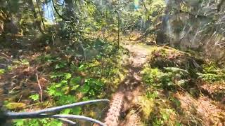
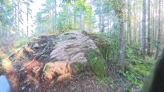
Ogopogo, Cumberland's version of the famed Okanagan lake monster, is a fun way to connect between the Eastern Block and the bottom of Nikkei mountain. The blue square trail includes a double lane bridge which one side easily negotiable and the other side is a humped roller coaster style cedar bridge & log ride that is sure to amuse. The humped section is rated as a black diamond feature and don't forget to carry enough speed to get over the next hump.

Tags
BridgesRollersSkinnies

Trail Supporters

  • Sponsor

Local Trail Association

Recent Activity on Trail

Past Week
  • 1 rides
  • 10 miles average
6 Months
  • 149 rides
  • 13 miles avg distance
All
  • 954 rides
  • Last: Nov 4, 2026
Status:
on Sep 6, 2026
Ideal
Avg: 3.59 (9 votes)
Your vote: 0

view (4,393)
close
      Directions to ogopogo trailhead (49.603690, -125.004410)

      Photos

      19 more »
      mtb
      87 |
      Jan 25, 2024 @ 8:06am
      Jan 25, 2024
      mtb
      143 |
      Jan 6, 2021 @ 10:57pm
      Jan 6, 2021
      mtb
      187 |
      Feb 12, 2020 @ 9:35am
      Feb 12, 2020
      mtb
      150 |
      Nov 21, 2019 @ 8:41pm
      Nov 21, 2019

      Videos

      2 more »
      Ogopogo
      ebike
      0:34 | 86 | Apr 16, 2025 , Cumberland
      Ogopogo
      ebike
      0:16 | 53 | Mar 5, 2025 , Cumberland

      Routes with this trail

      ★ 4.0 • 15 miles • 1,796 ft • 48 • Race •
      Full Cumby 25 km The Full Cumby 25 km delivers exactly what trail runners love most — fast, fun,...
      18 miles • 3,098 ft • 35 •
      3 - 5 hour circuit - to the top of Grunt and Grind, then down some Cumberland signature trails to a climb...
      10 miles • 1,204 ft • 14 • Race •
      The Half Cumby is the most popular race of our four races. All four races will start in our new Race...
      3.4 ★★★★★
      9 Ratings
      5 ★ 33%
      4 ★ 11%
      3 ★ 33%
      2 ★
      1 ★ 22%

      4 Reviews & Comments

      CaptG CaptG
      The humps could be a bit of a challenge with snow
      TonyLovett
      Thanks for the recent repairs to the bridge and grooming back the vegetation. Riding well.
      Durg
      Tree has fallen down onto the bridge where this trail meets Cabbage Patch

      We hope you've been enjoying Trailforks!

      Create a FREE account to view all trail reviews and much more.

      • By canadakaTF Pro Trailforks & contributors
      • #63849 - 2,903 views

      Frequently Asked Questions

      ▼ Where is Ogopogo located?
      Ogopogo is located in Cumberland trail network, Cumberland, British Columbia, Canada. It is part of the Cumberland trail network trail network. The trailhead is located at coordinates 49.60369, -125.00441.
      ▼ How hard is Ogopogo?
      Ogopogo is rated as Blue difficulty. The average grade is 11.5%.
      ▼ What is the elevation gain for Ogopogo?
      Ogopogo has 97 ft of elevation gain. The elevation ranges from 542 ft to 639 ft.
      ▼ Is Ogopogo a point to point trail?
      Ogopogo is not a point to point trail. The direction is Both Directions. The trail type is singletrack.
      ▼ How long is Ogopogo?
      Ogopogo is 843 ft long. The trail type is singletrack.
      ▼ Are dogs allowed on Ogopogo?
      Yes, dogs are allowed on Ogopogo. Please keep dogs on a leash where required and clean up after them.
      ▼ How do I access Ogopogo? Where is the closest parking trailhead?
      The closest parking and trailhead locations to Ogopogo are: View all parking locations in the area.
      ▼ How long does it take to ride Ogopogo?
      Based on recorded activities, it takes an average of 2 minutes to ride Ogopogo. The trail is 843 ft long. Actual times will vary based on fitness level, conditions, and pace. View recent activity logs for more details.
      ▼ How busy is Ogopogo?
      Ogopogo is a moderately popular trail. There have been 4,226 recorded activities on this trail. The trail has received 4,393 check-ins. View recent activity on this trail.

      Hit the Trail

      Open in App

      Get this trail on your phone instantly.

      open trail in app

      Download Trail

      Save to wishlist, Garmin & download.
      save the trail

      Find Related Routes

      Find routes and users activities that include this trail.
      find routes for this trail

      You must enter a description before submitting.