

more stats
3,783 ft
Distance
38 ft
Climb
-49 ft
Descent
00:10:00
Avg time
-10 ft
Altitude change
2,286 ft
Altitude min
2,309 ft
Altitude max
2,308 ft
Altitude start
2,297 ft
Altitude end
-0.3%
Grade
-11.8%
Grade max
10.9%
Grade min
1,493 ft
Distance climb
1,322 ft
Distance down
860 ft
Distance flat
00:10:00
Avg time

Papaschase Details

  • Activities
    • Mountain Bike
    • Winter Fat Bike
    • Hike
    • Trail Running
  • Riding Area
    Mill Woods
    Northwest Edmonton, Alberta
  • Difficulty Rating
  • Voted Difficulty
    Black Diamond (2 votes)
  • Local Popularity
    25 in Mountain Biking [+]
    • 5 in Trail Running
    • 70 in Hiking
    • 5 in Winter Fat Biking
  • Global Ranking
    #126429 in Mountain Biking [+]
    • #319580 in Trail Running
    • #130979 in Hiking
    • #7024 in Winter Fat Biking
  • Provincial Ranking
    #1,778 in Mountain Biking · Alberta [+]
    • #4,867 in Trail Running
    • #2,351 in Hiking
    • #261 in Winter Fat Biking
  • Trail Type
    Singletrack
  • Bike Type
    AM, XC, Fat
  • Direction
    Both Directions
  • Climb Difficulty
    Black Diamond
  • Physical Rating
    Hard
  • Trail Visibility
    Always easy to follow
  • Dogs Allowed
    Yes
  • eBike Allowed
  • TTFs on Trail
    Rock Garden

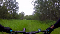
Chief Papaschase trail in the heart of the I.R. 136. A total of 7 climbs from creek to street level. Physically demanding but very enjoyable trail. Terrain & vegetation vary greatly throughout the trail with plenty of rest spots along the way. Watch for the rock garden. South entrance is half way up the multi-use exit to 47 st. at 39 A Ave across from entrance to No Where Man. North exit is the upper trail near the cutline.

Tags
Rock gardens
Local Trail Association

Recent Activity on Trail

Past Week
  • 0 rides
  •  
6 Months
  • 2 rides
  • 5 miles avg distance
All
  • 76 rides
  • Last: Sep 20, 2026
c1c2c3c4
January
February
March
April
May
June
July
August
September
October
November
December
update trails status or condition

Papaschase Trail Reports

statusdatedescription
Aug 14, 2024 @ 6:36pm
Aug 14, 2024
Quite overgrown on the north west section then it gets better.
Aug 28, 2022 @ 6:48pm
Aug 28, 2022
deadfall tree cleared
Aug 26, 2022 @ 6:46pm
Aug 26, 2022
downed tree
Jul 27, 2022 @ 7:09pm
Jul 27, 2022
Papaschase Extention report, approx. 1 km long (not listed on Trailforks but is on Strava) has been cleared of overgrowth and low hanging trunks...
Jul 19, 2022 @ 8:22am
Jul 19, 2022
remaining overgrowth has been cut back to improve sightlines and reveal obstacles, 3 more deadfall trees down across trail have been removed...
more »
Status:
on Aug 14, 2024
Ideal
Avg: 3.88 (3 votes)
Your vote: 0

view (580)
close
      Directions to papaschase trailhead (53.476060, -113.413770)

      Photos

      30 more »
      mtb
      201 |
      Oct 18, 2020 @ 6:39pm
      Oct 18, 2020
      mtb
      167 |
      Oct 13, 2019 @ 1:36pm
      Oct 13, 2019
      mtb
      94 |
      Sep 4, 2021 @ 1:08pm
      Sep 4, 2021
      mtb
      166 |
      Sep 4, 2021 @ 1:08pm
      Sep 4, 2021

      Videos

      1 more »
      Papaschase 2019
      mtb
      12:54 | 373 | Aug 8, 2019 , Northwest Edmonton

      Routes with this trail

      7 miles • 140 ft • 14 •
      This route connects majority of the blue trails in this area. Starts at 17th St going west with a...
      3.7 ★★★★★
      3 Ratings
      5 ★ 33%
      4 ★ 33%
      3 ★
      2 ★ 33%
      1 ★

      5 Reviews & Comments

      Bushellan Bushellan
      Overgrowth across the entire trail has been cut back to improve sight lines and reduce rider frustrations on the proper route to follow as there are several bail out paths and bypasses. Should improve the experience of those checking the area out. Also, several clothesline deadfalls have been removed.
      KellsT
      Has a downed tree you have to go under. Location: 53.4755,-113.411
      Bigjesse53
      I vote this trail is coded black for effort expenditure.

      We hope you've been enjoying Trailforks!

      Create a FREE account to view all trail reviews and much more.

      Nearby Trails

      • By cooper24TF Pro & contributors
      • #179735 - 2,157 views

      Frequently Asked Questions

      ▼ Where is Papaschase located?
      Papaschase is located in Mill Woods, Northwest Edmonton, Alberta, Canada. It is part of the Mill Woods trail network. The trailhead is located at coordinates 53.47606, -113.41377.
      ▼ How hard is Papaschase?
      Papaschase is rated as Blue difficulty. The physical rating is Hard. The average grade is 0.3%. The climb difficulty is rated Black Diamond.
      ▼ What is the elevation gain for Papaschase?
      Papaschase has 38 ft of elevation gain. The trail has 49 ft of elevation descent. The elevation ranges from 2,286 ft to 2,309 ft.
      ▼ Is Papaschase a point to point trail?
      Papaschase is not a point to point trail. The direction is Both Directions. The trail type is singletrack.
      ▼ How long is Papaschase?
      Papaschase is 3,783 ft long. The trail type is singletrack.
      ▼ Are dogs allowed on Papaschase?
      Yes, dogs are allowed on Papaschase. Please keep dogs on a leash where required and clean up after them.
      ▼ When is the best time of year to ride Papaschase?
      Based on activity log data, the most popular months to ride Papaschase are:
      • April (2 activities)
      • September (2 activities)
      • October (2 activities)
      Check the reports page for current trail conditions.
      ▼ How do I access Papaschase? Where is the closest parking trailhead?
      ▼ How long does it take to ride Papaschase?
      Based on recorded activities, it takes an average of 10 minutes to ride Papaschase. The trail is 3,783 ft long. Actual times will vary based on fitness level, conditions, and pace. View recent activity logs for more details.
      ▼ How busy is Papaschase?
      Papaschase is a less popular trail with lighter traffic. There have been 545 recorded activities on this trail. The trail has received 580 check-ins. View recent activity on this trail.

      Hit the Trail

      Open in App

      Get this trail on your phone instantly.

      open trail in app

      Download Trail

      Save to wishlist, Garmin & download.
      save the trail

      Find Related Routes

      Find routes and users activities that include this trail.
      find routes for this trail

      You must enter a description before submitting.



