
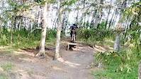
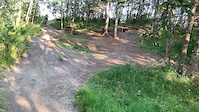
This route connects majority of the blue trails in this area. Starts at 17th St going west with a relatively easy blue for warm-up, gets physically and technically challenging after crossing 34th st going to 50th st., then ends with an easy green going back to 34th St.
Some of the segments are tight specially in the middle of spring, and will be hard to achieve flow. The trails are also great for winter biking as it becomes relatively wider without the foliage.
The trails in this route are fun if you are looking for a physically and technically challenging XC trail
Trail Issues on Route
- Significant Issue / Amber: 1 trail (newest: Aug 3, 2026)
- Minor Issue / Yellow: 4 trails (newest: Aug 14, 2026)
Local Trail Association
Edmonton Mountain Bike Alliance (www.edmmtnbike.ca)Stats
-
Distance7 miles
-
Avg time1 hr 53 min
-
Altitude change-18 ft
-
Altitude min2,270 ft
-
Altitude start2,333 ft
-
Altitude end2,316 ft
-
Climb140 ft
-
Descent-159 ft
-
Grade max-8.7%
-
Grade min7.9%
-
Distance climb2 miles
-
Distance down2 miles
-
Distance flat4 miles
13 Reviews & Comments
We hope you've been enjoying Trailforks!
Create a FREE account to view all route reviews and much more.
Trails in Route
| 1,138 ft | |||||
| 344 ft | |||||
| 991 ft | |||||
| 1,604 ft | |||||
| 2,451 ft | |||||
| 2,159 ft | |||||
| 3,205 ft | |||||
| 253 ft | |||||
| 2,477 ft | |||||
| 3,593 ft | |||||
Details
-
Riding area
-
Primary ActivityMountain Bike
-
Other Activities
- E-Bike
- Gravel Bike
- Hike
- Trail Running
-
Difficulty ratingBlue
-
eBike Allowed
-
Bike typeAM, XC, Fat, Gravel
- Unknown
- Snow Groomed
- Snow Packed
- Snow Covered
- Snow Cover Partial
- Freeze/thaw Cycle
- Icy
- Prevalent Mud
- Wet
- Variable
- Ideal
- Dry
- Very Dry
The colour categories are based on what percentage of users are riding a trail in its intended direction.
- > 96%
- > 90%
- > 80%
- > 70%
- > 50%
- < 50%
- bi-directional trail
- no data
- < 2 days
- < 1 week
- < 2 weeks
- < 1 month
- < 6 months
- > 6 months
- Downhill Only
- Downhill Primary
- Both Directions
- Uphill Primary
- Uphill Only
- One Direction
- Description
- Photos
- Description & Photos
- Videos
- most popular
- popular
- less popular
- not popular
Service Road Atlas is a free to use, community-driven service for viewing and creating reports on the numerous back-country service roads around B.C. and Alberta.
Save the current map location and zoom level as your default home location whenever this page is loaded.
Save- Singletrack
Photos
Videos
Recent Trail Reports Along Route
- By chrisroym
& contributors - #54403 - 570 views
