more stats
2.7 miles
Distance
252 ft
Climb
-1,161 ft
Descent
00:23:34
Avg time
-909 ft
Altitude change
1,843 ft
Altitude min
2,824 ft
Altitude max
2,753 ft
Altitude start
1,844 ft
Altitude end
-6.3%
Grade
-44.1%
Grade max
24.4%
Grade min
3,238 ft
Distance climb
2 miles
Distance down
1,654 ft
Distance flat
00:23:34
Avg time

Papoose Details

  • Activities
    • Mountain Bike
    • Winter Fat Bike
    • Hike
    • Trail Running
  • Riding Area
    Whiskeytown
    Redding, California
  • Difficulty Rating
  • Voted Difficulty
    Blue (1 vote)
  • Local Popularity
    40 in Mountain Biking [+]
    • 80 in Trail Running
    • 60 in Hiking
    • 5 in Winter Fat Biking
  • Global Ranking
    #128117 in Mountain Biking [+]
    • #68319 in Trail Running
    • #131575 in Hiking
    • #6220 in Winter Fat Biking
  • State Ranking
    #4,779 in Mountain Biking · California [+]
    • #3,307 in Trail Running
    • #7,398 in Hiking
    • #138 in Winter Fat Biking
  • Trail Type
    Singletrack
  • Bike Type
    AM, XC, Fat
  • Direction
    Both Directions
  • Climb Difficulty
    Blue
  • Physical Rating
    Moderate
  • Dogs Allowed
    Yes
  • TTFs on Trail
    Ladder Bridge

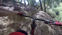
Papoose Trail is located in Whiskeytown National Park. A fun tight single track that starts right out of the campground. The trail winds through the forest and has minimal exposure. There are a few steep sections on your way up.

Access Info

Papoose Trail starts right out of the Sheep Camp campground, just to the right of the fire road. The trail is clearly marked with a sign.

Tags
ExposureSkinnies

Local Trail Association

Traditionally Indigenous Territory

Recent Activity on Trail

Past Week
  • 0 rides
  •  
6 Months
  • 5 rides
  • 14 miles avg distance
All
  • 30 rides
  • Last: Oct 10, 2026
c1c2c3c4
January
February
March
April
May
June
July
August
September
October
November
December
update trails status or condition

Papoose Trail Reports

statusdatedescription
Jun 4, 2026 @ 9:07am (America/Los_Angeles)
Jun 4, 2026
few trees down and a bit overgrown but rideable
Sep 13, 2025 @ 6:25pm (America/Los_Angeles)
Sep 13, 2025
Cleared most of the trail today with my hand saw. Only 2 trees left that were too big. Riding great!
May 17, 2025 @ 7:26pm
May 17, 2025
Still significant deadfall. Turned around about 2/3 up from Sheep Camp after encountering 18 downed trees
May 8, 2024 @ 2:22pm
May 8, 2024
Sawyers working on it today. Should be ready in a couple days
Nov 11, 2023 @ 12:00am
Nov 11, 2023
more »
Status:
on Jun 4, 2026
Ideal
Avg: 3.77 (3 votes)
Your vote: 0

view (405)
close
      Directions to papoose trailhead (40.609810, -122.611430)

      Photos

      15 more »
      mtb
      107 |
      Apr 19, 2022 @ 6:19pm
      Apr 19, 2022
      mtb
      104 |
      Apr 19, 2022 @ 6:19pm
      Apr 19, 2022
      mtb
      104 |
      Apr 19, 2022 @ 6:19pm
      Apr 19, 2022
      mtb
      114 |
      Apr 19, 2022 @ 6:19pm
      Apr 19, 2022

      Videos

      1 more »
      Papoose POV
      mtb
      14:05 | 228 | Apr 23, 2016 , Redding

      Routes with this trail

      17 miles • 3,433 ft • 6 • Loop •
      This Bigfoot Adventure Challenge route on the West side of the Whiskeytown National Recreation Area to the...
      12 miles • 2,731 ft • 7 •
      This Bigfoot Adventure Challenge run takes you to new elevations. You will climb to the top of both...
      ★ 5.0 • 21 miles • 4,534 ft • 9 • Race •
      The Jackalope Lope 30k featuring some of the biggest and steepest climbed Whiskeytown has to offer.
      3.4 ★★★★★
      3 Ratings
      5 ★
      4 ★ 67%
      3 ★
      2 ★ 33%
      1 ★

      3 Reviews & Comments

      GregxsjVi
      Rode this trail December 2025.. fun trail, but tons of trees down
      BarryLMB2Fx
      A dozen or so trees down at end of Nov 2024
      Dwilliams1144
      Rode down papoose a few days ago , it was great conditions just a little dusty. Some sticks and debris in the trail

      We hope you've been enjoying Trailforks!

      Create a FREE account to view all trail reviews and much more.

      • By Mouser0007 & contributors
      • #48032 - 3,263 views

      Frequently Asked Questions

      ▼ Where is Papoose located?
      Papoose is located in Whiskeytown, Redding, California, United States. It is part of the Whiskeytown trail network. The trailhead is located at coordinates 40.60981, -122.61143.
      ▼ How hard is Papoose?
      Papoose is rated as Blue difficulty. The physical rating is Moderate. The average grade is 6.3%. The climb difficulty is rated Blue.
      ▼ What is the elevation gain for Papoose?
      Papoose has 252 ft of elevation gain. The trail has 1,161 ft of elevation descent. The elevation ranges from 1,843 ft to 2,824 ft.
      ▼ Is Papoose a point to point trail?
      Papoose is not a point to point trail. The direction is Both Directions. The trail type is singletrack.
      ▼ How long is Papoose?
      Papoose is 2.7 miles long. The trail type is singletrack.
      ▼ Are dogs allowed on Papoose?
      Yes, dogs are allowed on Papoose. Please keep dogs on a leash where required and clean up after them.
      ▼ How do I access Papoose? Where is the closest parking trailhead?
      The closest parking and trailhead locations to Papoose are: View all parking locations in the area.
      ▼ How long does it take to ride Papoose?
      Based on recorded activities, it takes an average of 24 minutes to ride Papoose. The trail is 2.7 miles long. Actual times will vary based on fitness level, conditions, and pace. View recent activity logs for more details.
      ▼ How busy is Papoose?
      Papoose is a moderately popular trail. There have been 371 recorded activities on this trail. The trail has received 405 check-ins. View recent activity on this trail.

      Hit the Trail

      Open in App

      Get this trail on your phone instantly.

      open trail in app

      Download Trail

      Save to wishlist, Garmin & download.
      save the trail

      Find Related Routes

      Find routes and users activities that include this trail.
      find routes for this trail

      You must enter a description before submitting.