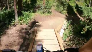
more stats
7.9 miles
Distance
428 ft
Climb
-1,303 ft
Descent
01:06:52
Avg time
-875 ft
Altitude change
9,098 ft
Altitude min
10,182 ft
Altitude max
9,990 ft
Altitude start
9,114 ft
Altitude end
-2.1%
Grade
-24.3%
Grade max
15.2%
Grade min
2 miles
Distance climb
5 miles
Distance down
2,320 ft
Distance flat
01:06:52
Avg time

Peaks Trail Details

  • Activities
    • Mountain Bike
    • Hike
    • Trail Running
  • Riding Area
    Breckenridge
    , Colorado
  • Difficulty Rating
  • Voted Difficulty
    Black Diamond (4 votes)
  • Local Popularity
    90 in Mountain Biking heatmap [+]
    • 95 in Trail Running
    • 80 in Hiking
  • Global Ranking
    #14855 in Mountain Biking [+]
    • #58385 in Trail Running
    • #74695 in Hiking
  • State Ranking
    #213 in Mountain Biking · Colorado [+]
    • #1,822 in Trail Running
    • #2,301 in Hiking
  • Trail Type
    Singletrack
  • Bike Type
    AM, XC
  • Direction
    Both Directions
  • Trail Visibility
    Always easy to follow
  • Dogs Allowed
    Yes
  • eBike Allowed

The Peaks Trail is an iconic Summit County staple, widely considered a rite of passage for any mountain biker. Stretching 8 miles one-way between Peak 7 in Breckenridge and the Frisco Backyard (ending near Rainbow Lake), this classic singletrack contours the lower flanks of the Tenmile Range.

While it can be ridden in either direction, it is best ridden point-to-point downhill from Breckenridge to Frisco, allowing you to turn a potentially grueling climb into an adrenaline-fueled, technical descent with a net elevation drop. You can easily catch the free Summit Stage bus from Frisco to shuttle back up to the Breckenridge trailhead.

Tags
Summit

Trail Supporters

Local Trail Association

Traditionally Indigenous Territory

Recent Activity on Trail

Past Week
  • 0 rides
  •  
6 Months
  • 105 rides
  • 29.2 km avg distance
All
  • 430 rides
  • Last: Nov 7, 2026
update trails status or condition

Peaks Trail Trail Reports

statusdatedescription
Nov 7, 2026 @ 3:44pm (America/Denver)
Nov 7, 2026
Snow and ice in the shade, some muddy spots. Non-shaded spots are clear
Oct 29, 2026 @ 9:46am (America/Denver)
Oct 29, 2026
reporter Snow and ice hanging out in the shade.
Oct 8, 2026 @ 10:36am (America/Denver)
Oct 8, 2026
Jul 27, 2026 @ 10:04am (America/Denver)
Jul 27, 2026
Jun 7, 2026 @ 1:53pm (America/Denver)
Jun 7, 2026
all clear. almost all puddles/wet spots dried up
more »
Status:
on Nov 7, 2026
Snow Covered
Avg: 4.32 (32 votes)
Your vote: 0

view (2,750)
close
      Directions to peaks-trail-12749 trailhead (39.487570, -106.067200)

      Photos

      72 more »
      mtb
      135 |
      Oct 4, 2025 @ 5:21pm
      Oct 4, 2025
      mtb
      145 |
      Oct 4, 2025 @ 5:21pm
      Oct 4, 2025
      mtb
      132 |
      Oct 4, 2025 @ 5:22pm
      Oct 4, 2025
      mtb
      172 |
      Sep 28, 2023 @ 11:53am
      Sep 28, 2023

      Videos

      3 more »
      Peaks Trail - Video shows the many faces of...
      mtb
      42:54 | 538 | Aug 17, 2023 , Breckenridge
      Peaks Trail and Frisco Bike Park
      mtb
      5:47 | 1239 | Jun 28, 2019 , Breckenridge
      Peaks Trail Frisco, CO
      mtb
      3:31 | 699 | Jun 29, 2014 , Breckenridge

      Routes with this trail

      more »
      ★ 3.5 • 12 miles • 2,724 ft • 5 •
      Just a little schnitzel that would be sick to shuttle.
      27 miles • 3 ft • 8 • Loop •
      Loop to leave and return back to Tiger Run Campground.
      9 miles • 1,479 ft • 6 • Loop •
      Miners Creek Rd to the top, CT/Peaks back to town. The perfect ride after work. Get to Miner's Creek Rd...

      Trail Events

      4.3 ★★★★★
      32 Ratings
      5 ★ 50%
      4 ★ 38%
      3 ★ 6%
      2 ★ 3%
      1 ★ 3%

      13 Reviews & Comments

      ashwc
      I've done the small section between peaks connect and Siberian Loop. It's a gnarly technical climb and it's a lotta fun. Rewards good line choice. I haven't done the rest of the trail though.
      AEnright
      3/10 at best. If baby headed, rooted, 8 foot wide “single track”cross country is your thing, then this is your ticket. If not, ride one of the other 150 trails Breck has to offer.
      Dmac13
      I loved it! A nice mix of tech and flow. Tons of chunky scetions and plenty of spots to have a nice break and take in the views. I'd say one of my favorite trails in Breck.

      We hope you've been enjoying Trailforks!

      Create a FREE account to view all trail reviews and much more.

      • By LesleyJaneTF Pro SCoMBA & contributors
      • #12749 - 14,149 views

      Frequently Asked Questions

      ▼ Where is Peaks Trail located?
      Peaks Trail is located in Breckenridge, Colorado, United States. It is part of the Breckenridge trail network. The trailhead is located at coordinates 39.48757, -106.0672.
      ▼ How hard is Peaks Trail?
      Peaks Trail is rated as Blue difficulty. The average grade is 2.1%.
      ▼ What is the elevation gain for Peaks Trail?
      Peaks Trail has 428 ft of elevation gain. The trail has 1,303 ft of elevation descent. The elevation ranges from 9,098 ft to 10,182 ft.
      ▼ Is Peaks Trail a point to point trail?
      Peaks Trail is not a point to point trail. The direction is Both Directions. The trail type is singletrack.
      ▼ How long is Peaks Trail?
      Peaks Trail is 7.9 miles long. The trail type is singletrack.
      ▼ Are dogs allowed on Peaks Trail?
      Yes, dogs are allowed on Peaks Trail. Please keep dogs on a leash where required and clean up after them.
      ▼ How do I access Peaks Trail? Where is the closest parking trailhead?
      The closest parking and trailhead locations to Peaks Trail are: View all parking locations in the area.
      ▼ How long does it take to ride Peaks Trail?
      Based on recorded activities, it takes an average of 1 hour 7 minutes to ride Peaks Trail. The trail is 7.9 miles long. Actual times will vary based on fitness level, conditions, and pace. View recent activity logs for more details.
      ▼ How busy is Peaks Trail?
      Peaks Trail is a very popular trail. There have been 2,636 recorded activities on this trail. The trail has received 2,750 check-ins. View recent activity on this trail.

      Hit the Trail

      Open in App

      Get this trail on your phone instantly.

      open trail in app

      Download Trail

      Save to wishlist, Garmin & download.
      save the trail

      Find Related Routes

      Find routes and users activities that include this trail.
      find routes for this trail

      You must enter a description before submitting.