

more stats
1.7 miles
Distance
394 ft
Climb
-10 ft
Descent
00:18:26
Avg time
383 ft
Altitude change
2,955 ft
Altitude min
3,339 ft
Altitude max
2,955 ft
Altitude start
3,337 ft
Altitude end
4.3%
Grade
-5.2%
Grade max
16%
Grade min
1 mile
Distance climb
574 ft
Distance down
1,955 ft
Distance flat
00:18:26
Avg time

Pilsit Details

  • Activities
    • Mountain Bike
    • E-Bike
    • Hike
    • Trail Running
  • Riding Area
    Cranbrook Community Forest
    Cranbrook, British Columbia
  • Ref Number
    #056
  • Difficulty Rating
  • Voted Difficulty
    Green (1 vote)
  • Local Popularity
    100 in Mountain Biking [+]
    • 100 in E-Biking
    • 100 in Trail Running
    • 100 in Hiking
  • Global Ranking
    #30593 in Mountain Biking [+]
    • #2743 in E-Biking
    • #77438 in Trail Running
    • #82018 in Hiking
  • Provincial Ranking
    #1,506 in Mountain Biking · British Columbia [+]
    • #251 in E-Biking
    • #4,492 in Trail Running
    • #4,301 in Hiking
  • Hiking SAC Scale
    T1 Hiking
  • Trail Type
    Machine Groomed
  • Bike Type
    XC
  • Climb Difficulty
    Green
  • Physical Rating
    Easy
  • Dogs Allowed
    Yes
  • eBike Allowed
    Yes up to Class 1
  • TTFs on Trail
    Berm
  • Land Owner
    FLNROD

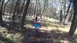
Pilisit Trail was named after the wife of revered Ktunaxa Chief Isadore.
This is an easy beginner trail that is 1.2 meters wide that climbs at 3 - 5 % from the Chief Isadore Trail to the Kettle Lake parking lot. The lower part of the trail can also be linked with [L=https://www.trailforks.com/trails/elephant-run/] Elephant Run to make a nice 3.8 km beginner loop.

Makes for a great first ever downhill run. This trail is also a part of the Cranbrook Great Trail Loop

Access Info

Kettle Lake Connector and Isadore Canyon

Tags
Berms
Local Trail Association
Traditionally Indigenous Territory

Recent Activity on Trail

Past Week
  • 18 rides
  • 7 miles average
6 Months
  • 508 rides
  • 9 miles avg distance
All
  • 2,607 rides
  • Last: Oct 4, 2026
c1c2c3c4
January
February
March
April
May
June
July
August
September
October
November
December
Status:
on Sep 26, 2026
Ideal
Avg: 4.16 (18 votes)
Your vote: 0

view (8,231)
close
      Directions to pilsit trailhead (49.540510, -115.737010)

      Photos

      14 more »
      mtb
      115 |
      May 18, 2023 @ 9:36pm
      May 18, 2023
      mtb
      91 |
      May 18, 2023 @ 9:35pm
      May 18, 2023
      mtb
      96 |
      Apr 18, 2022 @ 2:49pm
      Apr 18, 2022
      mtb
      93 |
      Apr 18, 2022 @ 2:48pm
      Apr 18, 2022

      Videos

      1 more »
      Pilsit Clips
      mtb
      0:27 | 115 | Sep 23, 2024 , Cranbrook

      Routes with this trail

      ★ 1.4 • 10 miles • 552 ft • 10 • Loop •
      Opened in May of 2019 The 16km+ loop intergrates graveled dirt trails within the Cranbrook Community...
      ★ 2.5 • 35 miles • 2,210 ft • 5 • Loop •
      The quintessential gravel loop from Cranbrook. Rides great in either direction.
      ★ 1.4 • 11 miles • 1,272 ft • 32 •
      Designated Forest Loops Trail as per Cranbrook Community Forest trail map.
      4.2 ★★★★★
      18 Ratings
      5 ★ 61%
      4 ★ 17%
      3 ★ 11%
      2 ★ 6%
      1 ★ 6%

      7 Reviews & Comments

      lrturner
      Super fun connector to fun rides in the community forest. Try connecting to migor then expresso. Fun trails
      Tunester
      Unequivocally one of the best trails I’ve ever ridden. Perfect gentle climb, and ear to ear grin on the fun flowy descent!
      usedbikerider usedbikerider
      E-Bikes are very welcome. Everyone can enjoy our trails.

      We hope you've been enjoying Trailforks!

      Create a FREE account to view all trail reviews and much more.

      • By usedbikeriderTF Pro & contributors
      • #134504 - 5,881 views

      Frequently Asked Questions

      ▼ Where is Pilsit located?
      Pilsit is located in Cranbrook Community Forest, Cranbrook, British Columbia, Canada. It is part of the Cranbrook Community Forest trail network. The trailhead is located at coordinates 49.54051, -115.73701.
      ▼ How hard is Pilsit?
      Pilsit is rated as Green difficulty. The physical rating is Easy. The average grade is 4.3%. The climb difficulty is rated Green.
      ▼ What is the elevation gain for Pilsit?
      Pilsit has 394 ft of elevation gain. The trail has 10 ft of elevation descent. The elevation ranges from 2,955 ft to 3,339 ft.
      ▼ How long is Pilsit?
      Pilsit is 1.7 miles long. The trail type is machine groomed.
      ▼ Are dogs allowed on Pilsit?
      Yes, dogs are allowed on Pilsit. Please keep dogs on a leash where required and clean up after them.
      ▼ When is the best time of year to ride Pilsit?
      Based on activity log data, the most popular months to ride Pilsit are:
      • April (299 activities)
      • May (222 activities)
      • August (203 activities)
      Check the reports page for current trail conditions.
      ▼ How do I access Pilsit? Where is the closest parking trailhead?
      The closest parking and trailhead locations to Pilsit are: View all parking locations in the area.
      ▼ How long does it take to ride Pilsit?
      Based on recorded activities, it takes an average of 18 minutes to ride Pilsit. The trail is 1.7 miles long. Actual times will vary based on fitness level, conditions, and pace. View recent activity logs for more details.
      ▼ How busy is Pilsit?
      Pilsit is a very popular trail. There have been 7,591 recorded activities on this trail. The trail has received 8,231 check-ins. View recent activity on this trail.

      Hit the Trail

      Open in App

      Get this trail on your phone instantly.

      open trail in app

      Download Trail

      Save to wishlist, Garmin & download.
      save the trail

      Find Related Routes

      Find routes and users activities that include this trail.
      find routes for this trail

      You must enter a description before submitting.