





Open in App
Get this trail on your phone instantly.

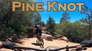
Great moderate downhill. Just enough tech to keep you on your toes.
Pineknot trail is sometimes difficult to follow at the northern end due to the heavy foot-traffic around the Aspen Glen Picnic Area and the lack of vegetation. The majority of the trail is easy to follow. It can be ridden in either direction, but it's definitely more fun from south to north heading downhill. It has some minor root and rock drops - pretty mellow - and lots of flow. There is one very small stream crossing which may be dry depending on season. it is a popular trail for mountain biking and has been used in XC races. Expect to encounter hikers and families at the northern end.


| c1 | c2 | c3 | c4 |
|---|---|---|---|
January | February | March | April |
May | June | July | August |
September | October | November | December |

Service Road Atlas is a free to use, community-driven service for viewing and creating reports on the numerous back-country service roads around B.C. and Alberta.
Save the current map location and zoom level as your default home location whenever this page is loaded.
SaveWe hope you've been enjoying Trailforks!
Create a FREE account to view all trail reviews and much more.
 TRAILFORKS & contributors
You must enter a description before submitting.

