
more stats
2,720 ft
Distance
-355 ft
Descent
00:03:34
Avg time
-355 ft
Altitude change
595 ft
Altitude min
950 ft
Altitude max
950 ft
Altitude start
594 ft
Altitude end
-13%
Grade
-53%
Grade max
-2.8%
Grade min
2,720 ft
Distance down
00:03:34
Avg time

Pipedream Details

  • Activities
    • Mountain Bike
    • E-Bike
  • Riding Area
    Ridgeline Park
    Eugene, Oregon
  • AKA
    Meaty Snack
  • Difficulty Rating
  • Voted Difficulty
    Blue (1 vote)
  • Local Popularity
    90 in Mountain Biking [+]
    • 50 in E-Biking
  • Global Ranking
    #13463 in Mountain Biking
  • Trail Type
    Singletrack
  • Bike Type
    DH, AM, XC
  • Direction
    Downhill Only
    Popular Direction Shown
  • Trail Visibility
    Always easy to follow
  • eBike Allowed
    Yes up to Class 1
  • TTFs on Trail
    Berm, Jump, Rock Garden
  • Ride in Rain
    Yes
  • Year Opened
    2022
  • Land Owner
    Eugene Parks and Open Space

This trail is a product of a partnership between the City of Eugene Parks and Open Space, and the Eugene Mountain Bike Stewards (led by Jack Hill) in improving a preexisting unsanctioned trail both to sustain more heavy use and rerouting about half of the trail through very steep terrain.

It represents the first official dedicated mountain bike trail in Eugene. More will soon follow. Please respect other riders and the hikers and runners on the ridgeline when accessing the trail.

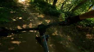
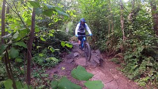
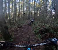
For features, there is a rock garden as the start of the trail, some berms which at times are pretty steep, some rollers and a step up, and small table top at the end.

Local Trail Association

Recent Activity on Trail

Past Week
  • 3 rides
  • 12 miles average
6 Months
  • 80 rides
  • 10 miles avg distance
All
  • 289 rides
  • Last: Sep 19, 2026
c1c2c3c4
January
February
March
April
May
June
July
August
September
October
November
December
update trails status or condition

Pipedream Trail Reports

statusdatedescription
Jul 26, 2026 @ 4:14pm (America/Boise)
Jul 26, 2026
Jun 7, 2026 @ 1:33pm (America/Los_Angeles)
Jun 7, 2026
Watch for a few blackberries and some rutted sections where it’s steeper
May 3, 2026 @ 10:13am (America/Boise)
May 3, 2026
Riding fast and fun. Winter was hard on the lowest berms and left water drainage tracks through several and makes it quite bumpy.
Apr 19, 2026 @ 8:54am (America/Los_Angeles)
Apr 19, 2026
Jan 20, 2026 @ 6:30pm (America/Boise)
Jan 20, 2026
Slick in the worst spots, frozen mostly. During the day its probably pure mud.
more »
Status:
on Jul 26, 2026
Ideal
Avg: 3.85 (9 votes)
Your vote: 0

view (1,217)
close
      Directions to pipedream-552299 trailhead (43.989630, -123.071350)

      Photos

      17 more »
      mtb
      142 |
      Nov 8, 2023 @ 12:53pm
      Nov 8, 2023
      mtb
      155 |
      Nov 8, 2023 @ 12:53pm
      Nov 8, 2023
      mtb
      131 |
      Nov 8, 2023 @ 12:53pm
      Nov 8, 2023
      mtb
      146 |
      Jul 26, 2023 @ 2:55pm
      Jul 26, 2023

      Videos

      4 more »
      Eugene Ridgeline Trail System: Pipedream
      mtb
      2:28 | 316 | Jul 29, 2025 , Eugene
      Pipedream Trail 8-10-22
      mtb
      2:15 | 637 | Aug 10, 2022 , Eugene
      Pipedream | Ridgeline System | Eugene Oregon
      mtb
      3:21 | 934 | Jul 27, 2022 , Eugene
      Dangerous Dave finds a slippery patch
      mtb
      0:14 | 152 | Dec 22, 2023 , Eugene

      Routes with this trail

      2 miles 485 ft 1 Loop
      The uphill has steepish climb sections that are longer than you usually see on trails designed for mtb's....
      3.9
      9 Ratings
      5 44%
      4 22%
      3 11%
      2 22%
      1

      6 Reviews & Comments

      Warp382
      Trail is lookin good! Like the storm never happened!
      stonesanddirt stonesanddirt
      finesse is key when it gets greasy…and a blast, you’ll be laughing out loud
      ssk1000
      Steep whippy berm section is so fun!

      Thank you to the people who made this!

      We hope you've been enjoying Trailforks!

      Create a FREE account to view all trail reviews and much more.

      • By BenconomicsTF Pro DOD & contributors
      • #552299 - 4,012 views

      Frequently Asked Questions

      Where is Pipedream located?
      Pipedream is located in Ridgeline Park, Eugene, Oregon, United States. It is part of the Ridgeline Park trail network. The trailhead is located at coordinates 43.98963, -123.07135.
      How hard is Pipedream?
      Pipedream is rated as Blue difficulty. The average grade is 13%.
      What is the elevation gain for Pipedream?
      The trail has 355 ft of elevation descent. The elevation ranges from 595 ft to 950 ft.
      Is Pipedream a point to point trail?
      Yes, Pipedream is a point to point trail. The direction is Downhill Only. The trail type is singletrack.
      How long is Pipedream?
      Pipedream is 2,720 ft long. The trail type is singletrack.
      Are dogs allowed on Pipedream?
      There is no information about dogs being allowed on Pipedream. Check with local trail managers or the trail page for the latest access rules.
      How do I access Pipedream? Where is the closest parking trailhead?
      The closest parking and trailhead locations to Pipedream are: View all parking locations in the area.
      How long does it take to ride Pipedream?
      The estimated time to ride Pipedream is approximately 4 minutes. The trail is 2,720 ft long. Actual times will vary based on fitness level, conditions, and pace.
      How busy is Pipedream?
      Pipedream is a very popular trail. There have been 964 recorded activities on this trail. The trail has received 1,217 check-ins. View recent activity on this trail.

      Hit the Trail

      Open in App

      Get this trail on your phone instantly.

      open trail in app

      Download Trail

      Save to wishlist, Garmin & download.
      save the trail

      Find Related Routes

      Find routes and users activities that include this trail.
      find routes for this trail

      You must enter a description before submitting.