
more stats
4,524 ft
Distance
97 ft
Climb
-109 ft
Descent
00:41:15
Avg time
-14 ft
Altitude change
7,740 ft
Altitude min
7,801 ft
Altitude max
7,795 ft
Altitude start
7,782 ft
Altitude end
-0.3%
Grade
-15.1%
Grade max
15.8%
Grade min
2,060 ft
Distance climb
2,087 ft
Distance down
374 ft
Distance flat
00:41:15
Avg time

Platta Details

  • Activities
    • Mountain Bike
    • E-Bike
    • Hike
    • Trail Running
  • Riding Area
  • Difficulty Rating
  • Local Popularity
    60 in Mountain Biking [+]
    • 75 in E-Biking
    • 5 in Trail Running
    • 90 in Hiking
  • Global Ranking
    #75013 in Mountain Biking [+]
    • #108371 in E-Biking
    • #336813 in Trail Running
    • #72229 in Hiking
  • National Ranking
    #1,674 in Mountain Biking · Switzerland [+]
    • #3,428 in E-Biking
    • #7,581 in Trail Running
    • #2,575 in Hiking
  • Hiking SAC Scale
    T1 Hiking
  • Trail Type
    Singletrack
  • Bike Type
    AM, XC
  • Direction
    Both Directions
  • Climb Difficulty
    Black Diamond
  • Physical Rating
    Hard
  • Trail Visibility
    Always easy to follow
  • Dogs Allowed
    Yes
  • eBike Allowed
    Yes up to Class 1

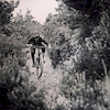
Tech singletrack, with lots of rocks, you have to push your bike sometimes and have good skills on rocks and trial The view is just awesome on the glacier !
Sentier trés technique, beaucoup de cailloux, il faudra pousser le vélo sur certaines portions. Il faudra des bonnes compétences sur des sentiers techniques et peu rapide ! Vue magnifique sur le glacier ! Uniquement en aller retour

Tags
GlacierHike-a-bike

Recent Activity on Trail

Past Week
  • 0 rides
  •  
6 Months
  • 17 rides
  • 20 miles avg distance
All
  • 32 rides
  • Last: Oct 17, 2026
c1c2c3c4
January
February
March
April
May
June
July
August
September
October
November
December
Status:
on Sep 4, 2026
Ideal
Avg: 3.81 (6 votes)
Your vote: 0

view (198)
close
      Directions to platta trailhead (46.444540, 8.088590)

      Photos

      19 more »
      mtb
      106 |
      Aug 9, 2023 @ 12:58pm
      Aug 9, 2023
      mtb
      104 |
      Aug 9, 2023 @ 12:58pm
      Aug 9, 2023
      mtb
      91 |
      Jul 18, 2022 @ 5:55am
      Jul 18, 2022
      mtb
      109 |
      Jul 18, 2022 @ 5:55am
      Jul 18, 2022

      Videos

      1 more »
      Where in Switzerland the trails end
      mtb
      0:18 | 112 | Aug 27, 2023 , Fiesch
      3.7 ★★★★★
      6 Ratings
      5 ★ 33%
      4 ★ 17%
      3 ★ 33%
      2 ★ 17%
      1 ★

      2 Reviews & Comments

      crisotop crisotop
      Not that hard to ride. Gets more tricky from about halfway through (narrow passage around a big rock). Only a couple of parts are very awkward creek dips that can’t really be ridden through. Epic view and well worth the effort
      vaclavs
      Just a couple of tircky sections through which I had to push the bike. I recommend not giving up and pushing the bike through all of them. The viewpoint at the end of the trail is amazing and you want to have your bike there with you for all the pics!

      We hope you've been enjoying Trailforks!

      Create a FREE account to view all trail reviews and much more.

      Frequently Asked Questions

      ▼ Where is Platta located?
      Platta is located in Fiesch, Switzerland. It is part of the Fiesch trail network. The trailhead is located at coordinates 46.44454, 8.08859.
      ▼ How hard is Platta?
      Platta is rated as Red difficulty. The physical rating is Hard. The average grade is 0.3%. The climb difficulty is rated Black Diamond.
      ▼ What is the elevation gain for Platta?
      Platta has 97 ft of elevation gain. The trail has 109 ft of elevation descent. The elevation ranges from 7,740 ft to 7,801 ft.
      ▼ Is Platta a point to point trail?
      Platta is not a point to point trail. The direction is Both Directions. The trail type is singletrack.
      ▼ How long is Platta?
      Platta is 4,524 ft long. The trail type is singletrack.
      ▼ Are dogs allowed on Platta?
      Yes, dogs are allowed on Platta. Please keep dogs on a leash where required and clean up after them.
      ▼ How do I access Platta? Where is the closest parking trailhead?
      The closest parking and trailhead locations to Platta are: View all parking locations in the area.
      ▼ How long does it take to ride Platta?
      Based on recorded activities, it takes an average of 41 minutes to ride Platta. The trail is 4,524 ft long. Actual times will vary based on fitness level, conditions, and pace. View recent activity logs for more details.
      ▼ How busy is Platta?
      Platta is a moderately popular trail. There have been 128 recorded activities on this trail. The trail has received 198 check-ins. View recent activity on this trail.

      Hit the Trail

      Open in App

      Get this trail on your phone instantly.

      open trail in app

      Download Trail

      Save to wishlist, Garmin & download.
      save the trail

      Find Related Routes

      Find routes and users activities that include this trail.
      find routes for this trail

      You must enter a description before submitting.

