Supporters, Builders, Maintainers & Land Managers of Pucker Up Trail
Singletrack TrailsBuilder
BLMLand Manager
Dave Grossman
since 2012Maintainer
Pucker Up Details
-
Activities
- Mountain Bike
-
Riding AreaLunch Loops
Grand Junction, Colorado -
Difficulty Rating
-
Voted DifficultyDouble Black Diamond (1 vote)
-
Trail TypeSingletrack
-
Bike TypeDH, AM
-
DirectionDownhill OnlyPopular direction shown
-
Physical RatingModerate
-
SeasonYear-round in dry conditions
-
Dogs AllowedYes
-
eBike Allowed
-
TTFs on TrailBerm, Drop, Jump, Gap Jump, Rock Garden, Wallride
-
Global Ranking#2700 in Mountain Biking
-
Local Popularity90 in Mountain Biking
-
Land OwnerBLM
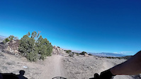
Pucker Up is a rowdy, technical jump trail that will push confident, advanced riders to new limits. Usually ridden starting at Wafer Rock below Widowmaker Hill as part of the Max Gnar route connecting Free Lunch and Moto. This fun romp flows downhill through the typical Lunch Loop chunk over gap jumps, drops, a rock wall ride, and a moderately terrifying last two features. The second to last feature drops through a notch between two large boulders and down a broken, scary looking rocky ramp that is filled with wheel catchers and favors speed. It's a 15+ foot feature and could have some serious consequences of things go sideways so scouting is highly recommended. The last feature rolls you down the face of a nearly vertical boulder. It actually rolls reasonably well, but is very mental rolling into it. Pucker Up exits into High Noon just before the start of Moto trail.
Access Info
Accessed via Tabeguache trail from the main Lunch Loops TH. Pucker Up parallels Lemon Squeezer trail.
Local Trail Association
-
Please consider joining or donating to the local trail association to supportdonate to earn trail karma!
trail development & maintenance.
Traditionally Indigenous Territory
More Stats for Pucker Up mountain bike trail trail
-
Altitude change-136 ft
-
Altitude min5,020 ft
-
Altitude max5,156 ft
-
Altitude start5,156 ft
-
Altitude end5,020 ft
-
Grade-9.1%
-
Grade max-28.3%
-
Grade min-3.7%
-
Distance down1,499 ft
-
Avg time00:02:52
-
Avg reverse time00:09:23
- view trail stats
- Unknown
- Snow Groomed
- Snow Packed
- Snow Covered
- Snow Cover Inadequate
- Freeze/thaw Cycle
- Icy
- Prevalent Mud
- Wet
- Variable
- Ideal
- Dry
- Very Dry
The colour categories are based on what percentage of riders are riding a trail in its intended direction.
- > 96%
- > 90%
- > 80%
- > 70%
- > 50%
- < 50%
- bi-directional trail
- no data
- < 2 days
- < 1 week
- < 2 weeks
- < 1 month
- < 6 months
- > 6 months
- Downhill Only
- Downhill Primary
- Both Directions
- Uphill Primary
- Uphill Only
- One Direction
- Description
- Photos
- Description & Photos
- Videos
- most popular
- popular
- less popular
- not popular
- mountain biking recent
- mountain biking (>6 month)
- hiking (1 year)
- moto (1 year)
- Downhill Ski
- Backcountry Ski
- Nordic Ski
- Snowmobile
Save the current map location and zoom level as your default home location whenever this page is loaded.
SavePucker Up Trail Reports
Recent Ridelog Activity on Trail
Past Week
- 11 rides
- 7 miles avg distance
6 Months
- 156 rides
- 9 miles avg distance
All
- 3,377 rides
- Last: Mar 29, 2023
Photos
Trail Lists
-
STT Lunch Loops
10 trails
Routes with this trail
We hope you've been enjoying Trailforks!
Create a FREE account to view trail comments and much more.
Videos
Nearby Trails
- Lemon Squeezer 85 ft
- Holy Cross 561 ft
- Eagle’s Connector 1,096 ft
- Lemon Squeezer 1,165 ft
- Pre Nup 1,552 ft
- embed Pucker Up trail on your website
- By todd
Trailforks & contributors
- #12174 - 4,860 views
- subscribe
- login to download gpx or kml files.