3,615 ft
Distance
11 ft
Climb
-460 ft
Descent
00:04:17
Avg time
Ramble On Details
-
Activities
- Mountain Bike
- E-Bike
- Horse
- Hike
- Trail Running
-
Riding AreaBirdsboro Preserve
Birdsboro, Pennsylvania -
Difficulty Rating
-
Voted DifficultyBlack Diamond (1 vote)
-
Hiking SAC ScaleT1 Hiking
-
Trail TypeSingletrack
-
Bike TypeAM, XC
-
DirectionDownhill PrimaryPopular direction shown
-
Climb DifficultyBlue
-
Physical RatingModerate
-
Trail VisibilityAlways easy to follow
-
Dogs AllowedYes
-
eBike Allowed
-
TTFs on TrailDrop, Rock Garden
-
Global Ranking
-
Local Popularity80 in Mountain Biking [+]
- 85 in E-Biking
- 70 in Trail Running
- 85 in Hiking
- 5 in Horseback
-
Land OwnerBirdsboro Municipal Authority
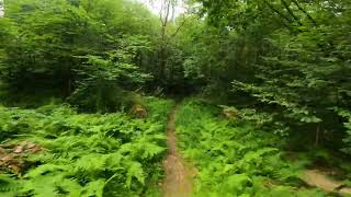
One of the longest DH in Birdsboro with rock overs on top then rip downhill with drops and banked turns. tends to be muddy post rainfall
Local Trail Association
-

-
Please consider joining or donating to the local trail association to supportdonate to earn trail karma!
trail development & maintenance.
Traditionally Indigenous Territory
More Stats for Ramble On multi-use trail trail
-
Altitude change-448 ft
-
Altitude min331 ft
-
Altitude max791 ft
-
Altitude start780 ft
-
Altitude end331 ft
-
Grade-12.4%
-
Grade max-31.5%
-
Grade min5.5%
-
Distance climb220 ft
-
Distance down3,369 ft
-
Distance flat26 ft
-
Avg time00:04:17
-
Avg reverse time00:18:20
- view trail stats
close
-
Layers w
- Map Content
- More Layers
- Pro
- Pro
- Pro
- Pro
- Pro
- Pro
- Pro
- Pro
-
Upgrade to

3D
Trail Conditions
- Unknown
- Snow Groomed
- Snow Packed
- Snow Covered
- Snow Cover Partial
- Freeze/thaw Cycle
- Icy
- Prevalent Mud
- Wet
- Variable
- Ideal
- Dry
- Very Dry
Trail Flow (Ridden Direction)
Trailforks scans users ridelogs to determine the most popular direction each trail is ridden. A good flowing trail network will have most trails flowing in a single direction according to their intension.
The colour categories are based on what percentage of riders are riding a trail in its intended direction.
The colour categories are based on what percentage of riders are riding a trail in its intended direction.
- > 96%
- > 90%
- > 80%
- > 70%
- > 50%
- < 50%
- bi-directional trail
- no data
Trail Last Ridden
Trailforks scans ridelogs to determine the last time a trail was ridden.
- < 2 days
- < 1 week
- < 2 weeks
- < 1 month
- < 6 months
- > 6 months
Trail Ridden Direction
The intended direction a trail should be ridden.
- Downhill Only
- Downhill Primary
- Both Directions
- Uphill Primary
- Uphill Only
- One Direction
Contribute Details
Colors indicate trail is missing specified detail.
- Description
- Photos
- Description & Photos
- Videos
Trail Popularity ?
Trailforks scans ridelogs to determine which trails are ridden the most in the last 9 months.
Trails are compared with nearby trails in the same city region with a possible 25 colour shades.
Think of this as a heatmap, more rides = more kinetic energy = warmer colors.
- most popular
- popular
- less popular
- not popular
ATV/ORV/OHV Filter
Max Vehicle Width
inches
US Cell Coverage
Legend

Radar Time
x
Activity Recordings
Trailforks users anonymized public ridelogs from the past 6 months.
- mountain biking recent
- mountain biking (>6 month)
- hiking (1 year)
- moto (1 year)
Activity Recordings
Trailforks users anonymized public skilogs from the past 12 months.
- Downhill Ski
- Backcountry Ski
- Nordic Ski
- Snowmobile
Winter Trails
Warning
A routing network for winter maps does not exist. Selecting trails using the winter trails layer has been disabled.
x
Missing Trails
Most Popular
Least Popular
Trails are colored based on popularity. The more popular a trail is, the more red. Less popular trails trend towards green.
Jump Magnitude Heatmap
Heatmap of where riders jump on trails. Zoom in to see individual jumps, click circles to view jump details.
Trails Deemphasized
Trails are shown in grey.
Only show trails with NO bikes.
Save the current map location and zoom level as your default home location whenever this page is loaded.
Save
Directions to ramble-on-267736 trailhead
(40.235320, -75.825830)
update trails status or condition
Ramble On Trail Reports
view all reports »
Recent Ridelog Activity on Trail
Past Week
- 10 rides
- 14.0 km avg distance
6 Months
- 104 rides
- 18.6 km avg distance
All
- 1,926 rides
- Last: May 17, 2024
Photos
more »
Routes with this trail
more »
8 Reviews & Comments
We hope you've been enjoying Trailforks!
Create a FREE account to view trail comments and much more.
Videos
more »

Nearby Trails
- Stairway To Heaven 856 ft
- Cross Hill Xc Loop 1,089 ft
- Double Track Up Over The Peak 1,883 ft
- Scratch And Sniff 2,064 ft
- South Side Fun 2,552 ft
- By Fatboy2000
 & contributors
 - #267736 - 3,828 views
- follow/subscribe
- login to download gpx or kml files.
You must enter a description before submitting.