

more stats
1.5 miles
Distance
3 ft
Climb
-1,351 ft
Descent
00:14:36
Avg time
-1,348 ft
Altitude change
3,538 ft
Altitude min
4,886 ft
Altitude max
4,886 ft
Altitude start
3,540 ft
Altitude end
-17.4%
Grade
-71.9%
Grade max
6.9%
Grade min
72 ft
Distance climb
1 mile
Distance down
66 ft
Distance flat
00:14:36
Avg time

Ribs Trail Details

  • Activities
    • Mountain Bike
    • E-Bike
  • Riding Area
  • Ref Number
    #787
  • Difficulty Rating
  • Voted Difficulty
    Black Diamond (6 votes)
  • Local Popularity
    75 in Mountain Biking heatmap [+]
    • 70 in E-Biking
  • Global Ranking
    #26162 in Mountain Biking [+]
    • #29108 in E-Biking
  • National Ranking
    #2,550 in Mountain Biking · Italy [+]
    • #3,355 in E-Biking
  • Trail Type
    Singletrack
  • Bike Type
    AM
  • Direction
    Downhill Primary
    Popular Direction Shown
  • Physical Rating
    Moderate
  • Season
    may - oct
  • Dogs Allowed
    Yes
  • eBike Allowed
    Yes up to Class 1
  • Land Owner

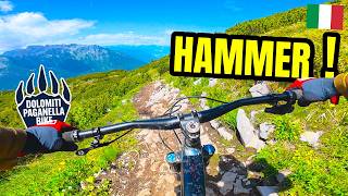
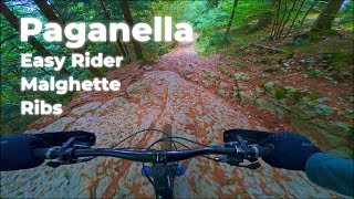
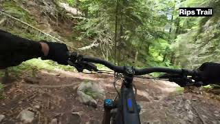
Enduro trail with a very fast first segment that becomes more technical in the second part with lots of rocks and roots. At the end of the trail you have to follow a side street to the left towards the ski lifts. You can reach the starting point through the lift "gondola Paganella 2001" and 5 minutes of riding on the dirt road that connects "Doss Pelà" to "Malga Zambana". The itinerary is suitable exclusively for expert and trained riders.

Tags

Trail Supporters

Bike Park

Recent Activity on Trail

Past Week
  • 0 rides
  •  
6 Months
  • 66 rides
  • 31 miles avg distance
All
  • 377 rides
  • Last: Oct 10, 2026
update trails status or condition

Ribs Trail Trail Reports

statusdatedescription
Jul 29, 2026 @ 8:11am (Europe/Rome)
Jul 28, 2026
Last bit after 786 gravel crossing road is closed (i guess for logging), detour on the road to andalo is indicated
Jun 14, 2026 @ 9:09am (Europe/Rome)
Jun 14, 2026
The last section is closed
Jun 1, 2026 @ 8:33am (Europe/Vaduz)
May 31, 2026
May 30, 2026 @ 9:30am (Europe/Vaduz)
May 30, 2026
Parte finale interrotta
May 30, 2026 @ 9:22am (Europe/Vaduz)
May 30, 2026
more »
Status:
on Jul 29, 2026
Ideal
Avg: 4.58 (30 votes)
Your vote: 0

view (2,437)
close
      Directions to ribs-trail trailhead (46.164490, 11.032680)

      Photos

      6 more »
      mtb
      49 |
      Jun 16, 2026 @ 7:58am
      Jun 16, 2026
      mtb
      38 |
      Jun 16, 2026 @ 7:58am
      Jun 16, 2026
      mtb
      190 |
      Jun 6, 2022 @ 8:18am
      Jun 6, 2022
      mtb
      299 |
      Aug 9, 2019 @ 9:05am
      Aug 9, 2019

      Videos

      6 more »
      youtuber Heftige Abfahrt von der Paganella nach Andalo:...
      mtb
      21:40 | 36 | Oct 16, 2026 , Andalo
      youtuber 787 - Ribs Trail - Andalo | Dolomiti Paganella...
      mtb
      4:22 | 618 | Jul 4, 2022 , Andalo
      Malghette  |  Ribs  |  Easy Rider
      mtb
      18:16 | 73 | Oct 31, 2025 , Andalo
      Giada & Rips
      mtb
      5:58 | 281 | Sep 27, 2024 , Andalo

      Routes with this trail

      more »
      24 miles • 8,008 ft • 6 • Loop •
      Quick lap on the Fai-Andalo-Molveno trail area Danger Zone. This is a bit shortened Bear Trails route, if...
      4.7 ★★★★★
      30 Ratings
      5 ★ 77%
      4 ★ 17%
      3 ★ 7%
      2 ★
      1 ★

      8 Reviews & Comments

      24sonder 24sonder
      Great technical trail. But as soon as it gets a bit wet it is certainly not a blue trail anymore!
      nrhnrh nrhnrh
      This is red/black on offical map. Fix it!
      larry81541 larry81541
      If Giada line is a black trail, then Ribs Trail should be black too. They are similar in difficulty.

      We hope you've been enjoying Trailforks!

      Create a FREE account to view all trail reviews and much more.

      Frequently Asked Questions

      ▼ Where is Ribs Trail located?
      Ribs Trail is located in Dolomiti Paganella Bike, Andalo, Italy. It is part of the Dolomiti Paganella Bike trail network. The trailhead is located at coordinates 46.16449, 11.03268.
      ▼ How hard is Ribs Trail?
      Ribs Trail is rated as Black difficulty. The physical rating is Moderate. The average grade is 17.4%.
      ▼ What is the elevation gain for Ribs Trail?
      Ribs Trail has 3 ft of elevation gain. The trail has 1,351 ft of elevation descent. The elevation ranges from 3,538 ft to 4,886 ft.
      ▼ Is Ribs Trail a point to point trail?
      Ribs Trail is not a point to point trail. The direction is Downhill Primary. The trail type is singletrack.
      ▼ How long is Ribs Trail?
      Ribs Trail is 1.5 miles long. The trail type is singletrack.
      ▼ Are dogs allowed on Ribs Trail?
      Yes, dogs are allowed on Ribs Trail. Please keep dogs on a leash where required and clean up after them.
      ▼ When is the best time of year to ride Ribs Trail?
      Ribs Trail is best visited during: may - oct.
      ▼ How do I access Ribs Trail? Where is the closest parking trailhead?
      The closest parking and trailhead locations to Ribs Trail are: View all parking locations in the area.
      ▼ How long does it take to ride Ribs Trail?
      Based on recorded activities, it takes an average of 15 minutes to ride Ribs Trail. The trail is 1.5 miles long. Actual times will vary based on fitness level, conditions, and pace. View recent activity logs for more details.
      ▼ How busy is Ribs Trail?
      Ribs Trail is a very popular trail. There have been 2,400 recorded activities on this trail. The trail has received 2,437 check-ins. View recent activity on this trail.

      Hit the Trail

      Open in App

      Get this trail on your phone instantly.

      open trail in app

      Download Trail

      Save to wishlist, Garmin & download.
      save the trail

      Find Related Routes

      Find routes and users activities that include this trail.
      find routes for this trail

      You must enter a description before submitting.