more stats
1.4 miles
Distance
383 ft
Climb
-491 ft
Descent
00:22:51
Avg time
-108 ft
Altitude change
8,059 ft
Altitude min
8,302 ft
Altitude max
8,246 ft
Altitude start
8,140 ft
Altitude end
-1.5%
Grade
-47.2%
Grade max
39.2%
Grade min
3,734 ft
Distance climb
3,169 ft
Distance down
377 ft
Distance flat
00:22:51
Avg time

Ring Dike Details

  • Activities
    • Mountain Bike
    • E-Bike
    • Hike
    • Trail Running
    • Dirtbike/Moto
  • Riding Area
    Hartman Rocks
    Gunnison, Colorado
  • Difficulty Rating
  • Local Popularity
    60 in Mountain Biking [+]
    • 75 in E-Biking
    • 5 in Trail Running
    • 50 in Hiking
    • 65 in Dirtbiking
  • Global Ranking
    #95206 in Mountain Biking [+]
    • #280573 in Trail Running
    • #110616 in Hiking
  • Trail Type
    Singletrack
  • Direction
    Downhill Primary
    Popular In Reverse
  • Climb Difficulty
    Black Diamond
  • Physical Rating
    Hard
  • Dogs Allowed
    Yes
  • eBike Allowed
    Yes up to Class 1

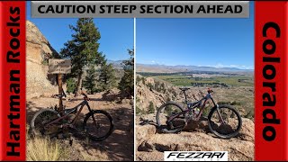
Weaves through a long spine of beautiful cliffs and rock spires. Endless granite slabs and chunk, intimidating descents and STEEP but fully rideable climbs. If you can roll the first slab you'll probably do alright. Some consequential exposure. A couple turns that are easy to miss. Amazing trail.

Trail Supporters
  • BLM
    BLM
    Land Manager
Local Trail Association
Traditionally Indigenous Territory

Recent Activity on Trail

Past Week
  • 0 rides
  •  
6 Months
  • 9 rides
  • 13 miles avg distance
All
  • 76 rides
  • Last: Jun 25, 2026
c1c2c3c4
January
February
March
April
May
June
July
August
September
October
November
December
update trails status or condition

Ring Dike Trail Reports

statusdatedescription
Sep 1, 2020 @ 10:27am
Sep 1, 2020
One large tree down, able to ride around
Jul 29, 2018 @ 8:17am
Jul 29, 2018
more »
Status:
on Sep 1, 2020
Dry
Avg: 4.14 (8 votes)
Your vote: 0

view (510)
close
3D
Trail Conditions
  • Unknown
  • Snow Groomed
  • Snow Packed
  • Snow Covered
  • Snow Cover Partial
  • Freeze/thaw Cycle
  • Icy
  • Prevalent Mud
  • Wet
  • Variable
  • Ideal
  • Dry
  • Very Dry
Trail Flow (Ridden Direction)
Trailforks scans users ridelogs to determine the most popular direction each trail is ridden. A good flowing trail network will have most trails flowing in a single direction according to their intension.
The colour categories are based on what percentage of riders are riding a trail in its intended direction.
  • > 96%
  • > 90%
  • > 80%
  • > 70%
  • > 50%
  • < 50%
  • bi-directional trail
  • no data
Trail Last Ridden
Trailforks scans ridelogs to determine the last time a trail was ridden.
  • < 2 days
  • < 1 week
  • < 2 weeks
  • < 1 month
  • < 6 months
  • > 6 months
Trail Ridden Direction
The intended direction a trail should be ridden.
  • Downhill Only
  • Downhill Primary
  • Both Directions
  • Uphill Primary
  • Uphill Only
  • One Direction
Contribute Details
Colors indicate trail is missing specified detail.
  • Description
  • Photos
  • Description & Photos
  • Videos
Trail Popularity ?
Trailforks scans ridelogs to determine which trails are ridden the most in the last 9 months. Trails are compared with nearby trails in the same city region with a possible 25 colour shades. Think of this as a heatmap, more rides = more kinetic energy = warmer colors.
  • most popular
  • popular
  • less popular
  • not popular
ATV/ORV/OHV Filter
Max Vehicle Width
inches
US Cell Coverage
Legend
cell carrier legend

Radar Time
Activity Recordings
Trailforks uses anonymized public activity data. ?
Activity Recordings
Trailforks uses anonymized public activity data. ?
Personal Heatmap
Activity Types
all / none
Options
2
Date range month
Winter Trails
Warning A routing network for winter maps does not exist. Selecting trails using the winter trails layer has been disabled.
Missing Trails
Most Popular
Least Popular
Trails are colored based on popularity. The more popular a trail is, the more red. Less popular trails trend towards green.
Jump Magnitude Heatmap
Heatmap of where riders jump on trails. Zoom in to see individual jumps, click circles to view jump details.
BC Backroad Status

Service Road Atlas is a free to use, community-driven service for viewing and creating reports on the numerous back-country service roads around B.C. and Alberta.

map legend
Slope Aspect
Direction the slope faces
Flat N NE E SE S SW W NW
Trails Deemphasized
Trails are shown in grey.
disable
Only show trails with no bike usage.
Enable
Suggested Layers
Based on selected activity type

    Save the current map location and zoom level as your default home location whenever this page is loaded.

    Save
        Directions to ring-dike trailhead (38.483140, -106.941500)

        Photos

        2 more »
        310 |
        Nov 28, 2020 @ 10:31am
        Nov 28, 2020
        751 |
        Jun 4, 2018 @ 7:44pm
        Jun 4, 2018

        Videos

        2 more »
        Ring Dike - Gunnison, CO - MTB Trail Preview
        4:09 | 108 | Feb 11, 2025 , Gunnison
        youtuber Fantastic Technical Riding at Hartman Rocks! |...
        27:06 | 111 | Sep 18, 2023 , Gunnison

        6 Reviews & Comments


        We hope you've been enjoying Trailforks!

        Create a FREE account to view trail comments and much more.

        • By toddTF Pro Trailforks & contributors
        • #22944 - 2,383 views

        Frequently Asked Questions About Ring Dike

        Where is Ring Dike located?
        Ring Dike is located in Hartman Rocks, Gunnison, Colorado, United States. It is part of the Hartman Rocks trail network. The trailhead is located at coordinates 38.48314, -106.9415.
        How hard is Ring Dike?
        Ring Dike is rated as Black Diamond difficulty. The physical rating is Hard. The average grade is 1.5%. The climb difficulty is rated Black Diamond.
        What is the elevation gain for Ring Dike?
        Ring Dike has 383 ft of elevation gain. The trail has 491 ft of elevation descent. The elevation ranges from 8,059 ft to 8,302 ft.
        Is Ring Dike a point to point trail?
        Ring Dike is not a point to point trail. The direction is Downhill Primary. The trail type is singletrack.

        Hit the Trail

        Open in App

        Get this trail on your phone instantly.
        open trail in app

        Download Trail

        Save to wishlist, Garmin & download.
        save the trail

        Find Related Routes

        Find routes and users activities that include this trail.
        find routes for this trail

        You must enter a description before submitting.