2,557 ft
Distance
39 ft
Climb
-203 ft
Descent
00:07:09
Avg time
Rock Solid Details
-
Riding areaColer Preserve
Bentonville, Arkansas -
Difficulty rating
-
Voted DifficultyBlack Diamond (1 vote)
-
Trail typeSingletrack
-
Bike typeDH, AM
-
Trail UsageBiking Only
-
DirectionDownhill PrimaryPopular direction shown
-
Climb DifficultyBlack Diamond
-
Physical ratingExtreme
-
eBike AllowedNo
-
TTFs on trailDrop, Gap Jump, Rock Garden
-
Global Ranking#928
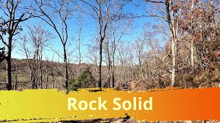
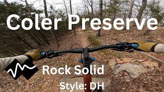
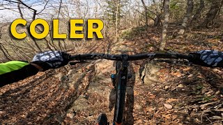
This technical downhill trail descend from the Hub through a rocky portion of the escarpment, ending at the northwest parking area for Coler. This "techflow" trail has many features including rock gardens, rock gap jumps, rock armored berms, and drops.
Local Trail Association
-
Friends of Arkansas Single Track
(fasttrails.org) Please consider joining or donating to the local riding association to support trail development & maintenance.donate to earn trail karma!
More Stats for Rock Solid mountain bike trail
-
Altitude change-164 ft
-
Altitude min1,091 ft
-
Altitude max1,255 ft
-
Altitude start1,255 ft
-
Altitude end1,091 ft
-
Grade-6.407%
-
Grade max-33.918%
-
Grade min21.713%
-
Distance climb495 ft
-
Distance down1,809 ft
-
Distance flat254 ft
-
Avg time00:07:09
-
Avg reverse time00:01:14
- view trail stats
close
Trail Conditions
- Unknown
- Snow Packed
- Snow Covered
- Freeze/thaw Cycle
- Icy
- Prevalent Mud
- Wet
- Variable
- Dry
- Very Dry
Directions to rock-solid trailhead
(36.391570, -94.236120)
update trails status or condition
Rock Solid Trail Reports
view all reports »
5 social media mentions
Photos
more »
Reviews / Comments
No reviews yet, be the first to write a review or ask a question.
Use trail reports to comment on trail conditions.
Videos
more »
Nearby Trails
- embed Rock Solid trail on your website
- By WanderingMan BSMTB & contributors
- #85160 - 556 views
- subscribe
- login to download gpx or kml files.
Open trail in mobile app