more stats
1,505 ft
Distance
5 ft
Climb
-269 ft
Descent
00:02:57
Avg time
-264 ft
Altitude change
2,113 ft
Altitude min
2,377 ft
Altitude max
2,377 ft
Altitude start
2,113 ft
Altitude end
-17.553%
Grade
-41.353%
Grade max
-3.673%
Grade min
48 ft
Distance climb
1,433 ft
Distance down
24 ft
Distance flat
00:02:57
Avg time

Rocksanne Details

  • Activities
    • Mountain Bike
  • Riding Area
    Majura Pines
    Canberra
  • Difficulty Rating
  • Voted Difficulty
    Double Black Diamond (1 vote)
  • Local Popularity
    80 in Mountain Biking
  • Global Ranking
    #48081 in Mountain Biking
  • Blaze Color
  • Trail Type
    Singletrack
  • Direction
    Downhill Primary
    Popular Direction Shown
  • Dogs Allowed
    Yes

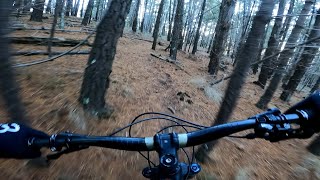
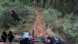
A super technical trail that descends parallel to Touching Cloth. Starting from the same stretch of fire road accessed by the link across Rock Lobster, the top section is all pure old DH trail. After an epic rock garden that will test most riders, the trail cuts left on to a new finish.

Local Trail Association
Traditionally Indigenous Territory

Recent Activity on Trail

Past Week
  • 0 rides
  •  
6 Months
  • 14 rides
  • 14 miles avg distance
All
  • 206 rides
  • Last: Jun 20, 2026
c1c2c3c4
January
February
March
April
May
June
July
August
September
October
November
December
update trails status or condition

Rocksanne Trail Reports

Status:
on Feb 16, 2025
Dry
Avg: 4.11 (2 votes)
Your vote: 0

view (2,897)
close
3D
Trail Conditions
  • Unknown
  • Snow Groomed
  • Snow Packed
  • Snow Covered
  • Snow Cover Partial
  • Freeze/thaw Cycle
  • Icy
  • Prevalent Mud
  • Wet
  • Variable
  • Ideal
  • Dry
  • Very Dry
Trail Flow (Ridden Direction)
Trailforks scans users ridelogs to determine the most popular direction each trail is ridden. A good flowing trail network will have most trails flowing in a single direction according to their intension.
The colour categories are based on what percentage of riders are riding a trail in its intended direction.
  • > 96%
  • > 90%
  • > 80%
  • > 70%
  • > 50%
  • < 50%
  • bi-directional trail
  • no data
Trail Last Ridden
Trailforks scans ridelogs to determine the last time a trail was ridden.
  • < 2 days
  • < 1 week
  • < 2 weeks
  • < 1 month
  • < 6 months
  • > 6 months
Trail Ridden Direction
The intended direction a trail should be ridden.
  • Downhill Only
  • Downhill Primary
  • Both Directions
  • Uphill Primary
  • Uphill Only
  • One Direction
Contribute Details
Colors indicate trail is missing specified detail.
  • Description
  • Photos
  • Description & Photos
  • Videos
Trail Popularity ?
Trailforks scans ridelogs to determine which trails are ridden the most in the last 9 months. Trails are compared with nearby trails in the same city region with a possible 25 colour shades. Think of this as a heatmap, more rides = more kinetic energy = warmer colors.
  • most popular
  • popular
  • less popular
  • not popular
ATV/ORV/OHV Filter
Max Vehicle Width
inches
US Cell Coverage
Legend
cell carrier legend

Radar Time
Activity Recordings
Trailforks uses anonymized public activity data. ?
Activity Recordings
Trailforks uses anonymized public activity data. ?
Personal Heatmap
Activity Types
all / none
Options
2
Date range month
Winter Trails
Warning A routing network for winter maps does not exist. Selecting trails using the winter trails layer has been disabled.
Missing Trails
Most Popular
Least Popular
Trails are colored based on popularity. The more popular a trail is, the more red. Less popular trails trend towards green.
Jump Magnitude Heatmap
Heatmap of where riders jump on trails. Zoom in to see individual jumps, click circles to view jump details.
BC Backroad Status

Service Road Atlas is a free to use, community-driven service for viewing and creating reports on the numerous back-country service roads around B.C. and Alberta.

map legend
Slope Aspect
Direction the slope faces
Flat N NE E SE S SW W NW
Trails Deemphasized
Trails are shown in grey.
disable
Only show trails with no bike usage.
Enable
Suggested Layers
Based on selected activity type

    Save the current map location and zoom level as your default home location whenever this page is loaded.

    Save
        Directions to rocksanne trailhead (-35.245580, 149.180980)

        Photos

        2 more »
        160 |
        Jun 19, 2021 @ 3:07am
        Jun 19, 2021
        266 |
        May 1, 2019 @ 5:10pm
        May 1, 2019

        Videos

        4 more »
        Majura Pines Mountain Biking (Rocksanne trail)...
        0:32 | 77 | Aug 21, 2025 , Canberra
        Majura Pines Advanced MTB Trails
        12:12 | 156 | Jul 11, 2024 , Canberra
        2021 NEW TRAIL DIRTY DISTANCING and RoCksAnNe ...
        8:32 | 491 | Jan 21, 2022 , Canberra
        youtuber Majura Pines ???? CORC Gravity Enduro Round 4...
        13:11 | 872 | Sep 9, 2019 , Canberra

        Routes with this trail

        5.0 50 miles 5,964 ft 39
        Mt Stromlo - Zoo Pines - Mt Majura - Bruce Ridge - Arboretum - Mt Stromlo(For beers)
        5.0 8 miles 1,791 ft 22 Race
        Round 1 of the new CORC Gravity Enduro Series to be held at Majura Pines on Sunday 19th May. Stage 1:...
        15 miles 2,914 ft 41 Race
        Majura Elite - NEW - Capital Kamikaze

        Reviews / Comments

        No reviews yet, be the first to write a review or ask a question.
        Use trail reports to comment on trail conditions.


        We hope you've been enjoying Trailforks!

        Create a FREE account to view trail comments and much more.

        • By Jake-HannahTF Pro MPTA & contributors
        • #83813 - 1,541 views

        Frequently Asked Questions About Rocksanne

        Where is Rocksanne located?
        Rocksanne is located in Majura Pines, Canberra, Australia. It is part of the Majura Pines trail network. The trailhead is located at coordinates -35.24558, 149.18098.
        How hard is Rocksanne?
        Rocksanne is rated as Double Black Diamond difficulty. The average grade is 17.553%.
        What is the elevation gain for Rocksanne?
        Rocksanne has 5 ft of elevation gain. The trail has 269 ft of elevation descent. The elevation ranges from 2,113 ft to 2,377 ft.
        Is Rocksanne a point to point trail?
        Rocksanne is not a point to point trail. The direction is Downhill Primary. The trail type is singletrack.

        Hit the Trail

        Open in App

        Get this trail on your phone instantly.
        open trail in app

        Download Trail

        Save to wishlist, Garmin & download.
        save the trail

        Find Related Routes

        Find routes and users activities that include this trail.
        find routes for this trail

        You must enter a description before submitting.