
more stats
1,050 ft
Distance
7 ft
Climb
-43 ft
Descent
00:03:02
Avg time
-36 ft
Altitude change
1,837 ft
Altitude min
1,886 ft
Altitude max
1,873 ft
Altitude start
1,837 ft
Altitude end
-3.4%
Grade
-22.6%
Grade max
21.6%
Grade min
240 ft
Distance climb
469 ft
Distance down
341 ft
Distance flat
00:03:02
Avg time

Rubbish Details

  • Activities
    • Mountain Bike
    • E-Bike
    • Hike
    • Trail Running
  • Riding Area
    Cheakamus
    Whistler, British Columbia
  • Difficulty Rating
  • Local Popularity
    40 in Mountain Biking heatmap [+]
    • 25 in E-Biking
    • 75 in Trail Running
    • 85 in Hiking
  • Global Ranking
    #116144 in Mountain Biking [+]
    • #105341 in E-Biking
    • #89832 in Trail Running
    • #63764 in Hiking
  • Provincial Ranking
    #6,016 in Mountain Biking · British Columbia [+]
    • #5,212 in E-Biking
    • #5,207 in Trail Running
    • #3,358 in Hiking
  • Trail Type
    Singletrack
  • Bike Type
    AM, XC
  • Direction
    Both Directions
    Popular Direction Shown
  • Climb Difficulty
    Black Diamond
  • Physical Rating
    Hard
  • Dogs Allowed
    Yes
  • eBike Allowed
  • TTFs on Trail
    Bridge
  • Year Opened
    2017

A re-route of the final section of Trash to replace the portion lost to the upgraded Train Wreck bridge access trail. Technical single track with a few bridges of varying width snaking through a mossy draw with rock bluffs. Completed by WORCA trail crew, and supported with 2 volunteer evenings this fall. Huge thank you to all who contributed

Tags
Bridges

Local Trail Association

Recent Activity on Trail

Past Week
  • 1 rides
  • 8 miles average
6 Months
  • 28 rides
  • 16 miles avg distance
All
  • 472 rides
  • Last: Nov 14, 2026
c1c2c3c4
January
February
March
April
May
June
July
August
September
October
November
December
Status:
on Nov 14, 2026
Wet
Avg: 3.99 (8 votes)
Your vote: 0

view (2,789)
close
      Directions to rubbish trailhead (50.081260, -123.051410)

      Photos

      4 more »
      report
      mtb
      81 |
      Feb 24, 2024 @ 11:35pm
      Feb 24, 2024
      report
      mtb
      99 |
      Feb 24, 2024 @ 11:35pm
      Feb 24, 2024
      report
      mtb
      96 |
      Apr 12, 2023 @ 6:30pm
      Apr 12, 2023
      report
      mtb
      83 |
      Apr 9, 2019 @ 7:39pm
      Apr 9, 2019

      Videos

      1 more »
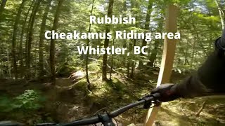
      Rubbish in Whistler, BC
      mtb
      3:41 | 131 | Nov 3, 2023 , Whistler

      Routes with this trail

      more »
      30 miles • 4,490 ft • 25 •
      proposed running race course for Tenderfoot Boogie 2024
      ★ 1.0 • 3 miles • 438 ft • 4 •
      2021 Worca Virtual Toonie #4 by Cascade Environmental Group and Blacks Pub Tour De Trash is back again!...
      6 miles • 901 ft • 7 •
      Whistler Relive Your Rides Cheakumus Quickie For other ride suggestions for this and other areas. As well...

      Trail Products

      4.0 ★★★★★
      8 Ratings
      5 ★ 25%
      4 ★ 50%
      3 ★ 25%
      2 ★
      1 ★

      2 Reviews & Comments

      pincho
      Great work! Beautiful BC, beautiful forest while enjoying the little challenges the trail has to offer! Thanks!
      Sun2306 Sun2306
      Nice new trail, though needs lots of riding. Lots of little up and overs, beautiful landscape. Some cool skinnies. The trail surface is quite narrow.

      We hope you've been enjoying Trailforks!

      Create a FREE account to view all trail reviews and much more.

      • By flipfantasiaTF Pro WORCA & contributors
      • #107538 - 2,381 views

      Frequently Asked Questions

      ▼ Where is Rubbish located?
      Rubbish is located in Cheakamus, Whistler, British Columbia, Canada. It is part of the Cheakamus trail network. The trailhead is located at coordinates 50.08126, -123.05141.
      ▼ How hard is Rubbish?
      Rubbish is rated as Black Diamond difficulty. The physical rating is Hard. The average grade is 3.4%. The climb difficulty is rated Black Diamond.
      ▼ What is the elevation gain for Rubbish?
      Rubbish has 7 ft of elevation gain. The trail has 43 ft of elevation descent. The elevation ranges from 1,837 ft to 1,886 ft.
      ▼ Is Rubbish a point to point trail?
      Rubbish is not a point to point trail. The direction is Both Directions. The trail type is singletrack.
      ▼ How long is Rubbish?
      Rubbish is 1,050 ft long. The trail type is singletrack.
      ▼ Are dogs allowed on Rubbish?
      Yes, dogs are allowed on Rubbish. Please keep dogs on a leash where required and clean up after them.
      ▼ When is the best time of year to ride Rubbish?
      Based on activity log data, the most popular months to ride Rubbish are:
      • September (19 activities)
      • July (16 activities)
      • August (13 activities)
      Check the reports page for current trail conditions.
      ▼ How do I access Rubbish? Where is the closest parking trailhead?
      The closest parking and trailhead locations to Rubbish are: View all parking locations in the area.
      ▼ How long does it take to ride Rubbish?
      Based on recorded activities, it takes an average of 3 minutes to ride Rubbish. The trail is 1,050 ft long. Actual times will vary based on fitness level, conditions, and pace. View recent activity logs for more details.
      ▼ How busy is Rubbish?
      Rubbish is a moderately popular trail. There have been 2,194 recorded activities on this trail. The trail has received 2,789 check-ins. View recent activity on this trail.

      Hit the Trail

      Open in App

      Get this trail on your phone instantly.

      open trail in app

      Download Trail

      Save to wishlist, Garmin & download.
      save the trail

      Find Related Routes

      Find routes and users activities that include this trail.
      find routes for this trail

      You must enter a description before submitting.