more stats
3.4 miles
Distance
484 ft
Climb
-497 ft
Descent
00:30:11
Avg time
-13 ft
Altitude change
4,008 ft
Altitude min
4,448 ft
Altitude max
4,179 ft
Altitude start
4,167 ft
Altitude end
-0.1%
Grade
-21.4%
Grade max
34.9%
Grade min
2 miles
Distance climb
2 miles
Distance down
279 ft
Distance flat
00:30:11
Avg time

Sam Braxton Details

  • Activities
    • Mountain Bike
    • Winter Fat Bike
    • Hike
    • Trail Running
    • Snowshoe
  • Riding Area
    Pattee Canyon
    Missoula, Montana
  • Difficulty Rating
  • Local Popularity
    75 in Mountain Biking [+]
    • 55 in Trail Running
    • 85 in Hiking
    • 5 in Snowshoeing
  • Global Ranking
    #88408 in Mountain Biking [+]
    • #98424 in Trail Running
    • #36826 in Hiking
  • Hiking SAC Scale
    T1 Hiking
  • Trail Type
    Singletrack
  • Snow Grooming
    Backcountry
  • Bike Type
    AM, XC, Fat
  • Direction
    Both Directions
  • Climb Difficulty
    Blue
  • Physical Rating
    Easy
  • Trail Visibility
    Always easy to follow
  • Family Friendly
    Yes
  • Dogs Allowed
    Yes
  • eBike Allowed
  • Land Owner
    USFS

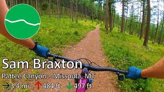
This is a fun loop which is more enjoyable ridden clockwise. there are many possible off-shoots and spur trails which can add or subtract from the overall milage. There are not really any technical trails in this area of Pattee Canyon.

Trail Supporters

  • USFS
    Land Manager
Local Trail Association
Traditionally Indigenous Territory

Recent Activity on Trail

Past Week
  • 1 rides
  • 30 miles average
6 Months
  • 9 rides
  • 8 miles avg distance
All
  • 130 rides
  • Last: Jun 21, 2026
c1c2c3c4
January
February
March
April
May
June
July
August
September
October
November
December
update trails status or condition

Sam Braxton Trail Reports

statusdatedescription
May 14, 2026 @ 5:51pm (America/Denver)
May 14, 2026
Feb 10, 2026 @ 9:04am (America/Denver)
Feb 10, 2026
Mix of soft snow and icy melting-out boot prints, best before the sun comes over the hill. Fat bike able but kinda miserable. Studs or ice grips...
May 17, 2025 @ 5:10pm
May 17, 2025
Nov 7, 2024 @ 6:02pm
Nov 7, 2024
May 24, 2024 @ 1:52pm
May 24, 2024
A few muddy sections (~4 or 5) on the east side of the trail, but nothing longer than 5 or 6 feet. Only one of the muddy sections takes up the...
more »
Status:
on May 14, 2026
Ideal
Avg: 3.82 (6 votes)
Your vote: 0

view (837)
close
3D
Trail Conditions
  • Unknown
  • Snow Groomed
  • Snow Packed
  • Snow Covered
  • Snow Cover Partial
  • Freeze/thaw Cycle
  • Icy
  • Prevalent Mud
  • Wet
  • Variable
  • Ideal
  • Dry
  • Very Dry
Trail Flow (Ridden Direction)
Trailforks scans users ridelogs to determine the most popular direction each trail is ridden. A good flowing trail network will have most trails flowing in a single direction according to their intension.
The colour categories are based on what percentage of riders are riding a trail in its intended direction.
  • > 96%
  • > 90%
  • > 80%
  • > 70%
  • > 50%
  • < 50%
  • bi-directional trail
  • no data
Trail Last Ridden
Trailforks scans ridelogs to determine the last time a trail was ridden.
  • < 2 days
  • < 1 week
  • < 2 weeks
  • < 1 month
  • < 6 months
  • > 6 months
Trail Ridden Direction
The intended direction a trail should be ridden.
  • Downhill Only
  • Downhill Primary
  • Both Directions
  • Uphill Primary
  • Uphill Only
  • One Direction
Contribute Details
Colors indicate trail is missing specified detail.
  • Description
  • Photos
  • Description & Photos
  • Videos
Trail Popularity ?
Trailforks scans ridelogs to determine which trails are ridden the most in the last 9 months. Trails are compared with nearby trails in the same city region with a possible 25 colour shades. Think of this as a heatmap, more rides = more kinetic energy = warmer colors.
  • most popular
  • popular
  • less popular
  • not popular
ATV/ORV/OHV Filter
Max Vehicle Width
inches
US Cell Coverage
Legend
cell carrier legend

Radar Time
Activity Recordings
Trailforks uses anonymized public activity data. ?
Activity Recordings
Trailforks uses anonymized public activity data. ?
Personal Heatmap
Activity Types
all / none
Options
2
Date range month
Winter Trails
Warning A routing network for winter maps does not exist. Selecting trails using the winter trails layer has been disabled.
Missing Trails
Most Popular
Least Popular
Trails are colored based on popularity. The more popular a trail is, the more red. Less popular trails trend towards green.
Jump Magnitude Heatmap
Heatmap of where riders jump on trails. Zoom in to see individual jumps, click circles to view jump details.
BC Backroad Status

Service Road Atlas is a free to use, community-driven service for viewing and creating reports on the numerous back-country service roads around B.C. and Alberta.

map legend
Slope Aspect
Direction the slope faces
Flat N NE E SE S SW W NW
Trails Deemphasized
Trails are shown in grey.
disable
Only show trails with no bike usage.
Enable
Suggested Layers
Based on selected activity type

    Save the current map location and zoom level as your default home location whenever this page is loaded.

    Save
        Directions to sam-braxton trailhead (46.823170, -113.922070)

        Photos

        9 more »
        67 |
        Oct 6, 2024 @ 7:09am
        Oct 6, 2024
        59 |
        Oct 6, 2024 @ 7:08am
        Oct 6, 2024
        52 |
        Oct 6, 2024 @ 7:08am
        Oct 6, 2024
        218 |
        Sep 1, 2020 @ 1:20pm
        Sep 1, 2020

        Videos

        1 more »
        youtuber Sam Braxton - Pattee Canyon - Missoula, MT
        26:01 | 47 | Jun 26, 2025 , Missoula

        Routes with this trail

        1.0 4 miles 602 ft 5
        A sampler of the fun, easy trail in Pattee Canyon. A great option for those looking for something mellower.

        1 Review & Comments


        We hope you've been enjoying Trailforks!

        Create a FREE account to view trail comments and much more.

        • By DbpooleTF Pro & contributors
        • #35736 - 5,532 views

        Frequently Asked Questions About Sam Braxton

        Where is Sam Braxton located?
        Sam Braxton is located in Pattee Canyon, Missoula, Montana, United States. It is part of the Pattee Canyon trail network. The trailhead is located at coordinates 46.82317, -113.92207.
        How hard is Sam Braxton?
        Sam Braxton is rated as Green difficulty. The physical rating is Easy. The average grade is 0.1%. The climb difficulty is rated Blue.
        What is the elevation gain for Sam Braxton?
        Sam Braxton has 484 ft of elevation gain. The trail has 497 ft of elevation descent. The elevation ranges from 4,008 ft to 4,448 ft.
        Is Sam Braxton a point to point trail?
        Sam Braxton is not a point to point trail. The direction is Both Directions. The trail type is singletrack.

        Hit the Trail

        Open in App

        Get this trail on your phone instantly.
        open trail in app

        Download Trail

        Save to wishlist, Garmin & download.
        save the trail

        Find Related Routes

        Find routes and users activities that include this trail.
        find routes for this trail

        You must enter a description before submitting.