

more stats
4,081 ft
Distance
-514 ft
Descent
00:05:38
Avg time
-514 ft
Altitude change
2,615 ft
Altitude min
3,128 ft
Altitude max
3,128 ft
Altitude start
2,615 ft
Altitude end
-12.6%
Grade
-38.4%
Grade max
-1.5%
Grade min
4,081 ft
Distance down
00:05:38
Avg time

Scapegoat Details

  • Activities
    • Mountain Bike
    • E-Bike
  • Riding Area
    Iron Mountain
    Merritt, British Columbia
  • Difficulty Rating
  • Voted Difficulty
    Black Diamond (1 vote)
  • Local Popularity
    90 in Mountain Biking [+]
    • 100 in E-Biking
  • Global Ranking
    #30256 in Mountain Biking [+]
    • #22 in E-Biking
  • Provincial Ranking
    #1,482 in Mountain Biking · British Columbia [+]
    • #9 in E-Biking
  • Trail Type
    Singletrack
  • Bike Type
    AM
  • Direction
    Downhill Only
    Popular Direction Shown
  • Dogs Allowed
    Yes
  • eBike Allowed
  • TTFs on Trail
    Berm, Drop, Jump, Gap Jump, Rock Face, Rock Garden

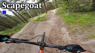
A newly built flow trail with Doubles, Shark Fins big Table tops, Step ups and a rock drop.

Tags

Local Trail Association

Recent Activity on Trail

Past Week
  • 0 rides
  •  
6 Months
  • 24 rides
  • 12 miles avg distance
All
  • 117 rides
  • Last: Oct 17, 2026
c1c2c3c4
January
February
March
April
May
June
July
August
September
October
November
December
update trails status or condition

Scapegoat Trail Reports

statusdatedescription
Aug 26, 2026 @ 9:58am (America/Vancouver)
Aug 26, 2026
Aug 24, 2026 @ 10:08pm (America/Vancouver)
Aug 24, 2026
Still very fun. Still hard to line it all up.
May 14, 2026 @ 7:13am (America/Vancouver)
May 14, 2026
Trees cleared, trail is good to go!
May 13, 2026 @ 7:52am (America/Vancouver)
May 13, 2026
Trail closed temporarily. Large tree down on high speed section. Will be cleared within a day or two, and will update when done.
Sep 6, 2024 @ 1:09pm
Sep 6, 2024
One of the best pedal up black jump trials in BC. So fun and a must ride if that's what you're into.
more »
Status:
on Aug 26, 2026
Ideal
Avg: 4.35 (6 votes)
Your vote: 0

view (575)
close
      Directions to scapegoat trailhead (50.077610, -120.737540)

      Photos

      4 more »
      mtb
      122 |
      May 16, 2023 @ 2:08pm
      May 16, 2023
      mtb
      133 |
      May 16, 2023 @ 2:08pm
      May 16, 2023
      mtb
      134 |
      May 16, 2023 @ 2:08pm
      May 16, 2023
      report
      mtb
      91 |
      Sep 22, 2021 @ 4:01pm
      Sep 22, 2021

      Videos

      3 more »
      Machine Built Jumps That You Have To Pedal Up...
      mtb
      3:36 | 227 | Oct 5, 2024 , Merritt
      Merritt's Scapegoat
      mtb
      5:39 | 164 | Jun 4, 2024 , Merritt
      A flow trail so new its not even named yet
      mtb
      3:26 | 414 | May 14, 2023 , Merritt
      4.9 ★★★★★
      6 Ratings
      5 ★ 83%
      4 ★ 17%
      3 ★
      2 ★
      1 ★

      6 Reviews & Comments

      konakurt konakurt
      It's safer to have larger tables at comfortabel trail speed then to limit your size of tables to a certain measurement to call it blue and cause a bunch of dangerous overshoots and crashes
      Olbones
      Such a fun and progressive trail!!! Thank you
      whiteymirbowl whiteymirbowl
      All rollable but damn! Such a fun black trail. Massive massive tables, big shark fin and a solid drop on the trail. Ya sure it's all rollable or you can ride around but come on, 20 feet table isn't blue anywhere
      Still recommend and can't wait to lap again

      We hope you've been enjoying Trailforks!

      Create a FREE account to view all trail reviews and much more.

      • By FlarixTF Pro MMBA & contributors
      • #133536 - 2,483 views

      Frequently Asked Questions

      ▼ Where is Scapegoat located?
      Scapegoat is located in Iron Mountain, Merritt, British Columbia, Canada. It is part of the Iron Mountain trail network. The trailhead is located at coordinates 50.07761, -120.73754.
      ▼ How hard is Scapegoat?
      Scapegoat is rated as Blue difficulty. The average grade is 12.6%.
      ▼ What is the elevation gain for Scapegoat?
      The trail has 514 ft of elevation descent. The elevation ranges from 2,615 ft to 3,128 ft.
      ▼ Is Scapegoat a point to point trail?
      Yes, Scapegoat is a point to point trail. The direction is Downhill Only. The trail type is singletrack.
      ▼ How long is Scapegoat?
      Scapegoat is 4,081 ft long. The trail type is singletrack.
      ▼ Are dogs allowed on Scapegoat?
      Yes, dogs are allowed on Scapegoat. Please keep dogs on a leash where required and clean up after them.
      ▼ How do I access Scapegoat? Where is the closest parking trailhead?
      The closest parking and trailhead locations to Scapegoat are: View all parking locations in the area.
      ▼ How long does it take to ride Scapegoat?
      Based on recorded activities, it takes an average of 6 minutes to ride Scapegoat. The trail is 4,081 ft long. Actual times will vary based on fitness level, conditions, and pace. View recent activity logs for more details.
      ▼ How busy is Scapegoat?
      Scapegoat is a very popular trail. There have been 503 recorded activities on this trail. The trail has received 575 check-ins. View recent activity on this trail.

      Hit the Trail

      Open in App

      Get this trail on your phone instantly.

      open trail in app

      Download Trail

      Save to wishlist, Garmin & download.
      save the trail

      Find Related Routes

      Find routes and users activities that include this trail.
      find routes for this trail

      You must enter a description before submitting.


