more stats
1.1 miles
Distance
74 ft
Climb
-420 ft
Descent
00:14:06
Avg time
-344 ft
Altitude change
705 ft
Altitude min
1,081 ft
Altitude max
1,081 ft
Altitude start
738 ft
Altitude end
-5.9%
Grade
-36.5%
Grade max
35.6%
Grade min
604 ft
Distance climb
4,127 ft
Distance down
1,145 ft
Distance flat
00:14:06
Avg time

Scary Details

  • Activities
    • Mountain Bike
    • E-Bike
    • Hike
    • Trail Running
  • Riding Area
    Marquette NTN South Trails
    Marquette, Michigan
  • Difficulty Rating
  • Voted Difficulty
    Double Black Diamond (1 vote)
  • Local Popularity
    50 in Mountain Biking [+]
    • 45 in E-Biking
    • 5 in Trail Running
    • 45 in Hiking
  • Global Ranking
    #81055 in Mountain Biking [+]
    • #63823 in E-Biking
    • #304662 in Trail Running
    • #152357 in Hiking
  • State Ranking
    #872 in Mountain Biking · Michigan [+]
    • #366 in E-Biking
    • #4,086 in Trail Running
    • #2,277 in Hiking
  • Trail Type
    Singletrack
  • Bike Type
    AM, XC
  • Direction
    Downhill Primary
    Popular Direction Shown
  • Climb Difficulty
    Black Diamond
  • Physical Rating
    Hard
  • Dogs Allowed
    Yes
  • eBike Allowed
    Yes up to Class 1
  • TTFs on Trail
    Bridge, Jump, Log Ride, Rock Garden, Roller Coaster, Skinny
  • Land Owner
    Northern Michigan University

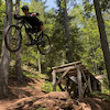
Tight, fast, flowy, hero dirt, roots, rock jump, log ride, steep downhill rolls and uphill punches. Did they leave anything out? You will need some skills, but this is 100% rideable and fun.

Access Info

Enter the blue loop from the top of Mt. Marquette. At the switchbacks, split tree goes left (west). Scary goes right (east).

Local Trail Association

Recent Activity on Trail

Past Week
  • 0 rides
  •  
6 Months
  • 22 rides
  • 11 miles avg distance
All
  • 154 rides
  • Last: Oct 18, 2026
c1c2c3c4
January
February
March
April
May
June
July
August
September
October
November
December
update trails status or condition

Scary Trail Reports

statusdatedescription
Jul 2, 2026 @ 3:01pm (America/Detroit)
Jul 2, 2026
Sep 3, 2024 @ 2:26pm
Sep 3, 2024
tree down 200-400 meters uphill from the intersection with Not So Scary and the log ride. Thanks for all you do.
Sep 14, 2022 @ 9:45am
Sep 14, 2022
Jul 23, 2022 @ 11:39am
Jul 23, 2022
Tree down near the top of the trail. On a straight section so not dangerous. Easy to lift your bike over the top.
Jun 12, 2022 @ 7:41am
Jun 12, 2022
more »
Status:
on Jul 2, 2026
Ideal
Avg: 4.38 (7 votes)
Your vote: 0

view (1,429)
close
      Directions to scary trailhead (46.513630, -87.402020)

      Photos

      8 more »
      mtb
      108 |
      May 29, 2023 @ 3:36pm
      May 29, 2023
      mtb
      119 |
      May 29, 2023 @ 3:35pm
      May 29, 2023
      mtb
      108 |
      May 29, 2023 @ 3:34pm
      May 29, 2023
      mtb
      570 |
      Sep 13, 2019 @ 4:58pm
      Sep 13, 2019

      Videos

      3 more »
      youtuber This is scary!
      mtb
      13:57 | 110 | Mar 19, 2026 , Marquette
      youtuber Scary Trail, but Is It Really? • Marquette,...
      mtb
      10:01 | 990 | Sep 18, 2020 , Marquette
      Riding Scary trail in Marquette
      mtb
      6:27 | 463 | Aug 25, 2023 , Marquette

      Routes with this trail

      ★ 5.0 • 105 miles • 10,821 ft • 64 •
      Marji Gesick 100 2021 race course route
      ★ 3.0 • 23 miles • 3,118 ft • 17 •
      Marquette Trails Fest 2023 long xc course
      ★ 2.0 • 106 miles • 11,040 ft • 69 •
      Marji Gesick 2022 100mile Course
      4.7 ★★★★★
      7 Ratings
      5 ★ 71%
      4 ★ 29%
      3 ★
      2 ★
      1 ★

      4 Reviews & Comments

      trusstruss
      Super fun challenge trail. Wish it were easier to get to and to find the trailhead!
      localridesonly localridesonly
      Tree down just 200-400 meters uphill from the intersection with Not So Scary and the long log ride. Thanks for all you do.
      steveschwass steveschwass
      Possibly my favorite trail in Marquette. Great mix of everything with some bonus features sprinkled in.

      We hope you've been enjoying Trailforks!

      Create a FREE account to view all trail reviews and much more.

      • By WanderingManTF Pro BSMTB & contributors
      • #63258 - 4,061 views

      Frequently Asked Questions

      ▼ Where is Scary located?
      Scary is located in Marquette NTN South Trails, Marquette, Michigan, United States. It is part of the Marquette NTN South Trails trail network. The trailhead is located at coordinates 46.51363, -87.40202.
      ▼ How hard is Scary?
      Scary is rated as Black Diamond difficulty. The physical rating is Hard. The average grade is 5.9%. The climb difficulty is rated Black Diamond.
      ▼ What is the elevation gain for Scary?
      Scary has 74 ft of elevation gain. The trail has 420 ft of elevation descent. The elevation ranges from 705 ft to 1,081 ft.
      ▼ Is Scary a point to point trail?
      Scary is not a point to point trail. The direction is Downhill Primary. The trail type is singletrack.
      ▼ How long is Scary?
      Scary is 1.1 miles long. The trail type is singletrack.
      ▼ Are dogs allowed on Scary?
      Yes, dogs are allowed on Scary. Please keep dogs on a leash where required and clean up after them.
      ▼ When is the best time of year to ride Scary?
      Based on activity log data, the most popular months to ride Scary are:
      • July (16 activities)
      • September (10 activities)
      • June (8 activities)
      Check the reports page for current trail conditions.
      ▼ How do I access Scary? Where is the closest parking trailhead?
      The closest parking and trailhead locations to Scary are: View all parking locations in the area.
      ▼ How long does it take to ride Scary?
      Based on recorded activities, it takes an average of 14 minutes to ride Scary. The trail is 1.1 miles long. Actual times will vary based on fitness level, conditions, and pace. View recent activity logs for more details.
      ▼ How busy is Scary?
      Scary is a moderately popular trail. There have been 1,438 recorded activities on this trail. The trail has received 1,429 check-ins. View recent activity on this trail.

      Hit the Trail

      Open in App

      Get this trail on your phone instantly.

      open trail in app

      Download Trail

      Save to wishlist, Garmin & download.
      save the trail

      Find Related Routes

      Find routes and users activities that include this trail.
      find routes for this trail

      You must enter a description before submitting.