5,187 ft
Distance
38 ft
Climb
-103 ft
Descent
00:06:40
Avg time
Supporters, Builders, Maintainers & Land Managers of Shady Side Trail

Shady Side Details

  • Activities
    • Mountain Bike
    • E-Bike
  • Riding Area
    Bur-Mil Park
    Greensboro, North Carolina
  • Difficulty Rating
  • Trail Type
    Singletrack
  • Bike Type
    DH, AM, XC
  • Direction
    One Direction
    Popular direction shown
  • Climb Difficulty
    Green
  • Physical Rating
    Easy
  • Season
    All
  • eBike Allowed
    Yes up to Class 1
  • Global Ranking
    #18259 in Mountain Biking [+]
    • #19352 in E-Biking
  • Local Popularity
    95 in Mountain Biking [+]
    • 75 in E-Biking
  • Land Owner
    Guilford County

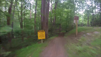
Shady Side Trail is one-direction single track you can reach from the fire roads that connect to Owl's Root Trail. Some fast, flowing single track connects back to Owl's Roost near the northern end of the trail.
This trail is closed to pedestrians due to high speed traffic and limited sight lines.

Local Trail Association
Traditionally Indigenous Territory
More Stats for Shady Side mountain bike trail trail
  • Altitude change
    -66 ft
  • Altitude min
    752 ft
  • Altitude max
    819 ft
  • Altitude start
    817 ft
  • Altitude end
    751 ft
  • Grade
    -1.3%
  • Grade max
    -18.1%
  • Grade min
    12.7%
  • Distance climb
    1,335 ft
  • Distance down
    2,782 ft
  • Distance flat
    1,070 ft
  • Avg time
    00:06:40
  • Avg reverse time
    00:11:44
  • view trail stats
Status:
on Sep 28, 2023
Dry
Avg: 4.45 (7 votes)
Your vote: 0

view (3,836)
close
3D
Trail Conditions
  • Unknown
  • Snow Groomed
  • Snow Packed
  • Snow Covered
  • Snow Cover Inadequate
  • Freeze/thaw Cycle
  • Icy
  • Prevalent Mud
  • Wet
  • Variable
  • Ideal
  • Dry
  • Very Dry
Trail Flow (Ridden Direction)
Trailforks scans users ridelogs to determine the most popular direction each trail is ridden. A good flowing trail network will have most trails flowing in a single direction according to their intension.
The colour categories are based on what percentage of riders are riding a trail in its intended direction.
  • > 96%
  • > 90%
  • > 80%
  • > 70%
  • > 50%
  • < 50%
  • bi-directional trail
  • no data
Trail Last Ridden
Trailforks scans ridelogs to determine the last time a trail was ridden.
  • < 2 days
  • < 1 week
  • < 2 weeks
  • < 1 month
  • < 6 months
  • > 6 months
Trail Ridden Direction
The intended direction a trail should be ridden.
  • Downhill Only
  • Downhill Primary
  • Both Directions
  • Uphill Primary
  • Uphill Only
  • One Direction
Contribute Details
Colors indicate trail is missing specified detail.
  • Description
  • Photos
  • Description & Photos
  • Videos
Trail Popularity ?
Trailforks scans ridelogs to determine which trails are ridden the most in the last 9 months. Trails are compared with nearby trails in the same city region with a possible 25 colour shades. Think of this as a heatmap, more rides = more kinetic energy = warmer colors.
  • most popular
  • popular
  • less popular
  • not popular
ATV/ORV/OHV Filter
Max Vehicle Width
inches

Radar Time
x Activity Recordings
Trailforks users anonymized public ridelogs from the past 6 months.
  • mountain biking recent
  • mountain biking (>6 month)
  • hiking (1 year)
  • moto (1 year)
Activity Recordings
Trailforks users anonymized public skilogs from the past 12 months.
  • Downhill Ski
  • Backcountry Ski
  • Nordic Ski
  • Snowmobile
Winter Trails
Warning A routing network for winter maps does not exist. Selecting trails using the winter trails layer has been disabled.
x Missing Trails
Most Popular
Least Popular
Trails are colored based on popularity. The more popular a trail is, the more red. Less popular trails trend towards green.
Jump Magnitude Heatmap
Heatmap of where riders jump on trails. Zoom in to see individual jumps, click circles to view jump details.
Trails Deemphasized
Trails are shown in grey.
disable
Only show trails with NO bikes.
enable

Save the current map location and zoom level as your default home location whenever this page is loaded.

Save
      Directions to shady-side trailhead (36.168220, -79.851460)
      update trails status or condition

      Shady Side Trail Reports

      statusdatedescription
      Sep 28, 2023 @ 1:22pm
      3 days
      reporter
      cleaned out 19 drains on SS and cleared all debris. also sawed a tree off LL and cleared trees and limbs off LL, OR, fire road. no pics just...
      Sep 26, 2023 @ 11:51am
      Sep 26, 2023
      reporter OPEN
      Sep 23, 2023 @ 6:07am
      Sep 23, 2023
      reporter CLOSED
      Sep 18, 2023 @ 3:27pm
      Sep 18, 2023
      reporter OPEN
      Sep 18, 2023 @ 3:23pm
      Sep 18, 2023
      reporter
      view all reports »

      Recent Ridelog Activity on Trail

      Past Week
      • 9 rides
      • 14 miles avg distance
      6 Months
      • 323 rides
      • 14 miles avg distance
      All
      • 3,196 rides
      • Last: Oct 1, 2023

      Photos

      more »
      28 |
      Nov 29, 2020 @ 7:03am
      Nov 29, 2020
      21 |
      Nov 29, 2020 @ 7:03am
      Nov 29, 2020
      23 |
      Nov 29, 2020 @ 7:02am
      Nov 29, 2020
      184 |
      May 5, 2020 @ 4:20am
      May 5, 2020

      Routes with this trail

      more »
      titledistance
      King & Queen of the Watershed ‘23 race featured25 miles
      Quick n Dirty15 miles
      Point to Point Shuttled Watershed Tails Epic34 miles
      Turkey, Owls Roost, Turkey14 miles

      1 Review & Comments


      We hope you've been enjoying Trailforks!

      Create a FREE account to view trail comments and much more.

      Videos

      more »
      Owls Roost shady side trail
      13:58 | 184 | May 28, 2018 , Greensboro
      Shady Side Trail ride
      3:34 | 145 | Apr 8, 2016 , Greensboro
      • By ERMorrison & contributors
      • #20112 - 7,044 views
      • subscribe
      • flag
      • login to download gpx or kml files.