close
-
Layers w
- Map Content
- More Layers
- Pro
- Pro
- Pro
- Pro
- Pro
- Pro
- Pro
- Pro
-
Upgrade to

3D
Trail Conditions
- Unknown
- Snow Groomed
- Snow Packed
- Snow Covered
- Snow Cover Partial
- Freeze/thaw Cycle
- Icy
- Prevalent Mud
- Wet
- Variable
- Ideal
- Dry
- Very Dry
Trail Flow (Ridden Direction)
Trailforks scans users ridelogs to determine the most popular direction each trail is ridden. A good flowing trail network will have most trails flowing in a single direction according to their intension.
The colour categories are based on what percentage of riders are riding a trail in its intended direction.
The colour categories are based on what percentage of riders are riding a trail in its intended direction.
- > 96%
- > 90%
- > 80%
- > 70%
- > 50%
- < 50%
- bi-directional trail
- no data
Trail Last Ridden
Trailforks scans ridelogs to determine the last time a trail was ridden.
- < 2 days
- < 1 week
- < 2 weeks
- < 1 month
- < 6 months
- > 6 months
Trail Ridden Direction
The intended direction a trail should be ridden.
- Downhill Only
- Downhill Primary
- Both Directions
- Uphill Primary
- Uphill Only
- One Direction
Contribute Details
Colors indicate trail is missing specified detail.
- Description
- Photos
- Description & Photos
- Videos
Trail Popularity ?
Trailforks scans ridelogs to determine which trails are ridden the most in the last 9 months.
Trails are compared with nearby trails in the same city region with a possible 25 colour shades.
Think of this as a heatmap, more rides = more kinetic energy = warmer colors.
- most popular
- popular
- less popular
- not popular
ATV/ORV/OHV Filter
Max Vehicle Width
inches
US Cell Coverage
Legend

Radar Time
x
Activity Recordings
Trailforks users anonymized public ridelogs from the past 6 months.
- mountain biking recent
- mountain biking (>6 month)
- hiking (1 year)
- moto (1 year)
Activity Recordings
Trailforks users anonymized public skilogs from the past 12 months.
- Downhill Ski
- Backcountry Ski
- Nordic Ski
- Snowmobile
Winter Trails
Warning
A routing network for winter maps does not exist. Selecting trails using the winter trails layer has been disabled.
x
Missing Trails
Most Popular
Least Popular
Trails are colored based on popularity. The more popular a trail is, the more red. Less popular trails trend towards green.
Jump Magnitude Heatmap
Heatmap of where riders jump on trails. Zoom in to see individual jumps, click circles to view jump details.
Trails Deemphasized
Trails are shown in grey.
Only show trails with NO bikes.
Save the current map location and zoom level as your default home location whenever this page is loaded.
Save
No description for Greensboro has been added yet!
Login or register to submit one.
Activities Click to view
- Mountain Bike
100 trails
- E-Bike
32 trails
- Hike
132 trails
- Trail Running
131 trails
Region Details
- 2
- 45
- 40
- 13
Region Status
Open as of 9 hoursStats
- Avg Trail Rating
- Trails (view details)
- 134
- Trails Mountain Bike
- 100
- Trails E-Bike
- 32
- Trails Hike
- 132
- Trails Trail Running
- 131
- Total Distance
- 117 miles
- Total Descent Distance
- 40 miles
- Total Descent
- 5,447 ft
- Total Vertical
- 302 ft
- Highest Trailhead
- 938 ft
- Reports
- 14,850
- Photos
- 4,043
- Ridden Counter
- 9,309
Sub Regions
-
Bald Eagle Trails
- 2
- 2
-
Bur-Mil Park
- 4
- 2
-
Country Park
- 1
- 2
-
Keely Park
- 12
- 1
-
Northeast Park
- 3
-
Watershed Trails
- 9
- 3
Popular Greensboro Mountain Biking Trails
Greensboro Mountain Bike Routes
| title | rating | distance |
|---|---|---|
| Quick n Dirty | 15 miles | |
| Turkey, Owls Roost, Turkey | 14 miles | |
| Point to Point Shuttled Watershed Tails Epic | 34 miles | |
| King & Queen of the Watershed ‘23 race | 25 miles | |
| King & Queen of the Watershed ‘19-'22 race | 29 miles |
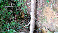
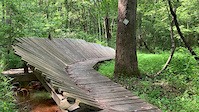
Photos of Greensboro Mountain Bike
trail: Owl's Roost
214 |
Mar 22, 2020 @ 5:51am
Mar 22, 2020
trail: Wild Turkey
133 |
Apr 1, 2019 @ 5:59pm
Apr 1, 2019
trail: Wild Turkey
372 |
Dec 2, 2018 @ 4:31pm
Dec 2, 2018
trail: Owl's Roost
199 |
Aug 5, 2018 @ 10:47am
Aug 5, 2018
trail: Reedy Fork
113 |
May 5, 2018 @ 7:56pm
May 5, 2018
trail: Owl's Roost
301 |
Apr 6, 2018 @ 1:36pm
Apr 6, 2018
trail: Copperhead
406 |
May 6, 2017 @ 9:36pm
May 6, 2017
trail: Copperhead
303 |
May 6, 2017 @ 9:36pm
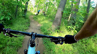
May 6, 2017Videos of Greensboro Mountain Bike
trail: Bald Eagle
0:59 |
54 |
Jul 24, 2020
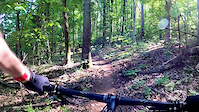
trail: Reedy Fork
20:53 |
109 |
May 8, 2020
trail: Kingfisher
12:31 |
200 |
May 5, 2020
trail: Owl's Roost
0:07 |
|
Mar 20, 2020
trail: Bald Eagle
0:06 |
|
Feb 7, 2020
trail: Shady Side
13:58 |
195 |
May 28, 2018
trail: Owl's Roost
1:14 |
486 |
May 13, 2018
trail: Shady Side
3:34 |
148 |
Apr 8, 2016
Current Trail Warnings
| status | trail | date | condition | user | info |
|---|---|---|---|---|---|
| Country Park Lakeside | May 17, 2024 @ 1:55pm 9 hours | Unknown | FritzNeal PFTS Admin | CLOSED | |
| Copperhead | May 17, 2024 @ 1:55pm 9 hours | Unknown | FritzNeal PFTS Admin | CLOSED | |
| Wild Turkey Connector (Lake Brandt Rd) | May 14, 2024 @ 7:15am May 14, 2024 | Unknown | FritzNeal PFTS Admin | CLOSED |
Recent Trail Reports
| status | trail | date | condition | info | user |
|---|---|---|---|---|---|
| Swan Song Connector | May 14, 2024 @ 7:15am May 14, 2024 | Unknown | FritzNeal PFTS Admin | ||
| Swan Song | May 14, 2024 @ 7:15am May 14, 2024 | Unknown | FritzNeal PFTS Admin | ||
| Squirrel Creek | May 14, 2024 @ 7:15am May 14, 2024 | Unknown | FritzNeal PFTS Admin | ||
| Shady Side Connector | May 14, 2024 @ 7:15am May 14, 2024 | Unknown | FritzNeal PFTS Admin | ||
| Shady Side (Jump Line) | May 14, 2024 @ 7:15am May 14, 2024 | Unknown | FritzNeal PFTS Admin | ||
| Shady Side | May 14, 2024 @ 7:15am May 14, 2024 | Unknown | FritzNeal PFTS Admin | ||
| Reedy Fork | May 14, 2024 @ 7:15am May 14, 2024 | Unknown | FritzNeal PFTS Admin | ||
| Plainfield Connector | May 14, 2024 @ 7:15am May 14, 2024 | Unknown | FritzNeal PFTS Admin | ||
| Owls Roost Fire Road | May 14, 2024 @ 7:15am May 14, 2024 | Unknown | FritzNeal PFTS Admin | ||
| Owl's Roost | May 14, 2024 @ 7:15am May 14, 2024 | Unknown | FritzNeal PFTS Admin |
Activity Feed
| username | action | type | title | date |
|---|---|---|---|---|
| FritzNeal | add | report | activity #52737266 and 1 more | May 17, 2024 @ 1:55pm 9 hours |
| FritzNeal | add | report | activity #52720712 and 1 more | May 17, 2024 @ 7:11am 16 hours |
| FritzNeal | add | report | activity #52585548 and 1 more | May 14, 2024 @ 7:15am May 14, 2024 |
| FritzNeal | add | report | activity #52585543 and 13 more | May 14, 2024 @ 7:15am May 14, 2024 |
| FritzNeal | add | report | activity #52585533 and 10 more | May 14, 2024 @ 7:15am May 14, 2024 |
Recent Comments
| username | type | title | comment | date |
|---|---|---|---|---|
| report | Next time, please indicate the location of... | May 12, 2024 @ 10:35am May 12, 2024 | ||
| report | *near marker 505 | May 10, 2024 @ 3:13pm May 10, 2024 | ||
| trail | Downed tree on last down hill section before... | Apr 17, 2024 @ 10:10am Apr 17, 2024 | ||
| report | Cleared Dg, dg, KP | Apr 14, 2024 @ 9:52am Apr 14, 2024 | ||
| report | Be aware tree is covered in poison ivy vine... | Apr 13, 2024 @ 12:56pm Apr 13, 2024 |
Local Badges
-

Big Ride 30k3,460 awarded -

10 Green Trails210 awarded -

Climbing 10k Badge92 awarded -

Climbing 100k Badge8 awarded -

Epic Ride Climb 2k3 awarded -

Epic Ride Descent 2k3 awarded
Bike & Skill Parks
| name | type | city | rating |
|---|---|---|---|
| The Zone Freeride Area | skill park | Greensboro |
Upcoming Local Events
Activity Type Stats
| activitytype | trails | distance | descent | descent distance | total vertical | rating | global rank | state rank | photos | reports | routes | ridelogs |
|---|---|---|---|---|---|---|---|---|---|---|---|---|
| Mountain Bike | 100 | 90 miles | 4,137 ft | 31 miles | 302 ft | #729 | #401 | 3,958 | 14,837 | 5 | 24,768 | |
| E-Bike | 32 | 71 miles | 3,215 ft | 24 miles | 220 ft | #256 | #82 | 3 | 7,940 | 4 | 691 | |
| Hike | 132 | 116 miles | 5,335 ft | 39 miles | 302 ft | #578 | #358 | 139 | 9,235 | 642 | ||
| Trail Running | 131 | 114 miles | 5,256 ft | 39 miles | 302 ft | #580 | #360 | 10 | 9,235 | 1,297 |
- By caleb93
 & contributors
 - Admins: FritzNeal, PFTS Admin
- #4378 - 14,501 views
- greensboro activity log | embed map of Greensboro mountain bike trails | greensboro mountain biking points of interest polygons
Downloading of trail gps tracks in kml & gpx formats is enabled for Greensboro.
You must login to download files.