more stats
1.2 miles
Distance
108 ft
Climb
-106 ft
Descent
00:08:42
Avg time
-1 ft
Altitude change
69 ft
Altitude min
131 ft
Altitude max
90 ft
Altitude start
89 ft
Altitude end
-0%
Grade
-17.1%
Grade max
11.2%
Grade min
2,359 ft
Distance climb
2,457 ft
Distance down
1,690 ft
Distance flat
00:08:42
Avg time

Sharks Tail Details

  • Activities
    • Mountain Bike
    • E-Bike
    • Hike
    • Trail Running
  • Riding Area
  • Difficulty Rating
  • Local Popularity
    75 in Mountain Biking [+]
    • 80 in E-Biking
    • 50 in Trail Running
    • 5 in Hiking
  • Global Ranking
    #69729 in Mountain Biking [+]
    • #24490 in E-Biking
    • #151069 in Trail Running
    • #336088 in Hiking
  • National Ranking
    #3,331 in Mountain Biking · Australia [+]
    • #1,622 in E-Biking
    • #5,056 in Trail Running
    • #8,415 in Hiking
  • Trail Type
    Singletrack
  • Bike Type
    AM, XC
  • Direction
    One Direction
    Popular Direction Shown
  • Physical Rating
    Moderate
  • Dogs Allowed
    Yes
  • eBike Allowed
    Yes up to Class 1
  • TTFs on Trail
    Berm, Bridge, Drop, Jump, Other
  • Land Owner
    Redland City Council

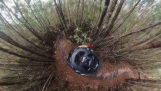
Shark Tail is a one-way trail ridden from south to north that is often used as a return trail for riders coming off The Maze. Both ends of Shark Tail are easy to ride, but you’ll find many challenges toward the middle, where the sandy soil has eroded to form deep ruts and holes. Exposed roots also cross the trail, creating step-ups and drops, especially along the sections that descend toward a creek crossing , where a dense sea of ferns are a highlight of the trail. This challenging trail is ideal for more advanced riders. Walkers should watch for mountain bike riders in places where the trail is very narrow. The link between Shark Tail and The Maze is an old trail, originally ridden west to east to form a circuit. Watch out for erosion ruts and exposed roots on descending sections.

Access Info

Access next to trail hut at the southern end on Native Dog Rd

Local Trail Association
Traditionally Indigenous Territory

Recent Activity on Trail

Past Week
  • 5 rides
  • 16 miles average
6 Months
  • 61 rides
  • 15 miles avg distance
All
  • 1,451 rides
  • Last: Oct 3, 2026
c1c2c3c4
January
February
March
April
May
June
July
August
September
October
November
December
Status:
on Jul 26, 2026
Ideal
Avg: 4.1 (3 votes)
Your vote: 0

view (5,711)
close
      Directions to sharks-tail trailhead (-27.674590, 153.286730)

      Photos

      27 more »
      mtb
      68 |
      Jul 13, 2022 @ 10:07pm
      Jul 13, 2022
      mtb
      64 |
      Jul 13, 2022 @ 10:07pm
      Jul 13, 2022
      mtb
      34 |
      Jul 13, 2022 @ 10:07pm
      Jul 13, 2022
      mtb
      53 |
      Jul 13, 2022 @ 10:06pm
      Jul 13, 2022

      Videos

      3 more »
      Bayview Conservation Park MTB trails - Sharks Tail
      mtb
      11:00 | 285 | Aug 6, 2024 , Redland City
      youtuber SHARK TAIL | Bayview | RAW WEDNESDAYS
      mtb
      8:56 | 264 | Mar 27, 2023 , Redland City
      ⚠ Tech and Turns ????SHARKS TAIL ????...
      mtb
      8:08 | 505 | Nov 30, 2020 , Redland City

      Routes with this trail

      ★ 3.0 • 12 miles • 887 ft • 11 • Loop •
      This was my third time to Bayview. I planned this route to avoid the hardest trails (Sorceress and Wolf...
      ★ 2.7 • 12 miles • 846 ft • 21 • Loop •
      Start at the main Bayview carpark/picnic area then cycle south down German Church Rd and enter to forest...
      21 miles • 1,652 ft • 15 •
      Bayview Conservation MTB Park 34 klm Loop
      4.4 ★★★★★
      3 Ratings
      5 ★ 33%
      4 ★ 67%
      3 ★
      2 ★
      1 ★

      1 Review & Comments


      We hope you've been enjoying Trailforks!

      Create a FREE account to view all trail reviews and much more.

      • By ONeillRide & contributors
      • #63910 - 2,114 views

      Frequently Asked Questions

      ▼ Where is Sharks Tail located?
      Sharks Tail is located in Bayview Conservation Area, Redland City, Australia. It is part of the Bayview Conservation Area trail network. The trailhead is located at coordinates -27.67459, 153.28673.
      ▼ How hard is Sharks Tail?
      Sharks Tail is rated as Green difficulty. The physical rating is Moderate.
      ▼ What is the elevation gain for Sharks Tail?
      Sharks Tail has 108 ft of elevation gain. The trail has 106 ft of elevation descent. The elevation ranges from 69 ft to 131 ft.
      ▼ Is Sharks Tail a point to point trail?
      Yes, Sharks Tail is a point to point trail. The direction is One Direction. The trail type is singletrack.
      ▼ How long is Sharks Tail?
      Sharks Tail is 1.2 miles long. The trail type is singletrack.
      ▼ Are dogs allowed on Sharks Tail?
      Yes, dogs are allowed on Sharks Tail. Please keep dogs on a leash where required and clean up after them.
      ▼ When is the best time of year to ride Sharks Tail?
      Based on activity log data, the most popular months to ride Sharks Tail are:
      • September (46 activities)
      • October (40 activities)
      • August (36 activities)
      Check the reports page for current trail conditions.
      ▼ How do I access Sharks Tail? Where is the closest parking trailhead?
      The closest parking and trailhead locations to Sharks Tail are: View all parking locations in the area.
      ▼ How long does it take to ride Sharks Tail?
      Based on recorded activities, it takes an average of 9 minutes to ride Sharks Tail. The trail is 1.2 miles long. Actual times will vary based on fitness level, conditions, and pace. View recent activity logs for more details.
      ▼ How busy is Sharks Tail?
      Sharks Tail is a very popular trail. There have been 5,771 recorded activities on this trail. The trail has received 5,711 check-ins. View recent activity on this trail.

      Hit the Trail

      Open in App

      Get this trail on your phone instantly.

      open trail in app

      Download Trail

      Save to wishlist, Garmin & download.
      save the trail

      Find Related Routes

      Find routes and users activities that include this trail.
      find routes for this trail

      You must enter a description before submitting.