

Open in App
Get this trail on your phone instantly.

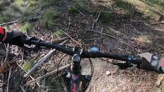
Best ridden from East to West but you can go either way. Heading from the west the first bit is a bomb down a rough fire trail before a sharp left halfway down onto single track. Single track varies from a rough section through a "rock garden" before a flowy trail down to Shaws Lake where you can cross the dam wall to the other side. Can be prone to small trees being down for some reason. One wall climb which can be hard for bikes as the motos dig slots where MTB pedals cant get up without hitting. Walk it - only a few metres - if required.
| c1 | c2 | c3 | c4 |
|---|---|---|---|
January | February | March | April |
May | June | July | August |
September | October | November | December |

Service Road Atlas is a free to use, community-driven service for viewing and creating reports on the numerous back-country service roads around B.C. and Alberta.
Save the current map location and zoom level as your default home location whenever this page is loaded.
SaveWe hope you've been enjoying Trailforks!
Create a FREE account to view all trail reviews and much more.
 & contributors
You must enter a description before submitting.

