


Open in App
Get this trail on your phone instantly.

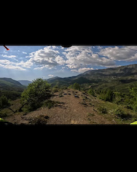
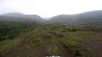
This 4 km long singletrack trail has natural mountainous terrain, offering excellent conditions for mountain biking. It's fast and technical with mixed terrain—grass, dirt, rocks, natural jumps, and tight turns—which can make certain sections challenging.
The Shutri Trail is fully signposted along its entire length and remains open in very good condition for a long period of the year, from March until the end of November. Access to the trailhead can be done either by pedalling or by using a personal 4x4 vehicle. The total length of the route is approximately 11 km.
History of the trail’s development:
 | This trail runs along a hilltop ridge and shepherds have used it for years with their livestock. At the same time, it is very well suited for mountain biking. During 2023, together with three friends of mine (members of the mountain biking community in Albania and Kosovo), we included this trail in a project called “Bike on Bus.” This project enables the transport of bicycles on the public bus line to the mountainous area of Tirana where this trail is located, about one hour from the city center. The project involved mounting bicycles on a rack installed at the rear of the bus. This made it easier not only for those who want to visit the area by mountain bike but also for local residents to use bicycles without needing to take a car into the city for daily activities. The Shutri Trail was included as part of this project. We made the necessary improvements, such as cleaning and shaping the trail to create favorable conditions for mountain biking, and installed signage and trail markers along its entire length. - Andi Qyqja |
| c1 | c2 | c3 | c4 |
|---|---|---|---|
January | February | March | April |
May | June | July | August |
September | October | November | December |

Service Road Atlas is a free to use, community-driven service for viewing and creating reports on the numerous back-country service roads around B.C. and Alberta.
Save the current map location and zoom level as your default home location whenever this page is loaded.
SaveWe hope you've been enjoying Trailforks!
Create a FREE account to view all trail reviews and much more.
 TRAILFORKS & contributors
You must enter a description before submitting.

