more stats
863 ft
Distance
-209 ft
Descent
00:03:26
Avg time
-219 ft
Altitude change
4,617 ft
Altitude min
4,837 ft
Altitude max
4,837 ft
Altitude start
4,616 ft
Altitude end
-25.4%
Grade
-53.7%
Grade max
-9.1%
Grade min
863 ft
Distance down
00:03:26
Avg time

Skidsteer Details

  • Activities
    • Mountain Bike
  • Riding Area
    Kershaw-Ryan State Park
    Caliente, Nevada
  • Difficulty Rating
  • Local Popularity
    45 in Mountain Biking
  • Global Ranking
    #107935 in Mountain Biking
  • State Ranking
    #598 in Mountain Biking · Nevada
  • Trail Type
    Singletrack
  • Bike Type
    AM
  • Direction
    Downhill Only
    Popular Direction Shown
  • Dogs Allowed
    Yes
  • Land Owner
    Nevada Division Of State Parks

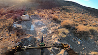
This trail drops about 250 feet straight off the face of the canyon rim. It was cut in by one builder then touched up by another. It is very steep with some rock outcrops to navigate on the way down. You will be surfing sand in places. Embrace it, it's fun. Also, at this time it still needs a little love toward the bottom where you will be locked out sliding down a fall line. Embrace that, too. It's also fun.

Tags

Local Trail Association

Traditionally Indigenous Territory

Recent Activity on Trail

Past Week
  • 0 rides
  •  
6 Months
  • 1 rides
  • 7 miles avg distance
All
  • 25 rides
  • Last: Oct 22, 2026
update trails status or condition

Skidsteer Trail Reports

Status:
on Apr 11, 2023
Dry
Avg: 4.11 (2 votes)
Your vote: 0

view (98)
close
      Directions to skidsteer trailhead (37.591770, -114.518680)

      Photos

      4 more »
      mtb
      72 |
      Mar 13, 2023 @ 9:42pm
      Mar 13, 2023
      mtb
      104 |
      Mar 13, 2023 @ 9:42pm
      Mar 13, 2023
      mtb
      195 |
      Apr 1, 2020 @ 6:29pm
      Apr 1, 2020
      mtb
      209 |
      Apr 1, 2020 @ 6:29pm
      Apr 1, 2020

      Videos

      1 more »
      Skidsteer DH
      mtb
      0:08 | 108 | Feb 2, 2021 , Caliente
      4.5 ★★★★★
      2 Ratings
      5 ★ 50%
      4 ★ 50%
      3 ★
      2 ★
      1 ★

      1 Review & Comments


      We hope you've been enjoying Trailforks!

      Create a FREE account to view all trail reviews and much more.

      Frequently Asked Questions

      ▼ Where is Skidsteer located?
      Skidsteer is located in Kershaw-Ryan State Park, Caliente, Nevada, United States. It is part of the Kershaw-Ryan State Park trail network. The trailhead is located at coordinates 37.59177, -114.51868.
      ▼ How hard is Skidsteer?
      Skidsteer is rated as Black Diamond difficulty. The average grade is 25.4%.
      ▼ What is the elevation gain for Skidsteer?
      The trail has 209 ft of elevation descent. The elevation ranges from 4,617 ft to 4,837 ft.
      ▼ Is Skidsteer a point to point trail?
      Yes, Skidsteer is a point to point trail. The direction is Downhill Only. The trail type is singletrack.
      ▼ How long is Skidsteer?
      Skidsteer is 863 ft long. The trail type is singletrack.
      ▼ Are dogs allowed on Skidsteer?
      Yes, dogs are allowed on Skidsteer. Please keep dogs on a leash where required and clean up after them.
      ▼ How do I access Skidsteer? Where is the closest parking trailhead?
      The closest parking and trailhead locations to Skidsteer are: View all parking locations in the area.
      ▼ How long does it take to ride Skidsteer?
      Based on recorded activities, it takes an average of 3 minutes to ride Skidsteer. The trail is 863 ft long. Actual times will vary based on fitness level, conditions, and pace. View recent activity logs for more details.
      ▼ How busy is Skidsteer?
      Skidsteer is a moderately popular trail. There have been 80 recorded activities on this trail. The trail has received 98 check-ins. View recent activity on this trail.

      Hit the Trail

      Open in App

      Get this trail on your phone instantly.

      open trail in app

      Download Trail

      Save to wishlist, Garmin & download.
      save the trail

      Find Related Routes

      Find routes and users activities that include this trail.
      find routes for this trail

      You must enter a description before submitting.