more stats
1.0 mile
Distance
-350 ft
Descent
00:08:42
Avg time
-351 ft
Altitude change
7,558 ft
Altitude min
7,909 ft
Altitude max
7,909 ft
Altitude start
7,559 ft
Altitude end
-6.6%
Grade
-15.4%
Grade max
1.3%
Grade min
4,839 ft
Distance down
423 ft
Distance flat
00:08:42
Avg time

Sol Train East Details

  • Activities
    • Mountain Bike
    • Hike
    • Trail Running
  • Riding Area
  • Difficulty Rating
  • Voted Difficulty
    Blue (1 vote)
  • Local Popularity
    85 in Mountain Biking heatmap [+]
    • 90 in Trail Running
    • 60 in Hiking
  • Global Ranking
    #61366 in Mountain Biking [+]
    • #114027 in Trail Running
    • #148533 in Hiking
  • State Ranking
    #1,077 in Mountain Biking · Colorado [+]
    • #3,234 in Trail Running
    • #4,491 in Hiking
  • Trail Type
    Singletrack
  • Bike Type
    AM, XC, DJ
  • Physical Rating
    Moderate
  • Trail Visibility
    Always easy to follow
  • Season
    April 16 - Nov 30th
  • Dogs Allowed
    Yes
  • eBike Allowed
  • TTFs on Trail
    Berm, Drop, Jump, Gap Jump
  • Year Opened
    2019
  • Land Owner
    BLM

Sol Train East (and West) was built to be a flow style trail, mountain bike optimized for maximum playfulness and fun, with lots of twists, turns, jumps, and berms. It has the feel of a long, linear pump track. Approximately a mile in length, with a fairly consistent 6% average downhill grade, beginning at the top of the Sun Up trail (and end of Gutz trail).

While built for downhill fun, please remember it's bi-directional, so be on the lookout and be courteous if you encounter any uphill users. Sol Train East drops you down to the intersection of Little Rainbow, Dead Bird, and Race Track.

Also try Sol Train West, which starts in the same spot at the top of Sun Up.

This trail is rated blue/black because of the features built into the trail, but the two largest features (step-down jumps) are optional lines.

The Sol Train trails were designed and built by Singletrack Trails Inc. for Salida Mountain Trails.

Access Info

Access from top of Sun Up trail.
Seasonal closure (above the powerline road only) Dec 1 – April 15.

Tags
BermsDropsJumpsPump trackViews

Trail Supporters

Local Trail Association

Traditionally Indigenous Territory

Recent Activity on Trail

Past Week
  • 1 rides
  • 7 miles average
6 Months
  • 80 rides
  • 10 miles avg distance
All
  • 373 rides
  • Last: Nov 7, 2026
c1c2c3c4
January
February
March
April
May
June
July
August
September
October
November
December
update trails status or condition

Sol Train East Trail Reports

Status:
on Oct 8, 2024
Dry
Avg: 3.99 (9 votes)
Your vote: 0

view (1,726)
close
      Directions to sol-train-east trailhead (38.492340, -105.994550)

      Photos

      4 more »
      mtb
      82 |
      Nov 2, 2026 @ 9:45am
      Nov 2, 2026
      mtb
      8 |
      Nov 2, 2026 @ 8:00am
      Nov 2, 2026
      mtb
      170 |
      Jul 28, 2020 @ 11:37am
      Jul 28, 2020
      mtb
      107 |
      Nov 24, 2020 @ 10:35am
      Nov 24, 2020

      Videos

      1 more »
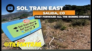
      Sol Train East - Salida, CO -MTB Trail Preview
      mtb
      0:32 | 83 | Feb 7, 2025 , Salida

      Routes with this trail

      more »
      6 miles • 870 ft • 12 • Loop •
      A quick tour up Race track and Sun Up then down both ends of Sol Train with finale choice of Dead Bird,...
      3.9 ★★★★★
      9 Ratings
      5 ★ 33%
      4 ★ 33%
      3 ★ 22%
      2 ★ 11%
      1 ★

      1 Review & Comments

      Pdonahue92
      Awesome berms with some rollers that can be doubled with a few smaller drops on rider right side of trail!

      We hope you've been enjoying Trailforks!

      Create a FREE account to view all trail reviews and much more.

      • By shutter2rideTF Pro & contributors
      • #221063 - 1,234 views

      Frequently Asked Questions

      ▼ Where is Sol Train East located?
      Sol Train East is located in Methodist Mountain Trail System, Salida, Colorado, United States. It is part of the Methodist Mountain Trail System trail network. The trailhead is located at coordinates 38.49234, -105.99455.
      ▼ How hard is Sol Train East?
      Sol Train East is rated as Blue difficulty. The physical rating is Moderate. The average grade is 6.6%.
      ▼ What is the elevation gain for Sol Train East?
      The trail has 350 ft of elevation descent. The elevation ranges from 7,558 ft to 7,909 ft.
      ▼ How long is Sol Train East?
      Sol Train East is 1.0 mile long. The trail type is singletrack.
      ▼ Are dogs allowed on Sol Train East?
      Yes, dogs are allowed on Sol Train East. Please keep dogs on a leash where required and clean up after them.
      ▼ When is the best time of year to ride Sol Train East?
      Based on activity log data, the most popular months to ride Sol Train East are:
      • May (35 activities)
      • July (35 activities)
      • June (30 activities)
      Check the reports page for current trail conditions.
      ▼ How do I access Sol Train East? Where is the closest parking trailhead?
      The closest parking and trailhead locations to Sol Train East are: View all parking locations in the area.
      ▼ How long does it take to ride Sol Train East?
      Based on recorded activities, it takes an average of 9 minutes to ride Sol Train East. The trail is 1.0 mile long. Actual times will vary based on fitness level, conditions, and pace. View recent activity logs for more details.
      ▼ How busy is Sol Train East?
      Sol Train East is a very popular trail. There have been 1,687 recorded activities on this trail. The trail has received 1,726 check-ins. View recent activity on this trail.

      Hit the Trail

      Open in App

      Get this trail on your phone instantly.

      open trail in app

      Download Trail

      Save to wishlist, Garmin & download.
      save the trail

      Find Related Routes

      Find routes and users activities that include this trail.
      find routes for this trail

      You must enter a description before submitting.