more stats
4,672 ft
Distance
12 ft
Climb
-275 ft
Descent
00:11:25
Avg time
-264 ft
Altitude change
4,983 ft
Altitude min
5,253 ft
Altitude max
5,247 ft
Altitude start
4,984 ft
Altitude end
-5.7%
Grade
-27.8%
Grade max
3.4%
Grade min
712 ft
Distance climb
3,543 ft
Distance down
417 ft
Distance flat
00:11:25
Avg time

Squirrel Shit Details

  • Activities
    • Mountain Bike
    • E-Bike
    • Hike
    • Trail Running
    • Snowshoe
  • Riding Area
    York Creek
    Coleman, Alberta
  • Difficulty Rating
  • Local Popularity
    95 in Mountain Biking [+]
    • 95 in E-Biking
    • 75 in Trail Running
    • 85 in Hiking
    • 5 in Snowshoeing
  • Global Ranking
    #42998 in Mountain Biking [+]
    • #60776 in Trail Running
    • #50313 in Hiking
    • #1737 in Snowshoeing
  • Hiking SAC Scale
    T2 Mountain Hiking
  • Trail Type
    Singletrack
  • Bike Type
    AM, XC
  • Direction
    Downhill Primary
    Popular Direction Shown
  • Climb Difficulty
    Blue
  • Physical Rating
    Moderate
  • Trail Visibility
    Sometimes hard to follow
  • Season
    May to October
  • Dogs Allowed
    Yes
  • eBike Allowed
  • TTFs on Trail
    Rock Garden
  • Ride in Rain
    Yes
  • Land Owner
    Alberta Environment and Parks

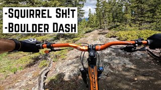
Follows a rocky ridge and open forest about 200 m west of the more advanced School of Rock. Technically much easier than School of Rock, it can also be ridden up (except for pushing up a couple of short steep sections), as an alternate access to School of Rock.

Access Info

The most direct route to the trail is climbing the York Creek Road (see to Sweet Duaneage, and Front Door (Lower York Creek Climb)) which is the doubletrack trail just west of School of Rock.

This trail is unsanctioned.

Recent Activity on Trail

Past Week
  • 1 rides
  • 13 miles average
6 Months
  • 37 rides
  • 9 miles avg distance
All
  • 300 rides
  • Last: Jun 23, 2026
c1c2c3c4
January
February
March
April
May
June
July
August
September
October
November
December
update trails status or condition

Squirrel Shit Trail Reports

Status:
on Jun 11, 2026
Ideal
Avg: 3.99 (6 votes)
Your vote: 0

view (955)
close
3D
Trail Conditions
  • Unknown
  • Snow Groomed
  • Snow Packed
  • Snow Covered
  • Snow Cover Partial
  • Freeze/thaw Cycle
  • Icy
  • Prevalent Mud
  • Wet
  • Variable
  • Ideal
  • Dry
  • Very Dry
Trail Flow (Ridden Direction)
Trailforks scans users ridelogs to determine the most popular direction each trail is ridden. A good flowing trail network will have most trails flowing in a single direction according to their intension.
The colour categories are based on what percentage of riders are riding a trail in its intended direction.
  • > 96%
  • > 90%
  • > 80%
  • > 70%
  • > 50%
  • < 50%
  • bi-directional trail
  • no data
Trail Last Ridden
Trailforks scans ridelogs to determine the last time a trail was ridden.
  • < 2 days
  • < 1 week
  • < 2 weeks
  • < 1 month
  • < 6 months
  • > 6 months
Trail Ridden Direction
The intended direction a trail should be ridden.
  • Downhill Only
  • Downhill Primary
  • Both Directions
  • Uphill Primary
  • Uphill Only
  • One Direction
Contribute Details
Colors indicate trail is missing specified detail.
  • Description
  • Photos
  • Description & Photos
  • Videos
Trail Popularity ?
Trailforks scans ridelogs to determine which trails are ridden the most in the last 9 months. Trails are compared with nearby trails in the same city region with a possible 25 colour shades. Think of this as a heatmap, more rides = more kinetic energy = warmer colors.
  • most popular
  • popular
  • less popular
  • not popular
ATV/ORV/OHV Filter
Max Vehicle Width
inches
US Cell Coverage
Legend
cell carrier legend

Radar Time
Activity Recordings
Trailforks uses anonymized public activity data. ?
Activity Recordings
Trailforks uses anonymized public activity data. ?
Personal Heatmap
Activity Types
all / none
Options
2
Date range month
Winter Trails
Warning A routing network for winter maps does not exist. Selecting trails using the winter trails layer has been disabled.
Missing Trails
Most Popular
Least Popular
Trails are colored based on popularity. The more popular a trail is, the more red. Less popular trails trend towards green.
Jump Magnitude Heatmap
Heatmap of where riders jump on trails. Zoom in to see individual jumps, click circles to view jump details.
BC Backroad Status

Service Road Atlas is a free to use, community-driven service for viewing and creating reports on the numerous back-country service roads around B.C. and Alberta.

map legend
Slope Aspect
Direction the slope faces
Flat N NE E SE S SW W NW
Trails Deemphasized
Trails are shown in grey.
disable
Only show trails with no bike usage.
Enable
Suggested Layers
Based on selected activity type

    Save the current map location and zoom level as your default home location whenever this page is loaded.

    Save
        Directions to squirrel-shit trailhead (49.608470, -114.510040)

        Photos

        4 more »
        162 |
        Jun 11, 2020 @ 12:55pm
        Jun 11, 2020
        193 |
        May 24, 2019 @ 5:48am
        May 24, 2019
        133 |
        Jun 21, 2020 @ 3:44pm
        Jun 21, 2020
        153 |
        Jun 21, 2020 @ 3:44pm
        Jun 21, 2020

        Videos

        3 more »
        Giant Trance- Crowsnest Pass AB (Part 1)
        12:27 | 217 | Jun 14, 2024 , Coleman
        Crowsnest Pass Squirrel Sh!t [Part 1]
        6:31 | 237 | Jun 2, 2023 , Coleman
        Squirrel Sh!t
        3:30 | 574 | Aug 11, 2017 , Coleman

        Trail Lists

        Routes with this trail

        4.0 8 miles 1,228 ft 21 Loop
        This route accesses three great trails in the northern half of the York Creek trail network, including the...
        16 miles 3,136 ft 9
        This is the suggested route to hit the five trails for the Jokers Wild poker hand. It does not include the...
        5.0 15 miles 2,953 ft 32 Loop
        This route covers most of the trails on the hill.

        Reviews / Comments

        No reviews yet, be the first to write a review or ask a question.
        Use trail reports to comment on trail conditions.


        We hope you've been enjoying Trailforks!

        Create a FREE account to view trail comments and much more.

        • #21056 - 3,872 views

        Frequently Asked Questions About Squirrel Shit

        Where is Squirrel Shit located?
        Squirrel Shit is located in York Creek, Coleman, Alberta, Canada. It is part of the York Creek trail network. The trailhead is located at coordinates 49.60847, -114.51004.
        How hard is Squirrel Shit?
        Squirrel Shit is rated as Blue difficulty. The physical rating is Moderate. The average grade is 5.7%. The climb difficulty is rated Blue.
        What is the elevation gain for Squirrel Shit?
        Squirrel Shit has 12 ft of elevation gain. The trail has 275 ft of elevation descent. The elevation ranges from 4,983 ft to 5,253 ft.
        Is Squirrel Shit a point to point trail?
        Squirrel Shit is not a point to point trail. The direction is Downhill Primary. The trail type is singletrack.

        Hit the Trail

        Open in App

        Get this trail on your phone instantly.
        open trail in app

        Download Trail

        Save to wishlist, Garmin & download.
        save the trail

        Find Related Routes

        Find routes and users activities that include this trail.
        find routes for this trail

        You must enter a description before submitting.