
more stats
2,936 ft
Distance
-225 ft
Descent
00:03:16
Avg time
-227 ft
Altitude change
1,987 ft
Altitude min
2,214 ft
Altitude max
2,214 ft
Altitude start
1,988 ft
Altitude end
-7.7%
Grade
-20.8%
Grade max
2,805 ft
Distance down
131 ft
Distance flat
00:03:16
Avg time

Stalingrab Details

  • Activities
    • Mountain Bike
    • E-Bike
    • Winter Fat Bike
  • Riding Area
    Beacon Hill
    Spokane, Washington
  • Difficulty Rating
  • Local Popularity
    100 in Mountain Biking [+]
    • 100 in E-Biking
    • 5 in Winter Fat Biking
  • Global Ranking
    #21064 in Mountain Biking [+]
    • #2727 in E-Biking
    • #3132 in Winter Fat Biking
  • State Ranking
    #384 in Mountain Biking · Washington [+]
    • #34 in E-Biking
    • #20 in Winter Fat Biking
  • Trail Type
    Singletrack
  • Bike Type
    DH, AM, XC, DJ, Fat
  • Direction
    Downhill Only
    Popular Direction Shown
  • Physical Rating
    Moderate
  • Trail Visibility
    Always easy to follow
  • Dogs Allowed
    Yes
  • eBike Allowed
  • TTFs on Trail
    Berm, Jump
  • Year Opened
    2014
  • Land Owner
    Evergreen East Mountain Bike Alliance

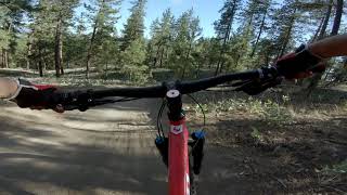
A local favorite, Stalingrab begins at the top of the downhill courses and ends at the southeast end of Camp Sekani. Stalingrab was built to be a beginner to intermediate jump trail riders can have fun and build confidence on. Stalingrab is packed with table tops, step-ups, rollers and berms from beginning to end.

Tags
RollersBermsJumps

Trail Supporters

Local Trail Association

Recent Activity on Trail

Past Week
  • 11 rides
  • 10 miles average
6 Months
  • 183 rides
  • 8 miles avg distance
All
  • 2,262 rides
  • Last: Oct 17, 2026
c1c2c3c4
January
February
March
April
May
June
July
August
September
October
November
December
Status:
on Sep 25, 2026
Variable
Avg: 4.43 (33 votes)
Your vote: 0

view (16,018)
close
      Directions to stalingrab-44700 trailhead (47.700020, -117.306840)

      Photos

      43 more »
      mtb
      91 |
      Nov 5, 2025 @ 10:54am
      Nov 5, 2025
      mtb
      162 |
      Aug 24, 2024 @ 6:17am
      Aug 24, 2024
      mtb
      143 |
      Aug 24, 2024 @ 6:17am
      Aug 24, 2024
      mtb
      252 |
      Apr 28, 2020 @ 9:32pm
      Apr 28, 2020

      Videos

      21 more »
      youtuber Stalingrab - Beacon Hill - Spokane, WA
      mtb
      3:45 | 558 | May 13, 2023 , Spokane
      youtuber The People's Enduro 2017 | Stage 1 Stahlingrab
      mtb
      2:50 | 530 | Apr 4, 2017 , Spokane
      youtuber Stalingrab - Spokane, Wa
      mtb
      3:16 | 1231 | Apr 23, 2019 , Spokane
      Stalingrab : Beacon Hill Spokane  - June 14...
      mtb
      301 | Jun 15, 2021 , Spokane

      Trail Lists

      Routes with this trail

      ★ 5.0 • 2 miles • 390 ft • 5 • Loop •
      This loop allows intermediate riders to progress and inspire confidence in their downhill capability. The...
      ★ 4.0 • 9 miles • 1,715 ft • 33 •
      How to hit all the best trails in one ride! All kinds of different trails, technical, flowy, and...
      14 miles • 2,291 ft • 12 •
      Starts at Ezzy Lot -> ends back at Ezzy.
      4.5 ★★★★★
      33 Ratings
      5 ★ 64%
      4 ★ 30%
      3 ★ 3%
      2 ★
      1 ★ 3%

      8 Reviews & Comments

      ogmtbvids ogmtbvids
      Upper part of trail from just below the junction with Upchuck is getting a face lift. First portion is done. Wide, super flowy much improved tables, step-ups and step downs. Watch your speed going into the first step up, you could send it right into the next jump. Easily lapped and fun to dial in.
      Nick1MTB
      Whoa, I could lap this one all day. Really fun! Flowy with small to medium jumps, perfect for gaining confidence. Lots of berms, flow and jumps as the description states. Don't skip this one!
      Brycebikes06
      I went head first into a bush on one of the burns so it’s a very fun trail????????

      We hope you've been enjoying Trailforks!

      Create a FREE account to view all trail reviews and much more.

      • By TimRidesBikesTF Pro & contributors
      • #44700 - 8,664 views

      Frequently Asked Questions

      ▼ Where is Stalingrab located?
      Stalingrab is located in Beacon Hill, Spokane, Washington, United States. It is part of the Beacon Hill trail network. The trailhead is located at coordinates 47.70002, -117.30684.
      ▼ How hard is Stalingrab?
      Stalingrab is rated as Blue difficulty. The physical rating is Moderate. The average grade is 7.7%.
      ▼ What is the elevation gain for Stalingrab?
      The trail has 225 ft of elevation descent. The elevation ranges from 1,987 ft to 2,214 ft.
      ▼ Is Stalingrab a point to point trail?
      Yes, Stalingrab is a point to point trail. The direction is Downhill Only. The trail type is singletrack.
      ▼ How long is Stalingrab?
      Stalingrab is 2,936 ft long. The trail type is singletrack.
      ▼ Are dogs allowed on Stalingrab?
      Yes, dogs are allowed on Stalingrab. Please keep dogs on a leash where required and clean up after them.
      ▼ When is the best time of year to ride Stalingrab?
      Based on activity log data, the most popular months to ride Stalingrab are:
      • May (180 activities)
      • April (177 activities)
      • March (175 activities)
      Check the reports page for current trail conditions.
      ▼ How do I access Stalingrab? Where is the closest parking trailhead?
      The closest parking and trailhead locations to Stalingrab are: View all parking locations in the area.
      ▼ How long does it take to ride Stalingrab?
      Based on recorded activities, it takes an average of 3 minutes to ride Stalingrab. The trail is 2,936 ft long. Actual times will vary based on fitness level, conditions, and pace. View recent activity logs for more details.
      ▼ How busy is Stalingrab?
      Stalingrab is a very popular trail. There have been 14,059 recorded activities on this trail. The trail has received 16,018 check-ins. View recent activity on this trail.

      Hit the Trail

      Open in App

      Get this trail on your phone instantly.

      open trail in app

      Download Trail

      Save to wishlist, Garmin & download.
      save the trail

      Find Related Routes

      Find routes and users activities that include this trail.
      find routes for this trail

      You must enter a description before submitting.