
more stats
1,378 ft
Distance
9 ft
Climb
-6 ft
Descent
00:02:53
Avg time
3 ft
Altitude change
2,333 ft
Altitude min
2,344 ft
Altitude max
2,333 ft
Altitude start
2,336 ft
Altitude end
0.2%
Grade
-8.1%
Grade max
8.5%
Grade min
292 ft
Distance climb
285 ft
Distance down
778 ft
Distance flat
00:02:53
Avg time

Star Lord Details

  • Activities
    • Mountain Bike
    • Gravel Bike
    • Hike
    • Trail Running
  • Riding Area
    Mill Woods
    Northwest Edmonton, Alberta
  • Difficulty Rating
  • Local Popularity
    55 in Mountain Biking heatmap [+]
    • 40 in Trail Running
    • 65 in Hiking
    • 70 in Gravel Biking
  • Global Ranking
    #105855 in Mountain Biking [+]
    • #152910 in Trail Running
    • #140194 in Hiking
    • #12939 in Gravel Biking
  • Provincial Ranking
    #1,510 in Mountain Biking · Alberta [+]
    • #2,984 in Trail Running
    • #2,557 in Hiking
    • #354 in Gravel Biking
  • Hiking SAC Scale
    T2 Mountain Hiking
  • Trail Type
    Singletrack
  • Bike Type
    AM, XC, Fat, Gravel
  • Direction
    Both Directions
  • Climb Difficulty
    Green
  • Physical Rating
    Moderate
  • Trail Visibility
    Sometimes hard to follow
  • TTFs on Trail
    Berm, Log Ride

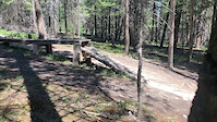
A narrow singletrack trail that starts next to the bridge along Alderan near 17 street (where Coyote Corridor ends). Trail path goes along the ravine edge winding in and out of trees. Sloped trail while riding along hills section make it technically challenging. There is a little fort build towards the end that signals the start of some log obstacles to ride over. path loops at the end around a tree to return or can continue to beat a path over the 17 st creek tunnel (landscaped) towards the north side of Alderaan.

Tags
BermsBridgesFaint trailSkinnies

Local Trail Association

Recent Activity on Trail

Past Week
  • 1 rides
  • 9.5 km average
6 Months
  • 17 rides
  • 14.7 km avg distance
All
  • 178 rides
  • Last: Nov 21, 2026
c1c2c3c4
January
February
March
April
May
June
July
August
September
October
November
December
update trails status or condition

Star Lord Trail Reports

statusdatedescription
Jul 17, 2025 @ 9:53am
Jul 17, 2025
Jul 27, 2024 @ 4:50pm
Jul 27, 2024
Needs a trim for sure. Both entrances are barely identifiable.
Jun 11, 2024 @ 9:27am
Jun 11, 2024
Early in the season, new growth manageable
Aug 22, 2023 @ 3:56pm
Aug 22, 2023
trail completely overgrown. entrance from 17th Street unidentifiable.
Aug 6, 2023 @ 6:19am
Aug 6, 2023
more »
Status:
on Jul 17, 2025
Dry
Avg: 4.24 (2 votes)
Your vote: 0

view (868)
close
      Directions to star-lord trailhead (53.465220, -113.374220)

      Photos

      10 more »
      mtb
      101 |
      Sep 21, 2021 @ 7:51pm
      Sep 21, 2021
      mtb
      91 |
      Dec 28, 2020 @ 4:43pm
      Dec 28, 2020
      mtb
      70 |
      Dec 28, 2020 @ 4:43pm
      Dec 28, 2020
      mtb
      99 |
      Sep 9, 2020 @ 8:30pm
      Sep 9, 2020

      Videos

      1 more »
      Wars
      mtb
      2:20 | 56 | Dec 8, 2022 , Northwest Edmonton

      Routes with this trail

      more »
      7 miles • 140 ft • 14 •
      This route connects majority of the blue trails in this area. Starts at 17th St going west with a...
      5.0 ★★★★★
      2 Ratings
      5 ★ 100%
      4 ★
      3 ★
      2 ★
      1 ★

      Reviews / Comments

      No reviews yet, be the first to write a review or ask a question.
      Use trail reports to comment on trail conditions.


      We hope you've been enjoying Trailforks!

      Create a FREE account to view all trail reviews and much more.

      • By BushellanTF Pro & contributors
      • #228641 - 911 views

      Frequently Asked Questions

      ▼ Where is Star Lord located?
      Star Lord is located in Mill Woods, Northwest Edmonton, Alberta, Canada. It is part of the Mill Woods trail network. The trailhead is located at coordinates 53.46522, -113.37422.
      ▼ How hard is Star Lord?
      Star Lord is rated as Blue difficulty. The physical rating is Moderate. The average grade is 0.2%. The climb difficulty is rated Green.
      ▼ What is the elevation gain for Star Lord?
      Star Lord has 9 ft of elevation gain. The trail has 6 ft of elevation descent. The elevation ranges from 2,333 ft to 2,344 ft.
      ▼ Is Star Lord a point to point trail?
      Star Lord is not a point to point trail. The direction is Both Directions. The trail type is singletrack.
      ▼ How long is Star Lord?
      Star Lord is 1,378 ft long. The trail type is singletrack.
      ▼ Are dogs allowed on Star Lord?
      There is no information about dogs being allowed on Star Lord. Check with local trail managers or the trail page for the latest access rules.
      ▼ How do I access Star Lord? Where is the closest parking trailhead?
      ▼ How long does it take to ride Star Lord?
      Based on recorded activities, it takes an average of 3 minutes to ride Star Lord. The trail is 1,378 ft long. Actual times will vary based on fitness level, conditions, and pace. View recent activity logs for more details.
      ▼ How busy is Star Lord?
      Star Lord is a moderately popular trail. There have been 787 recorded activities on this trail. The trail has received 868 check-ins. View recent activity on this trail.

      Hit the Trail

      Open in App

      Get this trail on your phone instantly.

      open trail in app

      Download Trail

      Save to wishlist, Garmin & download.
      save the trail

      Find Related Routes

      Find routes and users activities that include this trail.
      find routes for this trail

      You must enter a description before submitting.


