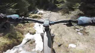
more stats
1.5 miles
Distance
49 ft
Climb
-1,686 ft
Descent
00:17:12
Avg time
-1,637 ft
Altitude change
980 ft
Altitude min
2,628 ft
Altitude max
2,628 ft
Altitude start
991 ft
Altitude end
-20.9%
Grade
-111.3%
Grade max
12.5%
Grade min
446 ft
Distance climb
1 mile
Distance down
502 ft
Distance flat
00:17:12
Avg time

Sti Magee Details

  • Activities
    • Mountain Bike
    • E-Bike
    • Hike
    • Trail Running
  • Riding Area
  • Difficulty Rating
  • Local Popularity
    45 in Mountain Biking [+]
    • 5 in E-Biking
    • 5 in Trail Running
    • 95 in Hiking
  • Global Ranking
    #117427 in Mountain Biking [+]
    • #108721 in E-Biking
    • #148882 in Trail Running
    • #7292 in Hiking
  • Hiking SAC Scale
    T1 Hiking
  • Trail Type
    Singletrack
  • Bike Type
    DH, AM
  • Direction
    Downhill Primary
  • Trail Visibility
    Always easy to follow
  • Dogs Allowed
    Yes
  • eBike Allowed
    Yes up to Class 1

Norsk (English below):
Vær oppmerksom: Enkelte deler av stien kan bli gjengrodd med høyt gress midt på sommeren, så den sykles helst tidlig eller sent i sesongen. Det kreves 30–40 minutter med dytting fra Utsikten for å nå toppen av Klevarudnatten, men nedkjøringen er vel verdt innsatsen. Start fra Trytetjern og følg stien ut til Utsikten, startpunktet for flere utforsyklingstraseer. Derfra følger du skilting mot Klevarudnatten og går det siste stykket til toppen, hvor du belønnes med fantastisk utsikt over Nesbyen.

Nedkjøringen starter på samme sti, men etter et stikryss holder du til høyre. Stien smalner inn og blir bratt, teknisk og svingete over 300 meter, før den åpner seg ut på en skogsvei. Her venter raske svinger og noen overraskelser. Etter hvert møter du en grusvei, følg denne 50 meter, og ta deretter til høyre inn på en gammel tømmervei. Herfra blir flyten rask og morsom, med to stikryss hvor du skal holde til venstre.

Stien ender ved en asfaltvei, hvor du kan sykle tilbake til Nesbyen eller fortsette ned NC-løypa. Om du vil ha mer moro, kan du shuttle tilbake til toppen for en ny runde

Stien starter ved utsiktspunktet Utsikten, nær Trytetjern på toppen av Østsida i Nesbyen.

English:

Beware: Some parts of the trail can become overgrown with tall grass during midsummer, so it's best to ride early or late in the season for optimal visibility.

A 30–40 minute push is required to reach the summit of Klevarudnatten, but the descent makes it all worth it. Start from Trytetjern and ride out to Utsikten, the launch point for several downhill trails. From there, follow signs to Klevarudnatten, hiking the final stretch to the top for stunning views over Nesbyen.

The descent starts the same way, but after a junction, take a right. The trail then narrows and becomes steep, technical, and winding for 300 meters before opening onto a forest road. Here, the fun picks up with fast corners and a few surprises. Eventually, you’ll hit a gravel road—follow it for 50 meters, then turn right onto an old timber haul road. From here, the flow is fast and fun, with two junctions where you’ll stay left.

The trail ends at an asphalt road, where you can either ride back to Nesbyen or continue down the NC trail. If you're up for more, shuttle back to the top for another exhilarating run!

The trail starts at the viewpoint Utsikten, near Trytetjern lake at the top of Østsida in Nesbyen.

Access Info

Norsk:


English:

Local Trail Association

Recent Activity on Trail

Past Week
  • 0 rides
  •  
6 Months
  • 1 rides
  • 11 miles avg distance
All
  • 9 rides
  • Last: Jul 12, 2026
update trails status or condition

Sti Magee Trail Reports

statusdatedescription
Aug 8, 2026 @ 5:07pm (Europe/Oslo)
Aug 8, 2026
upper part quite slippy (especially for full power rental ebike with worn tyres), middle section overgrown, lower section super fun.
Sep 13, 2019 @ 5:18am
Sep 13, 2019
more »
Status:
on Aug 8, 2026
Wet
Avg: 3.84 (2 votes)
Your vote: 0

view (62)
close
3D
Trail Conditions
  • Unknown
  • Snow Groomed
  • Snow Packed
  • Snow Covered
  • Snow Cover Partial
  • Freeze/thaw Cycle
  • Icy
  • Prevalent Mud
  • Wet
  • Variable
  • Ideal
  • Dry
  • Very Dry
Trail Flow (Ridden Direction)
Trailforks scans users activity logs to determine the most popular direction each trail is ridden. A good flowing trail network will have most trails flowing in a single direction according to their intension.
The colour categories are based on what percentage of users are riding a trail in its intended direction.
  • > 96%
  • > 90%
  • > 80%
  • > 70%
  • > 50%
  • < 50%
  • bi-directional trail
  • no data
Trail Last Used
Trailforks scans activity logs to determine the last time a trail was ridden.
  • < 2 days
  • < 1 week
  • < 2 weeks
  • < 1 month
  • < 6 months
  • > 6 months
Trail Ridden Direction
The intended direction a trail should be ridden.
  • Downhill Only
  • Downhill Primary
  • Both Directions
  • Uphill Primary
  • Uphill Only
  • One Direction
Contribute Details
Colors indicate trail is missing specified detail.
  • Description
  • Photos
  • Description & Photos
  • Videos
Trail Popularity ?
Trailforks scans activity logs to determine which trails are ridden the most in the last 9 months. Trails are compared with nearby trails in the same city region with a possible 25 colour shades. Think of this as a heatmap, more activities = more kinetic energy = warmer colors.
  • most popular
  • popular
  • less popular
  • not popular
ATV/ORV/OHV Filter
Max Vehicle Width
inches
US Cell Coverage
Legend
cell carrier legend

Radar Time
Activity Recordings
Trailforks uses anonymized public activity data. ?
Activity Recordings
Trailforks uses anonymized public activity data. ?
Winter Trails
Warning A routing network for winter maps does not exist. Selecting trails using the winter trails layer has been disabled.
Missing Trails
Most Popular
Least Popular
Trails are colored based on popularity. The more popular a trail is, the more red. Less popular trails trend towards green.
Jump Magnitude Heatmap
Heatmap of where users jump on trails. Zoom in to see individual jumps, click circles to view jump details.
BC Backroad Status

Service Road Atlas is a free to use, community-driven service for viewing and creating reports on the numerous back-country service roads around B.C. and Alberta.

map legend
Slope Aspect
Direction the slope faces
Flat N NE E SE S SW W NW
Trails Deemphasized
Trails are shown in grey.
disable
Only show trails with no bike usage.
Enable
Suggested Layers
Based on selected activity type

    Save the current map location and zoom level as your default home location whenever this page is loaded.

    Save
        Directions to sti-magee trailhead (60.586790, 9.135850)

        Photos

        1 more »
        mtb
        156 |
        Aug 14, 2022 @ 9:52am
        Aug 14, 2022

        Videos

        1 more »
        Sti Magee, Nesbyen
        mtb
        4:59 | 164 | Dec 10, 2024 , My City
        4.0
        2 Ratings
        5 50%
        4
        3 50%
        2
        1

        1 Review & Comments

        Roq
        Nice but a little demanding push bike to the trail head. The first part in the forest is nice and steep with a tricky turn. The lower part was over grown as promised but also pretty old school with straight down runs with no special features.

        We hope you've been enjoying Trailforks!

        Create a FREE account to view all trail reviews and much more.

        • By larsstorheimTF Pro H Rides & contributors
        • #183904 - 948 views

        Frequently Asked Questions

        Where is Sti Magee located?
        Sti Magee is located in Østsida, Norway. It is part of the Østsida trail network. The trailhead is located at coordinates 60.58679, 9.13585.
        How hard is Sti Magee?
        Sti Magee is rated as Red difficulty. The average grade is 20.9%.
        What is the elevation gain for Sti Magee?
        Sti Magee has 49 ft of elevation gain. The trail has 1,686 ft of elevation descent. The elevation ranges from 980 ft to 2,628 ft.
        Is Sti Magee a point to point trail?
        Sti Magee is not a point to point trail. The direction is Downhill Primary. The trail type is singletrack.
        How long is Sti Magee?
        Sti Magee is 1.5 miles long. The trail type is singletrack.
        Are dogs allowed on Sti Magee?
        Yes, dogs are allowed on Sti Magee. Please keep dogs on a leash where required and clean up after them.
        How do I access Sti Magee? Where is the closest parking trailhead?
        The closest parking and trailhead locations to Sti Magee are: View all parking locations in the area.
        How long does it take to ride Sti Magee?
        Based on recorded activities, it takes an average of 6 minutes to ride Sti Magee. The trail is 1.5 miles long. Actual times will vary based on fitness level, conditions, and pace. View recent activity logs for more details.
        How busy is Sti Magee?
        Sti Magee is a moderately popular trail. There have been 61 recorded activities on this trail. The trail has received 62 check-ins. View recent activity on this trail.

        Hit the Trail

        Open in App

        Get this trail on your phone instantly.

        open trail in app

        Download Trail

        Save to wishlist, Garmin & download.
        save the trail

        Find Related Routes

        Find routes and users activities that include this trail.
        find routes for this trail

        You must enter a description before submitting.