3,142 ft
Distance
233 ft
Climb
-26 ft
Descent
00:07:46
Avg time
Supporters, Builders, Maintainers & Land Managers of Suffer'n Switchbacks Trail
- past supporters
Mr TOPSOG
1998 - 1999Builder
Details
-
Activities
- Mountain Bike
- E-Bike
- Hike
- Trail Running
-
Riding AreaCampbell Mountain
Penticton, British Columbia -
Difficulty Rating
-
Trail TypeSingletrack
-
Bike TypeAM, XC
-
DirectionUphill OnlyPopular direction shown
-
Climb DifficultyBlue
-
Physical RatingModerate
-
SeasonAfter frost dries up
-
Dogs AllowedYes
-
eBike AllowedYes up to Class 1
-
Global Ranking
-
Local Popularity100 in Mountain Biking [+]
- 95 in E-Biking
- 100 in Trail Running
- 80 in Hiking
I am unsure of the original name, this is just what I have been told. It does make sense because the initial climb from the DQ table (Classic to DQ) is punishing to the uninitiated.
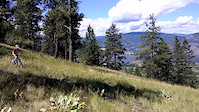
However, it is an excellent singletrack climb to get to the summit.
Access Info
From the DQ table (Classic to DQ), proceed straight (or left depending on perspective) down the gully and up the other side. Follow trail.
Local Trail Association
-
Please consider joining or donating to the local trail association to supportdonate to earn trail karma!
trail development & maintenance.
Traditionally Indigenous Territory
More Stats for Suffer'n Switchbacks mountain bike trail trail
-
Altitude change207 ft
-
Altitude min2,324 ft
-
Altitude max2,534 ft
-
Altitude start2,324 ft
-
Altitude end2,531 ft
-
Grade6.583%
-
Grade max-12.893%
-
Grade min33.382%
-
Distance climb2,181 ft
-
Distance down961 ft
-
Avg time00:07:46
-
Avg reverse time00:04:23
- view trail stats
close
3D
Trail Conditions
- Unknown
- Snow Groomed
- Snow Packed
- Snow Covered
- Snow Cover Inadequate
- Freeze/thaw Cycle
- Icy
- Prevalent Mud
- Wet
- Variable
- Ideal
- Dry
- Very Dry
Trail Flow (Ridden Direction)
Trailforks scans users ridelogs to determine the most popular direction each trail is ridden. A good flowing trail network will have most trails flowing in a single direction according to their intension.
The colour categories are based on what percentage of riders are riding a trail in its intended direction.
- > 96%
- > 90%
- > 80%
- > 70%
- > 50%
- < 50%
- bi-directional trail
- no data
Trail Last Ridden
Trailforks scans ridelogs to determine the last time a trail was ridden.
- < 2 days
- < 1 week
- < 2 weeks
- < 1 month
- < 6 months
- > 6 months
Trail Ridden Direction
The intended direction a trail should be ridden.
- Downhill Only
- Downhill Primary
- Both Directions
- Uphill Primary
- Uphill Only
- One Direction
Contribute Details
Colors indicate trail is missing specified detail.
- Description
- Photos
- Description & Photos
- Videos
Trail Popularity ?
Trailforks scans ridelogs to determine which trails are ridden the most in the last 9 months.
Trails are compared with nearby trails in the same city region with a possible 25 colour shades.
Think of this as a heatmap, more rides = more kinetic energy = warmer colors.
- most popular
- popular
- less popular
- not popular
ATV/ORV/OHV Filter
Max Vehicle Width
inches
Radar Time
x
Activity Recordings
Trailforks users anonymized public ridelogs from the past 6 months.
- mountain biking recent
- mountain biking (>6 month)
- hiking (1 year)
- moto (1 year)
Activity Recordings
Trailforks users anonymized public skilogs from the past 12 months.
- Downhill Ski
- Backcountry Ski
- Nordic Ski
- Snowmobile
Jump Magnitude Heatmap
Heatmap of where riders jump on trails. Zoom in to see individual jumps, click circles to view jump details.
Trails Deemphasized
Trails are shown in grey.
Only show trails with NO bikes.
Save the current map location and zoom level as your default home location whenever this page is loaded.
Save
Directions to suffer-n-switchbacks trailhead
(49.509060, -119.550240)
update trails status or condition
Suffer'n Switchbacks Trail Reports
view all reports »
Recent Ridelog Activity on Trail
Past Week
- 0 rides
6 Months
- 218 rides
- 8 miles avg distance
All
- 3,281 rides
- Last: Nov 3, 2022
Photos
more »
Routes with this trail
more »
-
+ 1

This trail starts at the top of Puke Hill. Head south off the road, crosses the DH course and winds it's way along the ledge until it crosses the power line. It then makes it's way up to the DQ table then up to the top of the DH course. Built in 1998\99 by TOPSOG.
[Reply]
Nearby Trails
- Dave's Whoop Trail 0 ft
- Dq To West Side Service Road 108 ft
- Trench Fickler 289 ft
- Summer Climb 2 1,148 ft
- Summer Climb 3 1,302 ft
- embed Suffer'n Switchbacks trail on your website
- By 1partatatime
PACA & contributors
- #17620 - 1,630 views
- subscribe
- login to download gpx or kml files.