

more stats
3,901 ft
Distance
171 ft
Climb
-51 ft
Descent
00:07:54
Avg time
120 ft
Altitude change
1,412 ft
Altitude min
1,540 ft
Altitude max
1,412 ft
Altitude start
1,532 ft
Altitude end
3.1%
Grade
-18.9%
Grade max
18%
Grade min
2,585 ft
Distance climb
1,004 ft
Distance down
312 ft
Distance flat
00:07:54
Avg time

Sunrise Loop Details

  • Activities
    • Mountain Bike
    • Hike
    • Trail Running
  • Riding Area
    Sunrise Mountain Preserve
    Peoria, Arizona
  • Difficulty Rating
  • Voted Difficulty
    Black Diamond (4 votes)
  • Local Popularity
    95 in Mountain Biking heatmap [+]
    • 100 in Trail Running
    • 100 in Hiking
  • Global Ranking
    #126149 in Mountain Biking [+]
    • #66787 in Trail Running
    • #60243 in Hiking
  • State Ranking
    #1,949 in Mountain Biking · Arizona [+]
    • #942 in Trail Running
    • #1,122 in Hiking
  • Hiking SAC Scale
    T2 Mountain Hiking
  • Trail Type
    Singletrack
  • Bike Type
    AM, XC
  • Direction
    Both Directions
  • Climb Difficulty
    Blue
  • Physical Rating
    Moderate
  • Trail Visibility
    Always easy to follow
  • Dogs Allowed
    Yes
  • TTFs on Trail
    Rock Garden

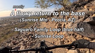
Peoria City Park trail with technical switchbacks and some extended climbing. Several new trails were professionally build to connect existing trails that are suitable for mountain bikes. This is a desert trail with cactus, rocks, loose climbs, very brief sand. There a also several bonus features with jumps and drops.

Access Info

Access is from West Wing Neighborhood park (27100 Westwing Pkwy, Peoria, AZ 85383) or parking behind West Wing Elementary School (gate locked M-F between 8am and 4pm)

Tags
DesertJumpsRestroomsRock gardens

Local Trail Association

Traditionally Indigenous Territory

Recent Activity on Trail

Past Week
  • 3 rides
  • 10 miles average
6 Months
  • 36 rides
  • 8 miles avg distance
All
  • 294 rides
  • Last: Nov 19, 2026
c1c2c3c4
January
February
March
April
May
June
July
August
September
October
November
December
Status:
on Oct 20, 2026
Ideal
Avg: 3.99 (10 votes)
Your vote: 0

view (3,985)
close
      Directions to sunrise-loop-288542 trailhead (33.727570, -112.247050)

      Photos

      13 more »
      mtb
      48 |
      May 19, 2024 @ 8:27pm
      May 19, 2024
      mtb
      58 |
      May 19, 2024 @ 8:27pm
      May 19, 2024
      mtb
      48 |
      May 19, 2024 @ 8:26pm
      May 19, 2024
      mtb
      76 |
      Mar 22, 2022 @ 9:43am
      Mar 22, 2022

      Videos

      4 more »
      Sunrise Mtn - Saguaro Family Loop, Sunrise...
      mtb
      10:16 | 95 | Apr 30, 2025 , Peoria
      MTB Sunrise Moutain - Miners Shaft Pass |...
      mtb
      5:54 | 231 | Dec 29, 2021 , Peoria
      Sunrise Moutain | Peoria, AZ
      mtb
      264 | Dec 5, 2021 , Peoria
      New Phoenix Flow Trail- Sunrise Mountain MTB
      mtb
      6:22 | 908 | May 26, 2020 , Peoria
      4.0 ★★★★★
      10 Ratings
      5 ★ 30%
      4 ★ 40%
      3 ★ 30%
      2 ★
      1 ★

      4 Reviews & Comments

      Timphead
      Surprisingly technical and quite difficult for a beginner to climb up but still probably in the blue to dark blue range. A couple of drop/bigger roll options for the more confident and experienced riders. Will be riding this one more often to help build my technical climbing.
      punkerina27 punkerina27
      I live in the neighborhood and this is great for a quality 45 min to 2 hrs. Never ceases to kick my ass - one of those trails you get out what you put in. Don’t let the blue rating diminish your curiosity if you haven’t checked it out - some sections are steep and punchy, which makes for some fast descents with good flow. There are a lot of trails not listed here in the network that would be rated black.
      Jabramson623
      I underestimated this one. It's tough, and very steep. Didn't make it very far. The pictures are of the flat areas which are few and far between. Also very busy with hikers on weekends.

      We hope you've been enjoying Trailforks!

      Create a FREE account to view all trail reviews and much more.

      • By DonSinger & contributors
      • #288542 - 3,937 views

      Frequently Asked Questions

      ▼ Where is Sunrise Loop located?
      Sunrise Loop is located in Sunrise Mountain Preserve, Peoria, Arizona, United States. It is part of the Sunrise Mountain Preserve trail network. The trailhead is located at coordinates 33.72757, -112.24705.
      ▼ How hard is Sunrise Loop?
      Sunrise Loop is rated as Blue difficulty. The physical rating is Moderate. The average grade is 3.1%. The climb difficulty is rated Blue.
      ▼ What is the elevation gain for Sunrise Loop?
      Sunrise Loop has 171 ft of elevation gain. The trail has 51 ft of elevation descent. The elevation ranges from 1,412 ft to 1,540 ft.
      ▼ Is Sunrise Loop a point to point trail?
      Sunrise Loop is not a point to point trail. The direction is Both Directions. The trail type is singletrack.
      ▼ How long is Sunrise Loop?
      Sunrise Loop is 3,901 ft long. The trail type is singletrack.
      ▼ Are dogs allowed on Sunrise Loop?
      Yes, dogs are allowed on Sunrise Loop. Please keep dogs on a leash where required and clean up after them.
      ▼ How do I access Sunrise Loop? Where is the closest parking trailhead?
      The closest parking and trailhead locations to Sunrise Loop are: View all parking locations in the area.
      ▼ How long does it take to ride Sunrise Loop?
      Based on recorded activities, it takes an average of 8 minutes to ride Sunrise Loop. The trail is 3,901 ft long. Actual times will vary based on fitness level, conditions, and pace. View recent activity logs for more details.
      ▼ How busy is Sunrise Loop?
      Sunrise Loop is a very popular trail. There have been 2,899 recorded activities on this trail. The trail has received 3,985 check-ins. View recent activity on this trail.

      Hit the Trail

      Open in App

      Get this trail on your phone instantly.

      open trail in app

      Download Trail

      Save to wishlist, Garmin & download.
      save the trail

      Find Related Routes

      Find routes and users activities that include this trail.
      find routes for this trail

      You must enter a description before submitting.