more stats
2.0 miles
Distance
201 ft
Climb
-814 ft
Descent
00:24:16
Avg time
-613 ft
Altitude change
8,422 ft
Altitude min
9,156 ft
Altitude max
9,035 ft
Altitude start
8,422 ft
Altitude end
-5.7%
Grade
-52.9%
Grade max
34.7%
Grade min
2,536 ft
Distance climb
1 mile
Distance down
568 ft
Distance flat
00:24:16
Avg time

Sunset (Upper) Details

  • Activities
    • Mountain Bike
    • Horse
    • Hike
    • Trail Running
  • Riding Area
    MEDL (Mount Elden Dry Lakes)
    Flagstaff, Arizona
  • Ref Number
    23
  • Difficulty Rating
  • Voted Difficulty
    Black Diamond (4 votes)
  • Local Popularity
    45 in Mountain Biking [+]
    • 75 in Trail Running
    • 65 in Hiking
    • 5 in Horseback
  • Global Ranking
    #91985 in Mountain Biking [+]
    • #70532 in Trail Running
    • #114542 in Hiking
    • #3117 in Horseback
  • State Ranking
    #1,259 in Mountain Biking · Arizona [+]
    • #1,003 in Trail Running
    • #2,190 in Hiking
    • #152 in Horseback
  • Hiking SAC Scale
    T2 Mountain Hiking
  • Trail Type
    Singletrack
  • Bike Type
    AM, XC
  • Direction
    Downhill Primary
    Popular Direction Shown
  • Climb Difficulty
    Black Diamond
  • Physical Rating
    Moderate
  • Trail Visibility
    Always easy to follow
  • Dogs Allowed
    Yes
  • eBike Allowed
  • TTFs on Trail
    Rock Garden

A fun, and often times, fast trail. Lower Sunset is easily ridden in both directions and is a Blue. Upper Sunset is primarily downhill and has some Black sections. The upper section is often referred to as "Hobbit Forest" between though the rocky switchback section below Heart and called "The Catwalk" between Upper Oldham and Heart. The Hobbit Forest section was realigned to its current alignment in 2018 by the Flagstaff Trail Faeries; Before the trail went directly down the hill in the section. Most sections of this trail are challenging uphill on a mountain bike.

Good trail for hiking and running as well; The section nearest to Elden Lookout Trail is for foot traffic only - no bikes or equestrians.

Tags
Rock gardens
Trail Supporters
Local Trail Association

Recent Activity on Trail

Past Week
  • 0 rides
  •  
6 Months
  • 8 rides
  • 23 miles avg distance
All
  • 25 rides
  • Last: Sep 29, 2026
c1c2c3c4
January
February
March
April
May
June
July
August
September
October
November
December
update trails status or condition

Sunset (Upper) Trail Reports

statusdatedescription
Aug 3, 2026 @ 3:08pm (America/Phoenix)
Aug 3, 2026
Jul 27, 2026 @ 11:25am (America/Phoenix)
Jul 27, 2026
Tree down across the trail when coming out of the chunky portion of hobbit forest before the flow. Careful, comes up quick!
Apr 13, 2026 @ 3:42pm (America/Phoenix)
Apr 13, 2026
All clear!
Mar 21, 2026 @ 10:01am (America/Phoenix)
Mar 21, 2026
10+ down trees on upper sunset
Jul 24, 2025 @ 7:47am
Jul 24, 2025
more »
Status:
on Aug 3, 2026
Dry
Avg: 4.51 (33 votes)
Your vote: 0

view (180)
close
      Directions to sunset-upper-16334 trailhead (35.244570, -111.601250)

      Photos

      52 more »
      mtb
      34 |
      Aug 30, 2026 @ 12:59pm
      Aug 30, 2026
      mtb
      27 |
      Aug 30, 2026 @ 12:58pm
      Aug 30, 2026
      mtb
      32 |
      Aug 30, 2026 @ 12:58pm
      Aug 30, 2026
      mtb
      168 |
      Sep 1, 2023 @ 8:07am
      Sep 1, 2023

      Videos

      14 more »
      youtuber SUNSET TRAIL in Flagstaff Arizona ????
      mtb
      16:27 | 1158 | Sep 28, 2019 , Flagstaff
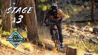
      Flagstaff Enduro: STAGE 3
      mtb
      5:14 | 194 | Nov 1, 2025 , Flagstaff
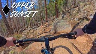
      Flagstaff Trail Guide: Upper Sunset
      mtb
      8:46 | 270 | Jul 1, 2025 , Flagstaff
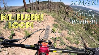
      Who Needs a Shuttle? Big Mt. Elden Loop!...
      mtb
      13:44 | 184 | Aug 4, 2024 , Flagstaff

      Routes with this trail

      ★ 5.0 • 14 miles • 2,134 ft • 7 • Loop •
      The Flagstaff classic. The climb up Elden Lookout Road start as pavement but quickly transitions into...
      ★ 4.5 • 19 miles • 2,297 ft • 37 • Loop •
      Great loop with plenty of climbing to earn your downhill fun. Some techie but rideable bits on Secret and...
      ★ 1.0 • 11 miles • 2,581 ft • 5 • Loop •
      4.6 ★★★★★
      33 Ratings
      5 ★ 76%
      4 ★ 15%
      3 ★ 6%
      2 ★
      1 ★ 3%

      11 Reviews & Comments

      PGomersall PGomersall
      The snap loose uphill section just prior to Hobbit Forest on the downhill has been bypassed with a steady meander; now a smooth run out.
      LiamG123
      This trail is absolutely not worth the massive climb to reach it. After 5 miles of fire road and an 1800ft ascent, I was gassed and didn’t really enjoy it
      zwade zwade
      As previous comments say don’t bother going to top top by radio tower. Trail is more of a hiking trail. Go in from first corner access off of road. This next section has some flow and rides good. After you start down into the burnt section the trail loses all flow and the jank factor is high. After you’re the trough the jank you’ll be rewarded with a fast and flowy section to end it.

      We hope you've been enjoying Trailforks!

      Create a FREE account to view all trail reviews and much more.

      • By toddTF Pro Trailforks & contributors
      • #16334 - 10,244 views

      Frequently Asked Questions

      ▼ Where is Sunset (Upper) located?
      Sunset (Upper) is located in MEDL (Mount Elden Dry Lakes), Flagstaff, Arizona, United States. It is part of the MEDL (Mount Elden Dry Lakes) trail network. The trailhead is located at coordinates 35.24457, -111.60125.
      ▼ How hard is Sunset (Upper)?
      Sunset (Upper) is rated as Black Diamond difficulty. The physical rating is Moderate. The average grade is 5.7%. The climb difficulty is rated Black Diamond.
      ▼ What is the elevation gain for Sunset (Upper)?
      Sunset (Upper) has 201 ft of elevation gain. The trail has 814 ft of elevation descent. The elevation ranges from 8,422 ft to 9,156 ft.
      ▼ Is Sunset (Upper) a point to point trail?
      Sunset (Upper) is not a point to point trail. The direction is Downhill Primary. The trail type is singletrack.
      ▼ How long is Sunset (Upper)?
      Sunset (Upper) is 2.0 miles long. The trail type is singletrack.
      ▼ Are dogs allowed on Sunset (Upper)?
      Yes, dogs are allowed on Sunset (Upper). Please keep dogs on a leash where required and clean up after them.
      ▼ How do I access Sunset (Upper)? Where is the closest parking trailhead?
      The closest parking and trailhead locations to Sunset (Upper) are: View all parking locations in the area.
      ▼ How long does it take to ride Sunset (Upper)?
      Based on recorded activities, it takes an average of 24 minutes to ride Sunset (Upper). The trail is 2.0 miles long. Actual times will vary based on fitness level, conditions, and pace. View recent activity logs for more details.
      ▼ How busy is Sunset (Upper)?
      Sunset (Upper) is a moderately popular trail. There have been 180 recorded activities on this trail. The trail has received 180 check-ins. View recent activity on this trail.

      Hit the Trail

      Open in App

      Get this trail on your phone instantly.

      open trail in app

      Download Trail

      Save to wishlist, Garmin & download.
      save the trail

      Find Related Routes

      Find routes and users activities that include this trail.
      find routes for this trail

      You must enter a description before submitting.