

Open in App
Get this trail on your phone instantly.

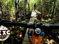
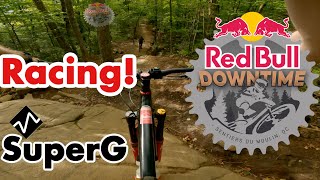
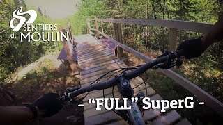
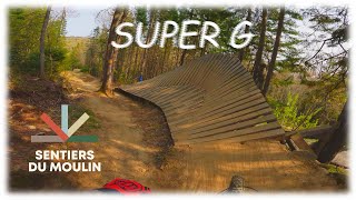
Cette descente "new school" comprend plusieurs beaux défis techniques tel que slab, drop et pierrier. Son design et sa diversité en a fait le sentier le plus populaire au Québec depuis son ouverture en 2015. Elle fait un peu plus d’un km vous permettra de partir du sommet à la base de la montagne sans donner un coup de pédale. Sourires garantis
Une réfection importante a été réalisée en 2024 pour sa 10e saison afin de recharger le sentier et améliorer le drainage. Les travaux de pelle ont été réalisés par Patrice Dorion et la finition par l'équipe SDM.
Gestion de projet : Éric Gagnon et Étienne Boileau
Aménagement mécanisé et design : Maxime Richard-Germain (Sentiers Boréals)
Finition : Équipe de sentiers SDM
This modern downhill trail offers a variety of technical challenges, including slabs, drops, and rock gardens. Its design and diversity have made it the most popular trail in Quebec since its opening in 2015. Spanning just over a kilometer, it allows riders to descend from the summit to the base without pedaling. Smiles guaranteed!
In 2024, to mark its 10th season, the trail underwent significant renovations to resurface the path and improve drainage. The excavation work was carried out by Patrice Dorion, with finishing touches by the SDM trail crew.
| c1 | c2 | c3 | c4 |
|---|---|---|---|
January | February | March | April |
May | June | July | August |
September | October | November | December |

Service Road Atlas is a free to use, community-driven service for viewing and creating reports on the numerous back-country service roads around B.C. and Alberta.
Save the current map location and zoom level as your default home location whenever this page is loaded.
SaveWe hope you've been enjoying Trailforks!
Create a FREE account to view trail comments and much more.
You must enter a description before submitting.

