


This trail is archived
This trail is permanently closed/decommissioned
more stats
3,350 ft
Distance
-260 ft
Descent
00:03:32
Avg time
-260 ft
Altitude change
807 ft
Altitude min
1,068 ft
Altitude max
1,068 ft
Altitude start
807 ft
Altitude end
-7.8%
Grade
-19.8%
Grade max
-0.9%
Grade min
3,281 ft
Distance down
72 ft
Distance flat
00:03:32
Avg time

Tap & Die Details

  • Activities
    • E-Bike
    • Hike
    • Trail Running
    Mountain Biking not recommended or allowed.
  • Riding Area
    Kingdom Trails
    East Burke, Vermont
  • Difficulty Rating
  • Voted Difficulty
    Blue (1 vote)
  • Trail Type
    Singletrack
  • Direction
    Downhill Only
    Popular Direction Shown
  • Climb Difficulty
    Black Diamond
  • Physical Rating
    Moderate
  • Trail Visibility
    Always easy to follow
  • eBike Allowed
  • TTFs on Trail
    Berm, Bridge, Jump
  • Land Owner
    Kingdom Trail Association

Tap & Die is one of Kingdom Trails’ Top Ten trails in the Trailforks Global Trail Rankings. The ranking is done by an algorithm that takes into account a number of uniform criteria that defines popularity amongst trail users world-wide.

Tap & Die is the middle one of the three iconic downhill trails on the Westside of Darling Hill, known as The Three T’s - Troll Stroll, Tap & Die and Tody’s Tour.

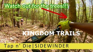
This trail is so much fun, with all kinds of really fast flow, that on a busy high season weekend people literally line up to ride it. This hand crafted trail has a mostly smooth, hard packed surface - interspersed with some modest rocks, roots and rough - with many flowing berms and hairpins. Beware of the high speed turns through the trees You don’t want to find out the hard way how this trail got it’s name!

While rated black, this trail is suitable for intermediate riders and, at a slower pace, even for confident novices.

Access Info

Tap & Die is accessed off Bemis, between the access to Tody's Tour and Troll Stroll.

Tags
BermsBridgesFlowyJumps
Local Trail Association
Traditionally Indigenous Territory

Recent Activity on Trail

Past Week
  • 0 rides
  •  
6 Months
  • 0 rides
  •  
All
  • 699 rides
  •  
update trails status or condition

Tap & Die Trail Reports

Status:
on Sep 30, 2026
Dry
Avg: 4.5 (31 votes)
Your vote: 0

view (4,253)
close
      Directions to tap--die trailhead (44.586580, -71.969790)

      Photos

      3 more »
      mtb
      793 |
      Sep 17, 2014 @ 8:34am
      Sep 17, 2014
      mtb
      800 |
      Oct 5, 2014 @ 7:42pm
      Oct 5, 2014
      mtb
      731 |
      Oct 22, 2013 @ 11:48am
      Oct 22, 2013

      Videos

      8 more »
      youtuber Tap & Die - Kingdom Trails - North East...
      mtb
      4:49 | 477 | Jan 10, 2020 , East Burke
      Kingdom Trails - Tap N Die - Burke, VT
      mtb
      3:54 | 504 | Oct 29, 2019 , East Burke
      youtuber Kingdom Trails| Part 2 | Tap n' Die |...
      mtb
      9:23 | 505 | Sep 17, 2019 , East Burke
      Kingdom Trails - Tap & Die - August 2019 (4K)
      mtb
      5:02 | 218 | Sep 3, 2019 , East Burke

      Trail Lists

      Routes with this trail

      ★ 3.0 • 32 miles • 3,798 ft • 111 • Loop •
      This loop is a great perimeter loop of KT that touches on almost all the riding areas except for the new...
      9 miles • 1,406 ft • 31 •
      Leave from our cabin on 114, ride up to the Three Ts, back down to Kitchel and back to the cabin.
      15 miles • 1,837 ft • 43 •
      Ride from our cabin up to the 3 Ts, back down Kitchel and back to the cabin
      4.5 ★★★★★
      31 Ratings
      5 ★ 55%
      4 ★ 39%
      3 ★ 6%
      2 ★
      1 ★

      Reviews / Comments

      No reviews yet, be the first to write a review or ask a question.
      Use trail reports to comment on trail conditions.


      We hope you've been enjoying Trailforks!

      Create a FREE account to view all trail reviews and much more.

      Hit the Trail

      Open in App

      Get this trail on your phone instantly.

      open trail in app

      Download Trail

      Save to wishlist, Garmin & download.
      save the trail

      Find Related Routes

      Find routes and users activities that include this trail.
      find routes for this trail

      You must enter a description before submitting.


