more stats
2.5 miles
Distance
281 ft
Climb
-332 ft
Descent
00:22:17
Avg time
-51 ft
Altitude change
1,612 ft
Altitude min
1,822 ft
Altitude max
1,673 ft
Altitude start
1,622 ft
Altitude end
-0.38%
Grade
-47.056%
Grade max
44.578%
Grade min
1 mile
Distance climb
1 mile
Distance down
1,320 ft
Distance flat
00:22:17
Avg time

Technical Loop Details

  • Activities
    • Mountain Bike
    • E-Bike
    • Adaptive Bike
  • Riding Area
    McDowell Mountain Regional Park
    Fountain Hills, Arizona
  • Difficulty Rating
  • Voted Difficulty
    Blue (1 vote)
  • Local Popularity
    45 in Mountain Biking [+]
    • 60 in E-Biking
  • Global Ranking
    #5829 in Mountain Biking [+]
    • #7785 in E-Biking
  • Trail Type
    Singletrack
  • Bike Type
  • Direction
    One Direction
    Popular Direction Shown
  • Climb Difficulty
    Black Diamond
  • Physical Rating
    Moderate
  • Dogs Allowed
    Yes
  • eBike Allowed
    Yes up to Class 1
  • Land Owner
    Maricopa County Parks

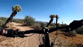
Technical Loop is a one-way (counter-clockwise) single track trail. Most of its "technical" nature occurs early, with two steep drops (both with bypasses) and a tough, somewhat rocky climb. After that it is similar to the Sport Loop, with fast flow sections, short steep climbs and descents, a few rocky areas, and some tight bermed switchbacks. Near the end of the loop there is a crossover to the Long Loop before the Sport and Technical Loops merge and pop out into the parking lot.

Adaptive Bike Info
aMTB Black Rating: Advanced obstacles exist, some trail obstructions.

One pinch point and two semi off-camber exposed spots on the climb. One off-camber spot after the DH.

Traditionally Indigenous Territory

Recent Activity on Trail

Past Week
  • 0 rides
  •  
6 Months
  • 49 rides
  • 15 miles avg distance
All
  • 368 rides
  • Last: Jun 8, 2026
c1c2c3c4
January
February
March
April
May
June
July
August
September
October
November
December
update trails status or condition

Technical Loop Trail Reports

statusdatedescription
Mar 10, 2026 @ 11:22am (America/Phoenix)
Mar 10, 2026
Except for a couple of very steep drops, there is nothing really "technical" about this trail. Both "drops" have bypass trails so in reality,...
Feb 24, 2023 @ 12:14am
Feb 24, 2023
Feb 5, 2023 @ 6:02am
Feb 5, 2023
Beautiful, so green, spots like riding through a golf course!
Jan 12, 2023 @ 6:51am
Jan 12, 2023
Oct 24, 2021 @ 11:08am
Oct 24, 2021
Trail is getting good again after a summer of lots of rain. Over growth is starting to die back.
more »
Status:
on Mar 10, 2026
Ideal
Avg: 4.09 (26 votes)
Your vote: 0

view (2,552)
close
3D
Trail Conditions
  • Unknown
  • Snow Groomed
  • Snow Packed
  • Snow Covered
  • Snow Cover Partial
  • Freeze/thaw Cycle
  • Icy
  • Prevalent Mud
  • Wet
  • Variable
  • Ideal
  • Dry
  • Very Dry
Trail Flow (Ridden Direction)
Trailforks scans users ridelogs to determine the most popular direction each trail is ridden. A good flowing trail network will have most trails flowing in a single direction according to their intension.
The colour categories are based on what percentage of riders are riding a trail in its intended direction.
  • > 96%
  • > 90%
  • > 80%
  • > 70%
  • > 50%
  • < 50%
  • bi-directional trail
  • no data
Trail Last Ridden
Trailforks scans ridelogs to determine the last time a trail was ridden.
  • < 2 days
  • < 1 week
  • < 2 weeks
  • < 1 month
  • < 6 months
  • > 6 months
Trail Ridden Direction
The intended direction a trail should be ridden.
  • Downhill Only
  • Downhill Primary
  • Both Directions
  • Uphill Primary
  • Uphill Only
  • One Direction
Contribute Details
Colors indicate trail is missing specified detail.
  • Description
  • Photos
  • Description & Photos
  • Videos
Trail Popularity ?
Trailforks scans ridelogs to determine which trails are ridden the most in the last 9 months. Trails are compared with nearby trails in the same city region with a possible 25 colour shades. Think of this as a heatmap, more rides = more kinetic energy = warmer colors.
  • most popular
  • popular
  • less popular
  • not popular
ATV/ORV/OHV Filter
Max Vehicle Width
inches
US Cell Coverage
Legend
cell carrier legend

Radar Time
Activity Recordings
Trailforks uses anonymized public activity data. ?
Activity Recordings
Trailforks uses anonymized public activity data. ?
Personal Heatmap
Activity Types
all / none
Options
2
Date range month
Winter Trails
Warning A routing network for winter maps does not exist. Selecting trails using the winter trails layer has been disabled.
Missing Trails
Most Popular
Least Popular
Trails are colored based on popularity. The more popular a trail is, the more red. Less popular trails trend towards green.
Jump Magnitude Heatmap
Heatmap of where riders jump on trails. Zoom in to see individual jumps, click circles to view jump details.
BC Backroad Status

Service Road Atlas is a free to use, community-driven service for viewing and creating reports on the numerous back-country service roads around B.C. and Alberta.

map legend
Slope Aspect
Direction the slope faces
Flat N NE E SE S SW W NW
Trails Deemphasized
Trails are shown in grey.
disable
Only show trails with no bike usage.
Enable
Suggested Layers
Based on selected activity type

    Save the current map location and zoom level as your default home location whenever this page is loaded.

    Save
        Directions to technical-loop-14914 trailhead (33.668830, -111.702130)

        Photos

        4 more »
        232 |
        Oct 27, 2019 @ 4:21pm
        Oct 27, 2019
        248 |
        Oct 27, 2019 @ 4:20pm
        Oct 27, 2019
        207 |
        Oct 27, 2019 @ 4:20pm
        Oct 27, 2019
        225 |
        Sep 18, 2017 @ 6:11am
        Sep 18, 2017

        Videos

        6 more »
        Tech Loop at McDowell Mountain Park
        11:33 | 1031 | Mar 4, 2022 , Fountain Hills
        The McDowell Loops 4K
        13:26 | 418 | Apr 9, 2021 , Fountain Hills
        McDowell Meltdown Course Preview
        16:18 | 442 | Dec 9, 2020 , Fountain Hills
        2020 Specialized Cactus Cup | Enduro Course |...
        5:57 | 574 | Nov 14, 2020 , Fountain Hills

        Routes with this trail

        1.0 7 miles 477 ft 2
        2024 AZ NICA McDowell Yellow Course
        38 miles 4,592 ft 36 Loop
        A nice long ride connecting both sides of the McDowell Mountains.
        23 miles 1,614 ft 22
        Nice long ride with a few very technical areas - about 100' total of possible hike/bike

        6 Reviews & Comments


        We hope you've been enjoying Trailforks!

        Create a FREE account to view trail comments and much more.

        • By toddTF Pro Trailforks & contributors
        • #14914 - 4,376 views

        Frequently Asked Questions About Technical Loop

        Where is Technical Loop located?
        Technical Loop is located in McDowell Mountain Regional Park, Fountain Hills, Arizona, United States. It is part of the McDowell Mountain Regional Park trail network. The trailhead is located at coordinates 33.66883, -111.70213.
        How hard is Technical Loop?
        Technical Loop is rated as Black Diamond difficulty. The physical rating is Moderate. The average grade is 0.38%. The climb difficulty is rated Black Diamond.
        What is the elevation gain for Technical Loop?
        Technical Loop has 281 ft of elevation gain. The trail has 332 ft of elevation descent. The elevation ranges from 1,612 ft to 1,822 ft.
        Is Technical Loop a point to point trail?
        Yes, Technical Loop is a point to point trail. The direction is One Direction. The trail type is singletrack.

        Hit the Trail

        Open in App

        Get this trail on your phone instantly.
        open trail in app

        Download Trail

        Save to wishlist, Garmin & download.
        save the trail

        Find Related Routes

        Find routes and users activities that include this trail.
        find routes for this trail

        You must enter a description before submitting.