
more stats
4,787 ft
Distance
55 ft
Climb
-129 ft
Descent
00:12:20
Avg time
-74 ft
Altitude change
646 ft
Altitude min
742 ft
Altitude max
726 ft
Altitude start
653 ft
Altitude end
-1.5%
Grade
-15.3%
Grade max
12.8%
Grade min
1,040 ft
Distance climb
2,543 ft
Distance down
1,204 ft
Distance flat
00:12:20
Avg time

The Pig Details

  • Activities
    • Mountain Bike
    • E-Bike
    • Hike
    • Trail Running
  • Riding Area
    Cumberland trail network
    Cumberland, British Columbia
  • Difficulty Rating
  • Local Popularity
    60 in Mountain Biking heatmap [+]
    • 60 in E-Biking
    • 95 in Trail Running
    • 95 in Hiking
  • Global Ranking
    #99600 in Mountain Biking [+]
    • #38582 in E-Biking
    • #63645 in Trail Running
    • #83486 in Hiking
  • Provincial Ranking
    #5,101 in Mountain Biking · British Columbia [+]
    • #2,665 in E-Biking
    • #3,547 in Trail Running
    • #4,399 in Hiking
  • Trail Type
    Singletrack
  • Bike Type
    AM, XC
  • Direction
    Both Directions
  • Physical Rating
    Moderate
  • Season
    Year round
  • Dogs Allowed
    Yes
  • eBike Allowed
  • TTFs on Trail
    A-Frame, Bridge, Skinny
  • Ride in Rain
    Yes

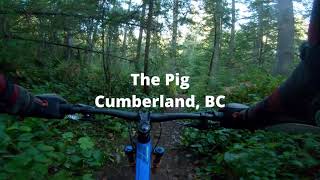
The original technical trail with lots of side stunts to play on. From log rides to elevated bridges, this is a trail to build lots of skills. Rideable both ways.

Access Info

Junction at the Perseverance Creek Bridge or from Two and a Juice.

Tags
BridgesSkinniesWooden features

Trail Supporters

  • UROC/Trail Harvest Crew/DMR
    Sponsor

Local Trail Association

Recent Activity on Trail

Past Week
  • 0 rides
  •  
6 Months
  • 95 rides
  • 11 miles avg distance
All
  • 1,365 rides
  • Last: Sep 7, 2026
c1c2c3c4
January
February
March
April
May
June
July
August
September
October
November
December
update trails status or condition

The Pig Trail Reports

Status:
on Nov 8, 2026
Avg: 3.43 (49 votes)
Your vote: 0

view (8,595)
close
      Directions to the-pig trailhead (49.605820, -125.042870)

      Photos

      91 more »
      mtb
      859 |
      May 15, 2015 @ 8:19pm
      May 15, 2015
      mtb
      467 |
      Apr 1, 2014 @ 11:52am
      Apr 1, 2014
      mtb
      139 |
      Jun 28, 2023 @ 1:29pm
      Jun 28, 2023
      mtb
      273 |
      May 2, 2021 @ 6:35pm
      May 2, 2021

      Videos

      19 more »
      The Pig at Cumberland, BC
      mtb
      11:05 | 358 | Oct 21, 2023 , Cumberland
      Buggered Pig // Cumberland BC. lot’s of...
      mtb
      2:17 | 1278 | Oct 11, 2020 , Cumberland
      Wet boardwalk, Cumberland feb10 3013
      mtb
      4:46 | 231 | Feb 11, 2013 , Cumberland
      Buggered Pig & Mama Bear
      mtb
      10:50 | 874 | Nov 3, 2013 , Cumberland

      Routes with this trail

      more »
      8 miles • 1,427 ft • 6 •
      his is the suggested route to complete the required trails for the 2021 United Riders of Cumberland(UROC)...
      4 miles • 403 ft • 5 •
      The Perseverance Trail Run is a community-driven, grassroots trail running event held in Cumberland, BC....
      7 miles • 1,319 ft • 7 •
      The Perseverance Trail Run is a community-driven, grassroots trail running event held in Cumberland, BC....
      3.4 ★★★★★
      49 Ratings
      5 ★ 14%
      4 ★ 35%
      3 ★ 35%
      2 ★ 10%
      1 ★ 6%

      8 Reviews & Comments

      lplug
      Nice trail to climb! A few punchy bits, but nothing very long and all doable on a motor-free bicycle. Enough tall roots and tight twists to keep my attention -proper mtbing. Some skinnies are not in good shape but ridearounds are present and obvious.
      lauren199209
      I should have listened to the other reviewers. This is not a bike friendly trail. Some insane steeps that are unrideable even on E-mtb. The skinnies are in poor shape and look really dangerous. Do yourself a favor and skip this one.
      jkor jkor
      most of the trail is pretty basic rooty riding (plus some climbs), until the lower section with some nice skinnies

      We hope you've been enjoying Trailforks!

      Create a FREE account to view all trail reviews and much more.

      • By skifreakTF Pro & contributors
      • #1430 - 7,599 views

      Frequently Asked Questions

      ▼ Where is The Pig located?
      The Pig is located in Cumberland trail network, Cumberland, British Columbia, Canada. It is part of the Cumberland trail network trail network. The trailhead is located at coordinates 49.60582, -125.04287.
      ▼ How hard is The Pig?
      The Pig is rated as Black Diamond difficulty. The physical rating is Moderate. The average grade is 1.5%.
      ▼ What is the elevation gain for The Pig?
      The Pig has 55 ft of elevation gain. The trail has 129 ft of elevation descent. The elevation ranges from 646 ft to 742 ft.
      ▼ Is The Pig a point to point trail?
      The Pig is not a point to point trail. The direction is Both Directions. The trail type is singletrack.
      ▼ How long is The Pig?
      The Pig is 4,787 ft long. The trail type is singletrack.
      ▼ Are dogs allowed on The Pig?
      Yes, dogs are allowed on The Pig. Please keep dogs on a leash where required and clean up after them.
      ▼ When is the best time of year to ride The Pig?
      Based on activity log data, the most popular months to ride The Pig are:
      • June (76 activities)
      • September (68 activities)
      • August (66 activities)
      Check the reports page for current trail conditions.
      ▼ How do I access The Pig? Where is the closest parking trailhead?
      The closest parking and trailhead locations to The Pig are: View all parking locations in the area.
      ▼ How long does it take to ride The Pig?
      Based on recorded activities, it takes an average of 12 minutes to ride The Pig. The trail is 4,787 ft long. Actual times will vary based on fitness level, conditions, and pace. View recent activity logs for more details.
      ▼ How busy is The Pig?
      The Pig is a moderately popular trail. There have been 8,362 recorded activities on this trail. The trail has received 8,595 check-ins. View recent activity on this trail.

      Hit the Trail

      Open in App

      Get this trail on your phone instantly.

      open trail in app

      Download Trail

      Save to wishlist, Garmin & download.
      save the trail

      Find Related Routes

      Find routes and users activities that include this trail.
      find routes for this trail

      You must enter a description before submitting.