

more stats
3,712 ft
Distance
14 ft
Climb
-661 ft
Descent
00:10:25
Avg time
-647 ft
Altitude change
56 ft
Altitude min
714 ft
Altitude max
703 ft
Altitude start
56 ft
Altitude end
-17.429%
Grade
-46.072%
Grade max
13.06%
Grade min
222 ft
Distance climb
3,490 ft
Distance down
00:10:25
Avg time

The Sentinel Details

  • Activities
    • Mountain Bike
    • Hike
    • Trail Running
  • Riding Area
    Bandite Trail Area
    Punta Ala
  • Difficulty Rating
  • Local Popularity
    30 in Mountain Biking heatmap [+]
    • 5 in Trail Running
    • 5 in Hiking
  • Global Ranking
    #118611 in Mountain Biking [+]
    • #213474 in Trail Running
    • #204556 in Hiking
  • National Ranking
    #9,072 in Mountain Biking · Italy [+]
    • #6,013 in Trail Running
    • #5,774 in Hiking
  • Trail Type
    Singletrack
  • Bike Type
    AM
  • Direction
    Downhill Primary
    Popular Direction Shown
  • Dogs Allowed
    Yes
  • TTFs on Trail
    Berm

No community description for The Sentinel trail has been added yet!

AI Generated Description

The Sentinel is a 1 km less popular blue difficulty singletrack trail located near Punta Ala. This mountain bike primary trail can be used downhill primary. It features berm. On average it takes 10 minutes to complete this trail.

Tags
Berms

Recent Activity on Trail

Past Week
  • 0 rides
  •  
6 Months
  • 3 rides
  • 15 miles avg distance
All
  • 38 rides
  • Last: Jun 5, 2021
c1c2c3c4
January
February
March
April
May
June
July
August
September
October
November
December
update trails status or condition

The Sentinel Trail Reports

statusdatedescription
Aug 14, 2026 @ 12:09pm (Europe/Rome)
Aug 14, 2026
Top and bottom part with lots of vegetation. Middle part slippery with loose rocks and pine needles.
Jul 16, 2026 @ 2:41pm (Europe/Rome)
Jul 16, 2026
May 19, 2026 @ 12:06am (Europe/Rome)
May 18, 2026
lower part very obergrown and hardly rideable. part obve the gravelroad is in better condition
Apr 27, 2025 @ 11:17pm
Apr 27, 2025
Top part slightly overgrown but still rideable. bottom part very good and nice to ride.
Apr 4, 2025 @ 12:45pm
Apr 4, 2025
la parte alta che parte da poggio Sentinella e’ impraticabile…c’è un albero a termine della prima parte. La seconda parte e’ molto...
more »
Status:
on Aug 14, 2026
Dry
Avg: 3.25 (19 votes)
Your vote: 0

view (166)
close
      Directions to the-sentinel trailhead (42.863860, 10.782327)

      Photos

      3 more »
      report
      mtb
      69 |
      Mar 20, 2025 @ 3:12am
      Mar 20, 2025
      report
      mtb
      104 |
      Aug 31, 2023 @ 1:35am
      Aug 31, 2023
      report
      mtb
      128 |
      Aug 31, 2023 @ 1:35am
      Aug 31, 2023

      Videos

      1 more »
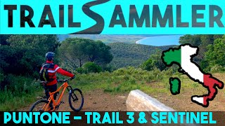
      Puntone di Scarlino | Trail 3 und The Sentinel...
      mtb
      14:52 | 1299 | Jul 9, 2019 , Punta Ala

      Routes with this trail

      more »
      26 miles • 3,876 ft • 9 • Loop •
      Punta Ala Trail Center's enduro trails are numerous and range from flowy and fast to steep and technical,...
      ★ 1.0 • 6 miles • 1,245 ft • 3 • Loop •
      This is a great fun ride for families with children and people new to two wheels who want to find out what...
      3.0 ★★★★★
      19 Ratings
      5 ★
      4 ★ 37%
      3 ★ 32%
      2 ★ 21%
      1 ★ 11%

      14 Reviews & Comments

      Meetmickey
      Not good. Overgrown, narrow, washed out. Doesn't feel like a 'trail' for mtb.
      Just not fun. Avoid imho
      Mauriziobikers Mauriziobikers
      Trail praticabile anche se un po' sporco,
      Scendendo si incontrano due alberi caduti ma sono secchi e sono stati spezzati i rami creando un varco transitabile scendendo dalla bici. Per il resto full gas!
      AndreaROAJd7
      Secondo me il trail più divertente ed enduristico della zona, non è molto largo ed è un po’ scavato, ha dei passaggi da fare con attenzione

      We hope you've been enjoying Trailforks!

      Create a FREE account to view all trail reviews and much more.

      Frequently Asked Questions

      ▼ Where is The Sentinel located?
      The Sentinel is located in Bandite Trail Area, Punta Ala, Italy. It is part of the Bandite Trail Area trail network. The trailhead is located at coordinates 42.86386, 10.78233.
      ▼ How hard is The Sentinel?
      The Sentinel is rated as Blue difficulty. The average grade is 17.429%.
      ▼ What is the elevation gain for The Sentinel?
      The Sentinel has 14 ft of elevation gain. The trail has 661 ft of elevation descent. The elevation ranges from 56 ft to 714 ft.
      ▼ Is The Sentinel a point to point trail?
      The Sentinel is not a point to point trail. The direction is Downhill Primary. The trail type is singletrack.
      ▼ How long is The Sentinel?
      The Sentinel is 3,712 ft long. The trail type is singletrack.
      ▼ Are dogs allowed on The Sentinel?
      Yes, dogs are allowed on The Sentinel. Please keep dogs on a leash where required and clean up after them.
      ▼ When is the best time of year to ride The Sentinel?
      Based on activity log data, the most popular months to ride The Sentinel are:
      • September (3 activities)
      • April (2 activities)
      • June (2 activities)
      Check the reports page for current trail conditions.
      ▼ How do I access The Sentinel? Where is the closest parking trailhead?
      The closest parking and trailhead locations to The Sentinel are: View all parking locations in the area.
      ▼ How long does it take to ride The Sentinel?
      Based on recorded activities, it takes an average of 10 minutes to ride The Sentinel. The trail is 3,712 ft long. Actual times will vary based on fitness level, conditions, and pace. View recent activity logs for more details.
      ▼ How busy is The Sentinel?
      The Sentinel is a less popular trail with lighter traffic. There have been 172 recorded activities on this trail. The trail has received 166 check-ins. View recent activity on this trail.

      Hit the Trail

      Open in App

      Get this trail on your phone instantly.

      open trail in app

      Download Trail

      Save to wishlist, Garmin & download.
      save the trail

      Find Related Routes

      Find routes and users activities that include this trail.
      find routes for this trail

      You must enter a description before submitting.

