more stats
1.3 miles
Distance
86 ft
Climb
-231 ft
Descent
00:24:34
Avg time
-145 ft
Altitude change
7,490 ft
Altitude min
7,686 ft
Altitude max
7,642 ft
Altitude start
7,497 ft
Altitude end
-2.1%
Grade
-31.2%
Grade max
17.5%
Grade min
1,768 ft
Distance climb
4,531 ft
Distance down
653 ft
Distance flat
00:24:34
Avg time

Three Bottles Details

  • Activities
    • Mountain Bike
    • E-Bike
    • Hike
    • Trail Running
    • Dirtbike/Moto
    • Observed Trials
  • Riding Area
    Otero, Tunnel, and David Canyons
    Albuquerque, New Mexico
  • Difficulty Rating
  • Voted Difficulty
    Blue (1 vote)
  • Local Popularity
    70 in Mountain Biking [+]
    • 80 in E-Biking
    • 5 in Trail Running
    • 5 in Hiking
    • 5 in Dirtbiking
    • 5 in Observed Trials
  • Global Ranking
    #70185 in Mountain Biking [+]
    • #16003 in E-Biking
    • #281846 in Trail Running
    • #277457 in Hiking
    • #2033 in Dirtbiking
  • Trail Type
    Singletrack
  • Dogs Allowed
    Yes
  • eBike Allowed
    Yes up to Class 1

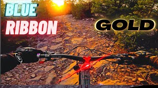
Three Bottles is an intermediate level trail in the Otero trail system. Three Bottles is somewhat unique in the area in that it is not actually a single trail. What it is, essentially is an intermediate difficulty, bi-directional through trail that has several single direction mini-loops along its length. Each of these mini-loops are of varying difficulty, from intermediate level up to double black diamond level expert lines.

All of these lines are signed, but pay close attention if you are new to the trail, as many people inadvertently end up on a loop going the wrong direction, or become confused when they all of a sudden end up back where they just were, but headed in the opposite direction.

In general follow the arrows of the green signs to stay on the through trail, and any other loops will be marked in either blue (intermediate), black (single black diamond), or red (double black diamond). Heading north to south, is the preferred (descending) direction. Three bottles is not purely descending or ascending in a given direction, however; expect to climb or descend in either direction.

As of Spring 2017, a "flow trail" extension is being built to add additional trail to the north end of Three Bottles. This trail will eventually connect to the south end of Blue Ribbon to avoid the double track section on the ridge. Expect to see this extension finished sometime in 2017.

Trail Supporters

  • USFS
    Land Manager
Local Trail Association
Traditionally Indigenous Territory

Recent Activity on Trail

Past Week
  • 1 rides
  • 9 miles average
6 Months
  • 9 rides
  • 13 miles avg distance
All
  • 290 rides
  • Last: Jul 1, 2026
c1c2c3c4
January
February
March
April
May
June
July
August
September
October
November
December
update trails status or condition

Three Bottles Trail Reports

statusdatedescription
May 24, 2026 @ 2:51pm (America/Denver)
May 24, 2026
super chunky. not worth the climb to get there. alot of walk a bike sections.
May 11, 2025 @ 9:16am
May 11, 2025
Oct 16, 2024 @ 11:11am
Oct 16, 2024
Same tree down that was there in the spring.
Mar 29, 2024 @ 12:18pm
Mar 29, 2024
Trees down on Three Bottles
Nov 12, 2023 @ 6:50am
Nov 12, 2023
more »
Status:
on May 24, 2026
Avg: 3.99 (9 votes)
Your vote: 0

view (1,719)
close
3D
Trail Conditions
  • Unknown
  • Snow Groomed
  • Snow Packed
  • Snow Covered
  • Snow Cover Partial
  • Freeze/thaw Cycle
  • Icy
  • Prevalent Mud
  • Wet
  • Variable
  • Ideal
  • Dry
  • Very Dry
Trail Flow (Ridden Direction)
Trailforks scans users ridelogs to determine the most popular direction each trail is ridden. A good flowing trail network will have most trails flowing in a single direction according to their intension.
The colour categories are based on what percentage of riders are riding a trail in its intended direction.
  • > 96%
  • > 90%
  • > 80%
  • > 70%
  • > 50%
  • < 50%
  • bi-directional trail
  • no data
Trail Last Ridden
Trailforks scans ridelogs to determine the last time a trail was ridden.
  • < 2 days
  • < 1 week
  • < 2 weeks
  • < 1 month
  • < 6 months
  • > 6 months
Trail Ridden Direction
The intended direction a trail should be ridden.
  • Downhill Only
  • Downhill Primary
  • Both Directions
  • Uphill Primary
  • Uphill Only
  • One Direction
Contribute Details
Colors indicate trail is missing specified detail.
  • Description
  • Photos
  • Description & Photos
  • Videos
Trail Popularity ?
Trailforks scans ridelogs to determine which trails are ridden the most in the last 9 months. Trails are compared with nearby trails in the same city region with a possible 25 colour shades. Think of this as a heatmap, more rides = more kinetic energy = warmer colors.
  • most popular
  • popular
  • less popular
  • not popular
ATV/ORV/OHV Filter
Max Vehicle Width
inches
US Cell Coverage
Legend
cell carrier legend

Radar Time
Activity Recordings
Trailforks uses anonymized public activity data. ?
Activity Recordings
Trailforks uses anonymized public activity data. ?
Personal Heatmap
Activity Types
all / none
Options
2
Date range month
Winter Trails
Warning A routing network for winter maps does not exist. Selecting trails using the winter trails layer has been disabled.
Missing Trails
Most Popular
Least Popular
Trails are colored based on popularity. The more popular a trail is, the more red. Less popular trails trend towards green.
Jump Magnitude Heatmap
Heatmap of where riders jump on trails. Zoom in to see individual jumps, click circles to view jump details.
BC Backroad Status

Service Road Atlas is a free to use, community-driven service for viewing and creating reports on the numerous back-country service roads around B.C. and Alberta.

map legend
Slope Aspect
Direction the slope faces
Flat N NE E SE S SW W NW
Trails Deemphasized
Trails are shown in grey.
disable
Only show trails with no bike usage.
Enable
Suggested Layers
Based on selected activity type

    Save the current map location and zoom level as your default home location whenever this page is loaded.

    Save
        Directions to three-bottles trailhead (35.000680, -106.353420)

        Photos

        12 more »
        294 |
        May 5, 2020 @ 4:19pm
        May 5, 2020
        279 |
        May 5, 2020 @ 4:23pm
        May 5, 2020
        242 |
        Oct 13, 2019 @ 7:04am
        Oct 13, 2019
        372 |
        Dec 25, 2018 @ 4:22pm
        Dec 25, 2018

        Videos

        1 more »
        Blue Ribbon Chunk | Otero Canyon Shred // MTB
        11:58 | 305 | Dec 6, 2020 , Albuquerque

        Routes with this trail

        3.5 52 miles 5,590 ft 25
        This is the course for 2018 MME.
        3.0 13 miles 946 ft 7 Point to Point
        Downhill only ride from Oak Flat Picnic area to 462 Trailhead.
        3.0 32 miles 3,350 ft 45
        Real fun route that traverses around all of the Cedro and Otero Canyon trail systems. There are many...

        2 Reviews & Comments


        We hope you've been enjoying Trailforks!

        Create a FREE account to view trail comments and much more.

        Frequently Asked Questions About Three Bottles

        Where is Three Bottles located?
        Three Bottles is located in Otero, Tunnel, and David Canyons, Albuquerque, New Mexico, United States. It is part of the Otero, Tunnel, and David Canyons trail network. The trailhead is located at coordinates 35.00068, -106.35342.
        How hard is Three Bottles?
        Three Bottles is rated as Black Diamond difficulty. The average grade is 2.1%.
        What is the elevation gain for Three Bottles?
        Three Bottles has 86 ft of elevation gain. The trail has 231 ft of elevation descent. The elevation ranges from 7,490 ft to 7,686 ft.
        How long is Three Bottles?
        Three Bottles is 1.3 miles long. The trail type is singletrack.

        Hit the Trail

        Open in App

        Get this trail on your phone instantly.
        open trail in app

        Download Trail

        Save to wishlist, Garmin & download.
        save the trail

        Find Related Routes

        Find routes and users activities that include this trail.
        find routes for this trail

        You must enter a description before submitting.