1.3 miles
Distance
14 ft
Climb
-1,059 ft
Descent
00:28:06
Avg time
Supporters, Builders, Maintainers & Land Managers of Time Killer Trail
  • past supporters

Time Killer Details

  • Activities
    • Mountain Bike
    • Hike
    • Trail Running
  • Riding Area
    Sumas Mountain
    Abbotsford, British Columbia
  • Difficulty Rating
  • Voted Difficulty
    Black Diamond (2 votes)
  • Trail Type
    Singletrack
  • Bike Type
    DH, AM, XC
  • Direction
    Downhill Primary
    Popular direction shown
  • Dogs Allowed
    Yes
  • Global Ranking
    #13957 in Mountain Biking [+]
    • #41806 in Trail Running
    • #34291 in Hiking
  • Local Popularity
    65 in Mountain Biking [+]
    • 90 in Trail Running
    • 50 in Hiking

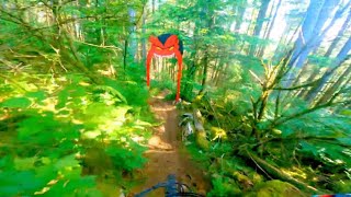
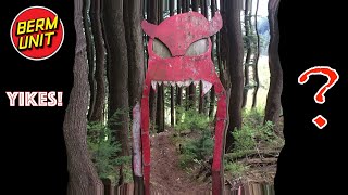
Loose rock in clearcut, a few drops or TTF's scattered throughout. A few rock rolls at the top. Enter over a pile of rocks off spur road just beyond the upper staging area. Some exposed rocks in the first section of trail, than a loamy stretch with some optional jumps / drops.

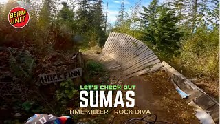
Through the clearcut lots of lose rock, flowing into a fast jump section near the bottom. Only jump trail on Sumas challenging rock sections at the top, some fun jumps and speed sections

Local Trail Association
Traditionally Indigenous Territory
More Stats for Time Killer mountain bike trail trail
  • Altitude change
    -1,045 ft
  • Altitude min
    1,397 ft
  • Altitude max
    2,447 ft
  • Altitude start
    2,442 ft
  • Altitude end
    1,397 ft
  • Grade
    -15.293%
  • Grade max
    -76.95%
  • Grade min
    11.404%
  • Distance climb
    445 ft
  • Distance down
    1 mile
  • Distance flat
    394 ft
  • Avg time
    00:28:06
  • Avg reverse time
    01:02:38
  • view trail stats
Status:
on Mar 20, 2023
Variable
Avg: 4.4 (20 votes)
Your vote: 0

view (1,024)
close
3D
Trail Conditions
  • Unknown
  • Snow Groomed
  • Snow Packed
  • Snow Covered
  • Snow Cover Inadequate
  • Freeze/thaw Cycle
  • Icy
  • Prevalent Mud
  • Wet
  • Variable
  • Ideal
  • Dry
  • Very Dry
Trail Flow (Ridden Direction)
Trailforks scans users ridelogs to determine the most popular direction each trail is ridden. A good flowing trail network will have most trails flowing in a single direction according to their intension.
The colour categories are based on what percentage of riders are riding a trail in its intended direction.
  • > 96%
  • > 90%
  • > 80%
  • > 70%
  • > 50%
  • < 50%
  • bi-directional trail
  • no data
Trail Last Ridden
Trailforks scans ridelogs to determine the last time a trail was ridden.
  • < 2 days
  • < 1 week
  • < 2 weeks
  • < 1 month
  • < 6 months
  • > 6 months
Trail Ridden Direction
The intended direction a trail should be ridden.
  • Downhill Only
  • Downhill Primary
  • Both Directions
  • Uphill Primary
  • Uphill Only
  • One Direction
Contribute Details
Colors indicate trail is missing specified detail.
  • Description
  • Photos
  • Description & Photos
  • Videos
Trail Popularity ?
Trailforks scans ridelogs to determine which trails are ridden the most in the last 9 months. Trails are compared with nearby trails in the same city region with a possible 25 colour shades. Think of this as a heatmap, more rides = more kinetic energy = warmer colors.
  • most popular
  • popular
  • less popular
  • not popular
ATV/ORV/OHV Filter
Max Vehicle Width
inches

Radar Time
x Activity Recordings
Trailforks users anonymized public ridelogs from the past 6 months.
  • mountain biking recent
  • mountain biking (>6 month)
  • hiking (1 year)
  • moto (1 year)
Activity Recordings
Trailforks users anonymized public skilogs from the past 12 months.
  • Downhill Ski
  • Backcountry Ski
  • Nordic Ski
  • Snowmobile
Jump Magnitude Heatmap
Heatmap of where riders jump on trails. Zoom in to see individual jumps, click circles to view jump details.
Trails Deemphasized
Trails are shown in grey.
disable
Only show trails with NO bikes.
enable

Save the current map location and zoom level as your default home location whenever this page is loaded.

Save
      Directions to time-killer trailhead (49.117720, -122.150400)
      update trails status or condition

      Time Killer Trail Reports

      statusdatedescription
      Mar 20, 2023 @ 2:01pm
      Mar 20, 2023
      reporter Tree down at top of lower clearcut (below the big rock drop). Cleared where it crossed the trail but ran out of time to clear where it parallels...
      Jan 5, 2023 @ 7:56pm
      Jan 5, 2023
      Cleared through the gaps and woodwork after the clearcut.
      Jan 4, 2023 @ 11:29am
      Jan 4, 2023
      tree
      Dec 28, 2022 @ 6:58pm
      Dec 28, 2022
      Only rode down to the old saw turn off. A cluster of 4 trees is down on the upper rock roll section before the first bridge. Will need a saw.
      Dec 5, 2022 @ 1:54pm
      Dec 5, 2022
      Trees cleared, bridge re-settled, trail repaired where tree was uprooted, etc.
      view all reports »

      Recent Ridelog Activity on Trail

      Past Week
      • 0 rides
      •  
      6 Months
      • 27 rides
      • 8 miles avg distance
      All
      • 861 rides
      • Last: Feb 11, 2023

      Photos

      more »
      1 |
      Feb 27, 2023 @ 1:44pm
      Feb 27, 2023
      4 |
      Feb 27, 2023 @ 1:44pm
      Feb 27, 2023
      312 |
      Jan 3, 2017 @ 11:33pm
      Jan 3, 2017
      | 1 comments
      477 |
      May 10, 2016 @ 10:29am
      May 10, 2016

      Routes with this trail

      more »
      titledistance
      Centennial Sumas 15 km9 miles
      Valley VertiKiller, 1st Climb5 miles
      Rod's 50 for 5032 miles
      Sumas Mtn 3 Lapper21 miles

      Trail Products

      4 Reviews & Comments


      We hope you've been enjoying Trailforks!

      Create a FREE account to view trail comments and much more.

      Videos

      more »
      youtuber I Chose My New Bike Based on Your Suggestions!
      10:08 | 201 | Jul 22, 2021 , Abbotsford
      youtuber
      9:42 | 357 | Sep 12, 2020 , Abbotsford
      youtuber Can You Ride this Feature? I'll Pay You CASH.
      6:48 | 185 | Jun 27, 2021 , Abbotsford
      youtuber Time Killer is a Technical Masterpiece
      11:05 | 240 | Jun 20, 2021 , Abbotsford

      Nearby Trails

      • subscribe
      • flag
      • login to download gpx or kml files.