
more stats
4,249 ft
Distance
184 ft
Climb
-288 ft
Descent
00:09:27
Avg time
-105 ft
Altitude change
1,183 ft
Altitude min
1,332 ft
Altitude max
1,322 ft
Altitude start
1,217 ft
Altitude end
-2.5%
Grade
-48.3%
Grade max
23.4%
Grade min
1,604 ft
Distance climb
2,054 ft
Distance down
591 ft
Distance flat
00:09:27
Avg time

Tinder Details

  • Activities
    • Mountain Bike
    • E-Bike
    • Trail Running
  • Riding Area
    Diamond Head
    Squamish, British Columbia
  • Difficulty Rating
  • Voted Difficulty
    Blue (2 votes)
  • Local Popularity
    85 in Mountain Biking [+]
    • 90 in E-Biking
    • 80 in Trail Running
  • Global Ranking
    #19579 in Mountain Biking [+]
    • #2816 in E-Biking
  • Trail Type
    Singletrack
  • Bike Type
    AM, XC
  • Direction
    Downhill Primary
    Popular Direction Shown
  • Dogs Allowed
    Yes
  • eBike Allowed
    Yes up to Class 1
  • Year Opened
    2014

Tinder is a connector, providing a flowy link between Fred and Your Mom. Funded and constructed by Dream Wizards.

Trail Supporters
  • Dream Wizards
    since 2014
    Builder
Local Trail Association
Traditionally Indigenous Territory

Recent Activity on Trail

Past Week
  • 11 rides
  • 15 miles average
6 Months
  • 214 rides
  • 15 miles avg distance
All
  • 1,639 rides
  • Last: Sep 15, 2026
c1c2c3c4
January
February
March
April
May
June
July
August
September
October
November
December
Status:
on Aug 31, 2026
Ideal
Avg: 3.7 (58 votes)
Your vote: 0

view (9,598)
close
      Directions to tinder trailhead (49.754230, -123.091430)

      Photos

      40 more »
      mtb
      1,472 |
      Apr 12, 2016 @ 5:52pm
      Apr 12, 2016
      mtb
      484 |
      Aug 21, 2015 @ 7:09pm
      Aug 21, 2015
      mtb
      34 |
      Apr 3, 2026 @ 8:15am
      Apr 3, 2026
      mtb
      179 |
      Jul 10, 2022 @ 4:28pm
      Jul 10, 2022

      Videos

      7 more »
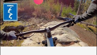
      youtuber TINDER | Blue trail | Squamish - University
      mtb
      3:28 | 313 | Dec 27, 2023 , Squamish
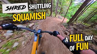
      SHRED Shuttling Squamish
      mtb
      17:18 | 15 | Jul 26, 2026 , Squamish
      Fred Tinder & Your Mom
      mtb
      18:35 | 551 | Jul 15, 2020 , Squamish
      FRED & TINDER & YOUR MOM - Squamish -...
      mtb
      7:39 | 485 | Sep 4, 2019 , Squamish

      Routes with this trail

      4.0 6 miles 1,370 ft 29 Loop
      This is an awesome loop of one hour if you are flying or 2+ hours if you are taking it easy and looking at...
      4.4 36 miles 8,106 ft 66
      this course I have created is from my biggest ride that I have done so far. it includes many trails from...
      8 miles 1,570 ft 8
      **COURSE IS SUBJECT TO CHANGE AND FINAL COURSES WILL BE ANNOUNCED AT COACH'S MEETING ON MAY 22, 2024** XC...
      3.7
      58 Ratings
      5 26%
      4 33%
      3 28%
      2 10%
      1 3%

      7 Reviews & Comments

      excel
      The least good trail I have done in Squamish over 4 different visits. Gravelly corners, no recent maintenance, weird features, and too much pedaling for a flow trail. This could be your warm-up if you're an out-of-town intermediate at best, or mainly x/c rider, with no prior experience in the Lower Mainland or Sea-to-Sky. It has a lot of mini features that can be sessioned. It's going dead last on my Squamish repeat or recommend list.
      whyapinkbike
      A definite enduro run. Lots of up-and-downs. Its elevation profile had definitely suggested so; but, on the ground, each one of those lines was, itself, composed of many tight ups and downs. Constant gear shifting; so much so that, for even a shifting junkie like me, a bit more reaction-speed is called for.
      The initial part requires a lot of practice; as yet, I cannot climb, or descend, all of those boulders.
      Then the flowy descent starts, followed by a sharp climb.
      It's a great run, offering variety from the Nelsons and the Pseudos I usually do. Much thanks to its designers & crew.
      blackcombterry blackcombterry
      It's like if Half Nelson and Fifty Shades Of Green had a kid.

      We hope you've been enjoying Trailforks!

      Create a FREE account to view all trail reviews and much more.

      • By canadakaTF Pro Trailforks & contributors
      • #8195 - 13,423 views

      Frequently Asked Questions

      Where is Tinder located?
      Tinder is located in Diamond Head, Squamish, British Columbia, Canada. It is part of the Diamond Head trail network. The trailhead is located at coordinates 49.75423, -123.09143.
      How hard is Tinder?
      Tinder is rated as Blue difficulty. The average grade is 2.5%.
      What is the elevation gain for Tinder?
      Tinder has 184 ft of elevation gain. The trail has 288 ft of elevation descent. The elevation ranges from 1,183 ft to 1,332 ft.
      Is Tinder a point to point trail?
      Tinder is not a point to point trail. The direction is Downhill Primary. The trail type is singletrack.
      How long is Tinder?
      Tinder is 4,249 ft long. The trail type is singletrack.
      Are dogs allowed on Tinder?
      Yes, dogs are allowed on Tinder. Please keep dogs on a leash where required and clean up after them.
      When is the best time of year to ride Tinder?
      Based on activity log data, the most popular months to ride Tinder are:
      • June (120 activities)
      • July (111 activities)
      • May (103 activities)
      Check the reports page for current trail conditions.
      How do I access Tinder? Where is the closest parking trailhead?
      The closest parking and trailhead locations to Tinder are: View all parking locations in the area.
      How long does it take to ride Tinder?
      Based on recorded activities, it takes an average of 10 minutes to ride Tinder. The trail is 4,249 ft long. Actual times will vary based on fitness level, conditions, and pace. View recent activity logs for more details.
      How busy is Tinder?
      Tinder is a very popular trail. There have been 10,055 recorded activities on this trail. The trail has received 9,598 check-ins. View recent activity on this trail.

      Hit the Trail

      Open in App

      Get this trail on your phone instantly.

      open trail in app

      Download Trail

      Save to wishlist, Garmin & download.
      save the trail

      Find Related Routes

      Find routes and users activities that include this trail.
      find routes for this trail

      You must enter a description before submitting.