more stats
4.6 miles
Distance
885 ft
Climb
-112 ft
Descent
00:44:38
Avg time
772 ft
Altitude change
4,302 ft
Altitude min
5,075 ft
Altitude max
4,302 ft
Altitude start
5,075 ft
Altitude end
3.2%
Grade
-10.3%
Grade max
21.8%
Grade min
3 miles
Distance climb
4,642 ft
Distance down
3,793 ft
Distance flat
00:44:38
Avg time

Tinton Trail Details

  • Activities
    • Mountain Bike
    • Hike
    • Trail Running
  • Riding Area
    Northern Black Hills
    Spearfish, South Dakota
  • Ref Number
    #55
  • Difficulty Rating
  • Local Popularity
    100 in Mountain Biking heatmap [+]
    • 5 in Trail Running
    • 5 in Hiking
  • Global Ranking
    #29151 in Mountain Biking [+]
    • #341511 in Trail Running
    • #329041 in Hiking
  • State Ranking
    #47 in Mountain Biking · South Dakota [+]
    • #556 in Trail Running
    • #542 in Hiking
  • Trail Type
    Singletrack
  • Bike Type
    XC
  • Dogs Allowed
    Yes
  • Land Owner
    Black Hills National Forest

This four mile section is the original Tinton Trail. A classic single-track that is accessible from town and is the popular starting-point for many trails in the Northern Black Hills. The Tinton Trail System consist of 46 miles of single track looping through the Northern Black Hills. Several reroutes in 2019 have made this attractive to many different levels of rider. This trail is also the beginning and ending point of the annual Dakota FiveO race over Labor Day.

Access Info

Two trailheads provide access to TInton Trail. The first is just across Tinton Rd from the USFS Work Center. A high profile vehicle might be necessary to access this trailhead. Continue up Tinton Rd for another 1.5 miles to the second trailhead. It is accessible to lower clearance vehicles.

Tags

Trail Supporters

Traditionally Indigenous Territory

Recent Activity on Trail

Past Week
  • 1 rides
  • 11 miles average
6 Months
  • 104 rides
  • 31 miles avg distance
All
  • 398 rides
  • Last: Nov 15, 2026
c1c2c3c4
January
February
March
April
May
June
July
August
September
October
November
December
Status:
on Sep 6, 2026
Dry
Avg: 4.44 (5 votes)
Your vote: 0

view (4,954)
close
      Directions to tinton-trail trailhead (44.472600, -103.900310)

      Photos

      12 more »
      mtb
      421 |
      Oct 16, 2019 @ 7:58am
      Oct 16, 2019
      mtb
      322 |
      Oct 16, 2019 @ 7:58am
      Oct 16, 2019
      mtb
      354 |
      Oct 16, 2019 @ 7:58am
      Oct 16, 2019
      mtb
      365 |
      Oct 16, 2019 @ 7:58am
      Oct 16, 2019

      Videos

      3 more »
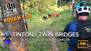
      youtuber MTB Riding Tinton and Twin Bridges | Black...
      mtb
      6:08 | 275 | Jul 18, 2024 , Spearfish
      Supercal 9.9 XTR med
      mtb
      0:19 | 13 | Jan 22, 2026 , Spearfish
      Tinton Time With Friends
      mtb
      0:44 | 463 | Sep 9, 2011 , Spearfish

      Routes with this trail

      more »
      5 miles • 108 ft • 1 •
      Shuttle up to the Aspen Hills rd. and ride the Tinton Trail back to the lower Tinton Trailhead, or all the...
      15 miles • 1,716 ft • 5 •
      A local favorite, this route features a playful mix of climbing and descending along the Tinton Trail,...
      13 miles • 762 ft • 5 •
      Is this a route? Is this working?
      5.0 ★★★★★
      5 Ratings
      5 ★ 100%
      4 ★
      3 ★
      2 ★
      1 ★

      1 Review & Comments

      jeffgicklhorn jeffgicklhorn
      The grade in the first 1.5 miles is really high with a number of technical sections. If you're riding with someone unused to those grades I would suggest driving 1 mile further up Tollgate Rd to a small parking area on the left side just before the motorized quarry trailhead. There is a cut in to Tinton from here and makes for a more enjoyable ride.

      We hope you've been enjoying Trailforks!

      Create a FREE account to view all trail reviews and much more.

      • By toddTF Pro Trailforks & contributors
      • #99078 - 9,946 views

      Frequently Asked Questions

      ▼ Where is Tinton Trail located?
      Tinton Trail is located in Northern Black Hills, Spearfish, South Dakota, United States. It is part of the Northern Black Hills trail network. The trailhead is located at coordinates 44.4726, -103.90031.
      ▼ How hard is Tinton Trail?
      Tinton Trail is rated as Blue difficulty. The average grade is 3.2%.
      ▼ What is the elevation gain for Tinton Trail?
      Tinton Trail has 885 ft of elevation gain. The trail has 112 ft of elevation descent. The elevation ranges from 4,302 ft to 5,075 ft.
      ▼ How long is Tinton Trail?
      Tinton Trail is 4.6 miles long. The trail type is singletrack.
      ▼ Are dogs allowed on Tinton Trail?
      Yes, dogs are allowed on Tinton Trail. Please keep dogs on a leash where required and clean up after them.
      ▼ When is the best time of year to ride Tinton Trail?
      Based on activity log data, the most popular months to ride Tinton Trail are:
      • September (66 activities)
      • August (54 activities)
      • July (37 activities)
      Check the reports page for current trail conditions.
      ▼ How do I access Tinton Trail? Where is the closest parking trailhead?
      The closest parking and trailhead locations to Tinton Trail are: View all parking locations in the area.
      ▼ How long does it take to ride Tinton Trail?
      Based on recorded activities, it takes an average of 45 minutes to ride Tinton Trail. The trail is 4.6 miles long. Actual times will vary based on fitness level, conditions, and pace. View recent activity logs for more details.
      ▼ How busy is Tinton Trail?
      Tinton Trail is a very popular trail. There have been 3,563 recorded activities on this trail. The trail has received 4,954 check-ins. View recent activity on this trail.

      Hit the Trail

      Open in App

      Get this trail on your phone instantly.

      open trail in app

      Download Trail

      Save to wishlist, Garmin & download.
      save the trail

      Find Related Routes

      Find routes and users activities that include this trail.
      find routes for this trail

      You must enter a description before submitting.